Hi all,
Where is time going? Almost a third of summer done.
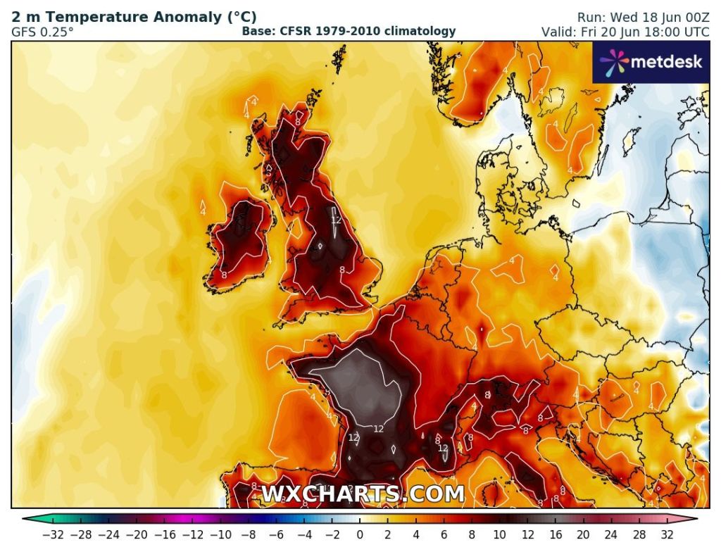
So far June has an average temperature of 15.6°C which makes it the joint-second warmest June I’ve recorded with records back to June 2013. June 2023 was the warmest at 17.3°C. This is mostly down to some warm and muggy nights, and we have some more of these to come this week.
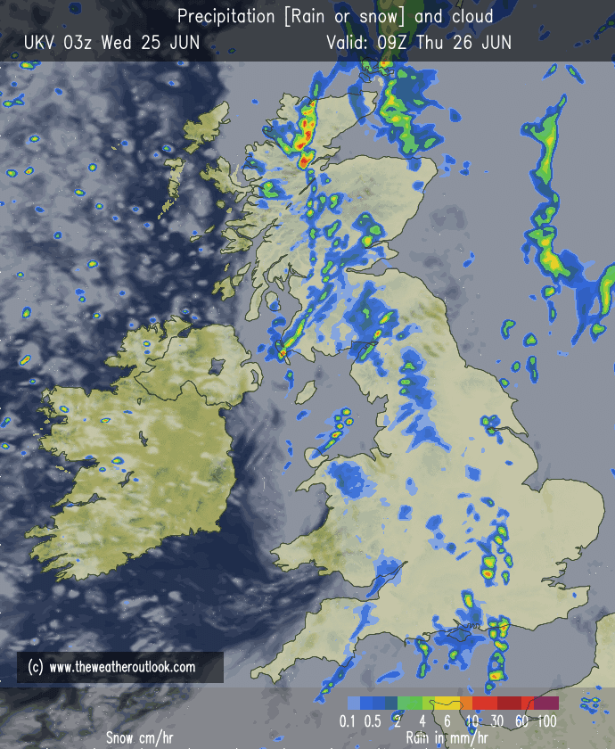
Thursday: A band of rain to start which will turn showery towards lunchtime. Generally turning brighter and drier into the afternoon but also fresher and windier. Max 20°C Min 13°C Max Gusts 30mph
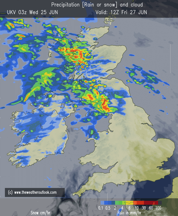
Friday: There will be a new weather-front close by to our northwest on Friday. Parts of the region close to this front could well see some light rain with most places cloudy. Some bright spells in the southeast are possible. Starting to turn quite humid and windy again. Warm night. Max 22°C Min 17°C Max Gusts 25mph
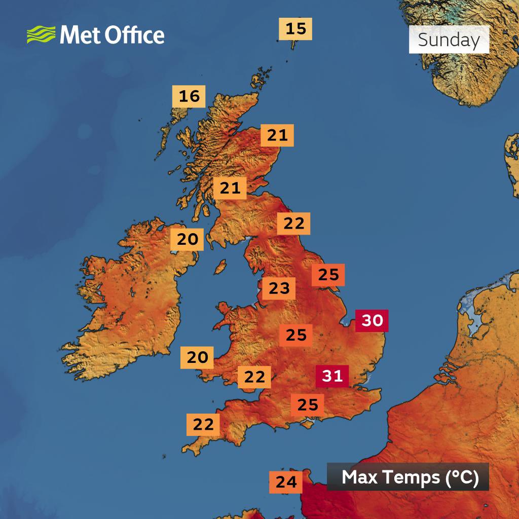
Weekend: The thermometer rises into Sunday.
Saturday: Some early rain should move on quite quickly and then a breezy day with sunny spells and mostly dry conditions. Becoming very warm. Max 24°C Min 16°C Max Gusts 25mph
Sunday: Some stubborn cloud to clear and very warm to hot with sunny spells developing. Not as windy as recently. Max 25°C Min 16°C
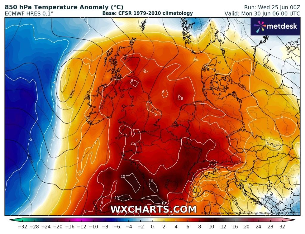
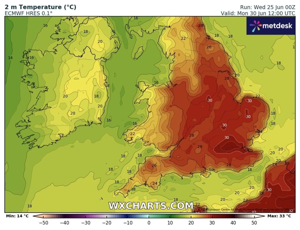
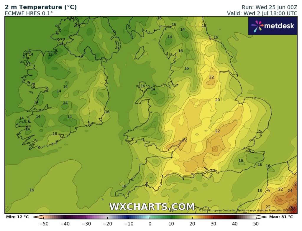
Outlook: Monday will be another hot one with plenty of sunny spells. Fresher air will arrive on Tuesday with a few showers blown in on a northwesterly wind. After that becomes a little bit more uncertain, but a ridge of high pressure nudging up from the Azores is currently the favourable outcome. So we do see some hot weather as we enter next week but it will be short-lived and shouldn’t reach the heatwave threshold.

Thanks for stopping by to read. Follow @ChadWeather on X or Bluesky for the latest forecasts and warnings.
Thanks,
Jon
Forecast Issued: Wednesday the 25th of June 2025 at 5pm
Images: http://www.theweatheroutlook.com & http://www.wxcharts.com