
Hi all,
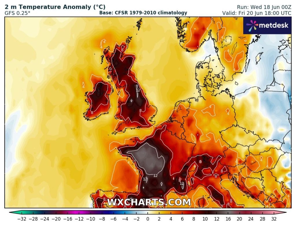
Spring was a belter, very dry and with some really warm days, but summer hasn’t got off to the best of starts. That said, we are about to experience our first heatwave of the season.
There is a certain threshold for it to be classed as a heatwave and no matter how long it lasts, there is no such thing as a “mini-heatwave”.

So far this year the warmest temperature I’ve recorded, came in April (30th) with a high of 25.9°C. That will certainly get beaten over the next few days. There’s an outside chance that somewhere could see 30°C. As we head into the weekend there will be a bit of a welcome breeze picking up and eventually cooler air and also the risk of a thunderstorm or two.
Hot days and warm nights ahead but how long will the heatwave last?
Thursday: A southerly airflow and plenty of hazy sunshine, making it feel toasty from mid-morning onwards as temperatures rocket. With light winds the heat will build and it will be hot into the afternoon. Overnight, expect a warm one but a bit breezier. Max 29°C Min 17°C
Friday: Another hot day but at least a wind will have picked up, helping those who hate the heat. Plenty of sunny spells and there’s a chance that some cloud could bubble up and set off an isolated shower towards evening but the risk is low. An uncomfortable night for sleeping. Max 28°C Min 18°C
💡 Heatwave safety tip: Keep pets cool and drink plenty of fluids with your BBQ 😉.
Weekend: Change into Sunday. Thunderstorms possible.
Saturday: Starting to feel more humid and after a morning of sunny spells, cloud is expected to bubble up and there will be a few scattered thundery downpours into the afternoon/evening and also overnight. Again it will be breezy and a switch to a westerly wind later into the night. Max 29°C Min 16°C

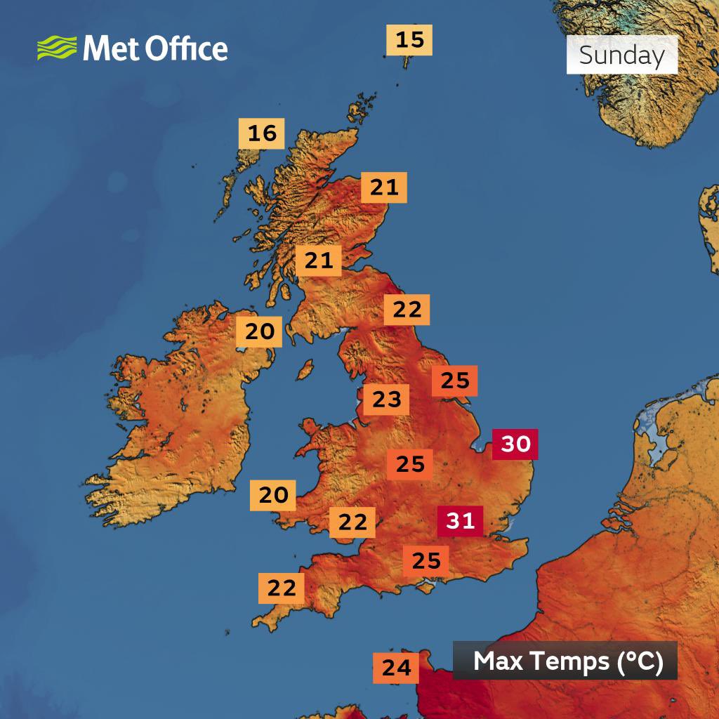
Sunday: Winds are now expected from a westerly direction, so this will have an impact on the temperature knocking it back down several degrees. Another reasonable day ahead with sunny spells but it will be breezy and there is a slight chance of an afternoon or evening shower which could be thundery. Max 23°C Min 15°C
Outlook: A mixed bag into next week with bright spells and a few showers. Temperatures returning to 19-20°C for a few days and then becoming a little bit warmer towards the end of the week and hopefully high pressure will build again. But at this stage what pans out after midweek next week is uncertain. So stay tuned to my social media accounts for updates.
Follow @ChadWeather on X and Bluesky for the latest forecasts and warnings.
Thanks,
Jon
Forecast Issued: Wednesday the 18th of June 2025 at 6:16pm.
Images: http://www.wxcharts.com & BBC Weather
