
Hi all,
Personally, I’m not a fan once temperatures start to get into the mid-20s or beyond. Obviously I’m talking about this country where heat is usually accompanied by high dew points leading to humid conditions and uncomfortable nights trying to get to sleep.
I’ll be keeping an eye on the dew points and the humidity over the course of the heatwave, as it’s likely that the first couple of days will not be as muggy as you would expect. As the temperature rises day-on-day and the nights become warmer and the heatwave starts to reach its latter stage, it is likely that the humidity and dew point values will rise which some people will find unpleasant.
If you love a heatwave and hot conditions with plenty of sunny spells, then this forecast is for you.

Thursday: A heatwave is not declared until we have three consecutive days of 25°C or above. So technically the heatwave will not be confirmed until Saturday, but because we are confident that temperatures will exceed the threshold then today is the first day of the heatwave which is expected to last 5 days. Mostly light winds. Very warm sunny spells and not too humid for now. Max 26°C Min 15°C
Friday: Hot and sunny with light and variable winds. Max 30°C Min 17°C
Weekend: A scorcher.
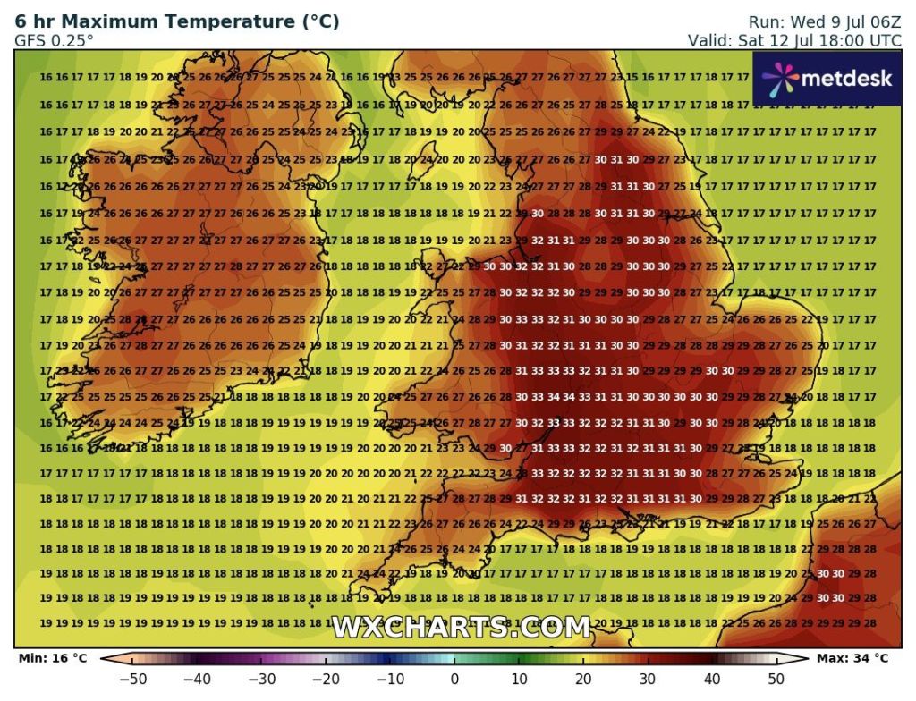
Saturday: Another hot or very hot and sunny day. Hopefully a little bit of a breeze into the afternoon. A very low chance of an isolated thunderstorm but it seems highly unlikely. A warm night for sleeping. Starting to become more humid. Max 32°C Min 18°C
Sunday: Rinse and repeat for Sunday. If any difference perhaps the breeze will have picked up a little bit which will bring a bit of relief from a very hot day. Again, a very low risk of a shower on the hills. Fans on full blast for bedtime. Max 31°C Min 19°C
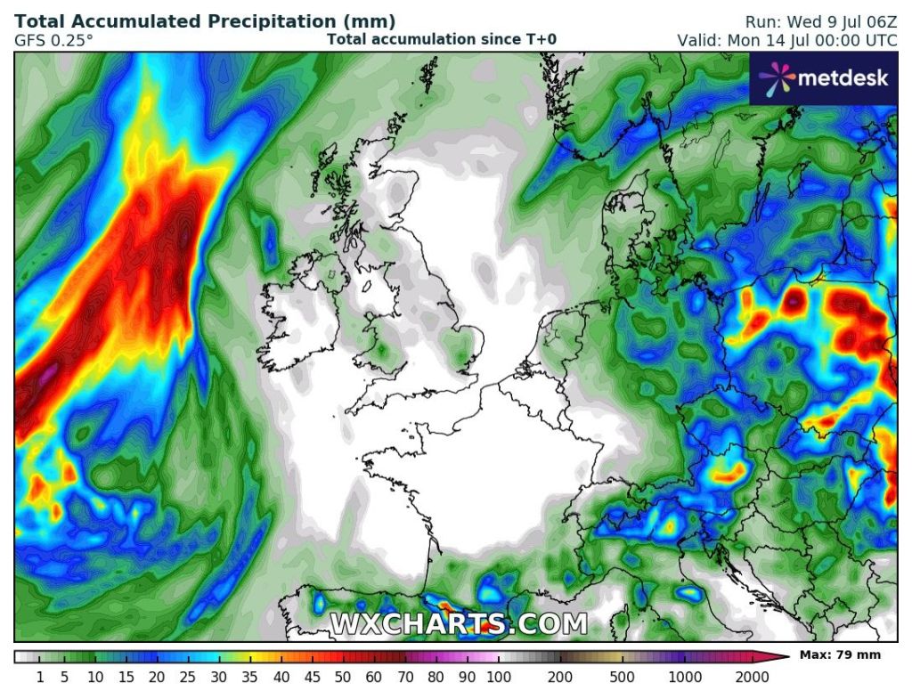

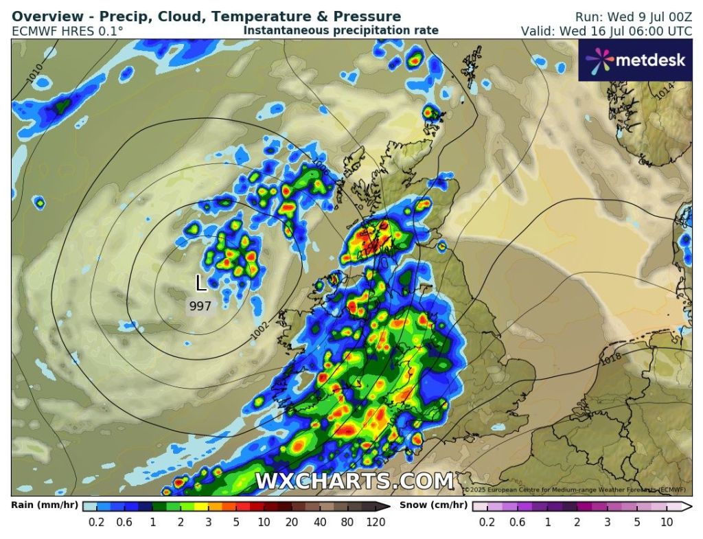
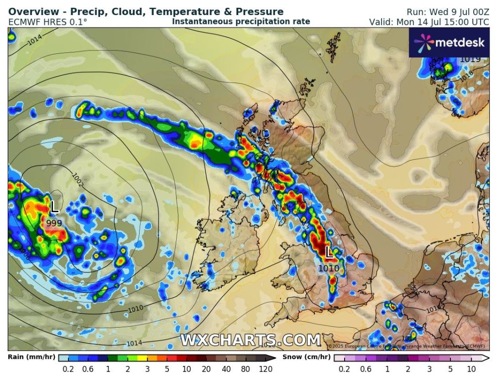
Outlook: The heat could eventually trigger some localised thundery downpours on Monday but this could well be delayed until Tuesday such is the uncertainty at this stage. But what looks certain is that the heatwave threshold will end with cooler temperatures arriving on Tuesday but still humid. After that the week looks warm, early-20s, muggy and with bright spells and heavy thundery showers.
Follow @ChadWeather on X for the latest forecasts and warnings.
Thanks as always for reading.
Jon
Forecast Issued: Wednesday the 9th of July 2025 at 5:30pm.
Images: http://www.wxcharts.com & http://www.theweatheroutlook.com
