
Hi all,
No sunny heatwave over the coming days but temperatures will be into the early-20s but as well as feeling muggy there will be some rain in the mix too.
After an unsettled spell, I’m hopeful (but it’s now looking increasingly unlikely) that an area of high pressure will be close by to keep our weather a bit more settled into next week with temperatures expected to return to normal.
Tuesday was a very wet day compared to recent times with 17.8mm falling at Chadderton HQ making it the wettest day since January the 5th. Just what the gardens needed after months of below-average rainfall.
Thursday: Humid on Thursday and a cloudy morning as a weakening band of rain and drizzle moves through. Into the afternoon it will slowly become brighter and the sunshine could set off a few localised hefty showers. Warm overnight. Max 22°C Min 15°C
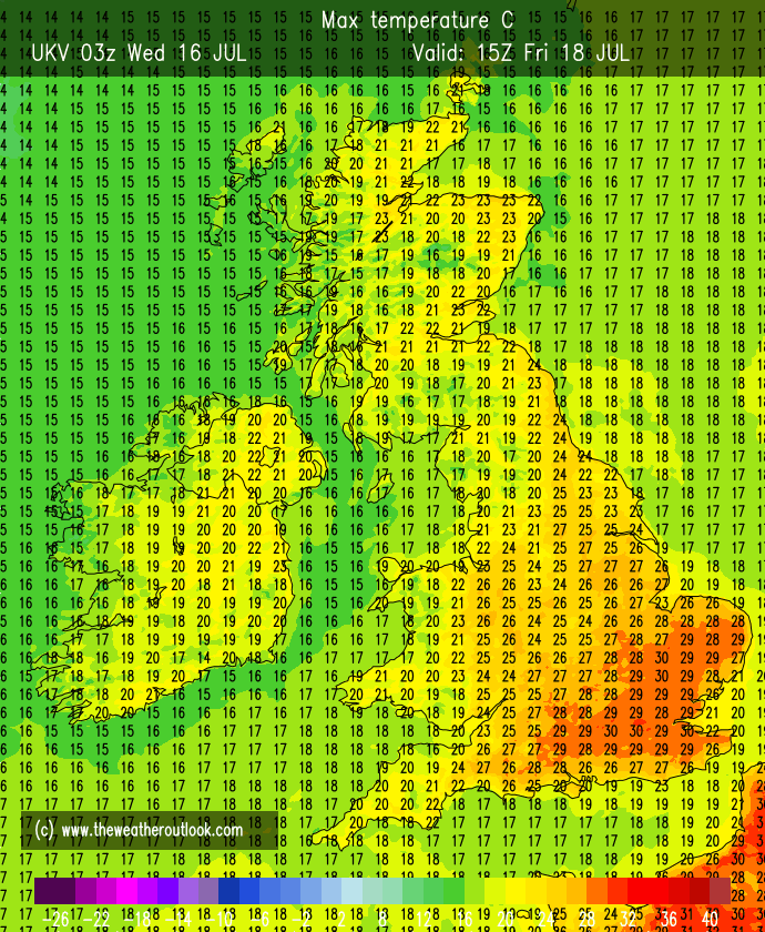
Friday: Very warm with sunny spells but also the chance of an isolated shower, especially during the morning. Another muggy one. Max 24°C Min 16°C
Weekend: Feeling close and wet at times.
Saturday: Some uncertainty for Saturday’s forecast. At this stage we could see an area of low pressure drift up from the south. It will be a warm day but after any brightness during the morning cloud will thicken and rain or thundery showers will spread up from the south. Max 23°C Min 15°C
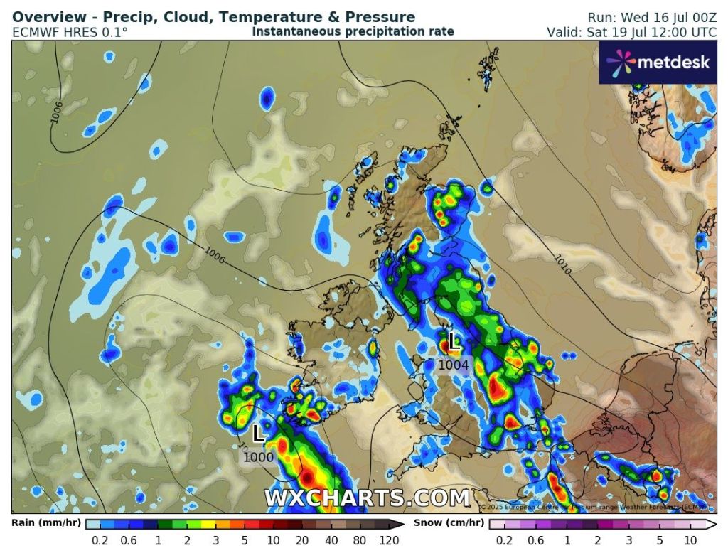
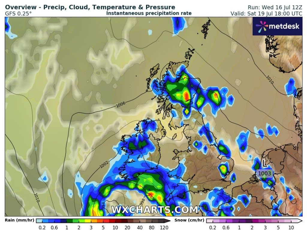
Sunday: A day of bright spells and showers which could be thundery and increase in frequency later in the day. Still warm especially overnight. Max 23°C Min 15°C
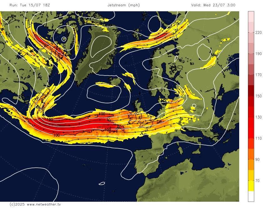
Outlook: It did look like an area of high pressure will ridge in from the southwest as the week progresses, but now it looks like it could remain unsettled as the high can’t push in and the jet stream brings in occasional showery rain from the west. Hard to pin down any details at this stage.
Thanks for reading as always.
Follow @ChadWeather on X and Bluesky for the latest forecasts and warnings.
Thanks,
Jon
Forecast Issued: Wednesday the 16th of July 2025 at 6:30pm.
Images: http://www.wxcharts.com & http://www.theweatheroutlook.com & http://www.netweather.tv
