Remaining settled either side of rain returning at the weekend – Thursday 25th September 2025 – Sunday 28th September 2025

Hi all,

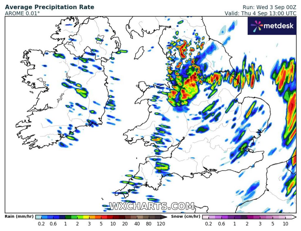
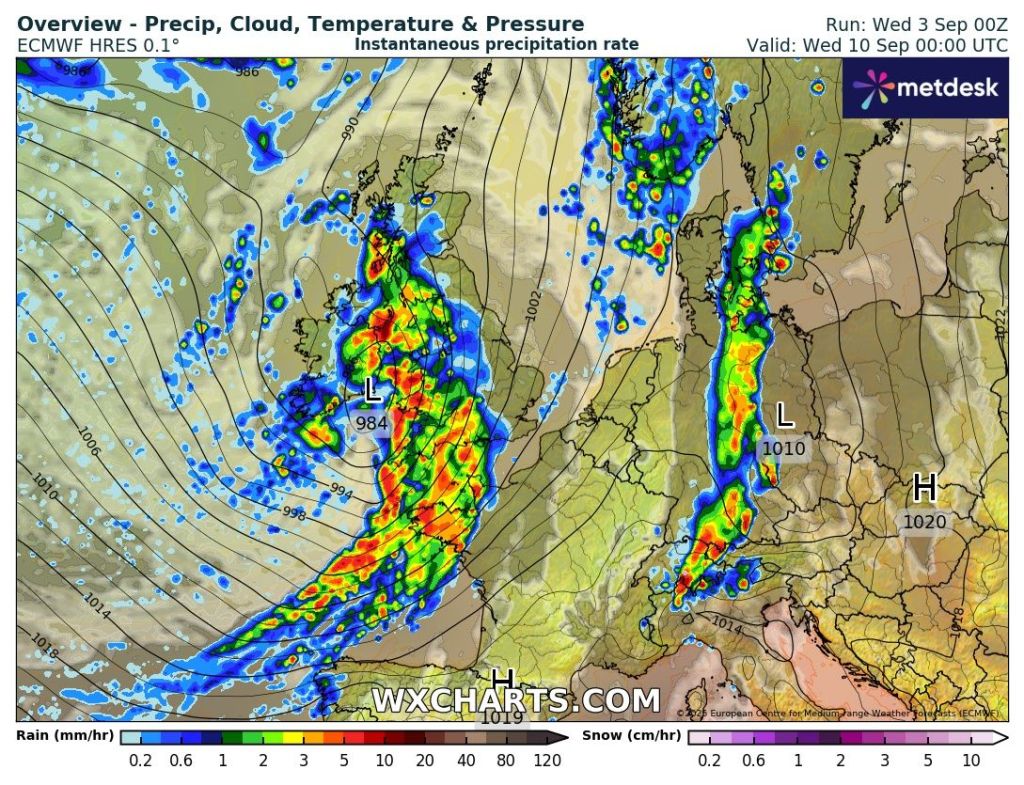
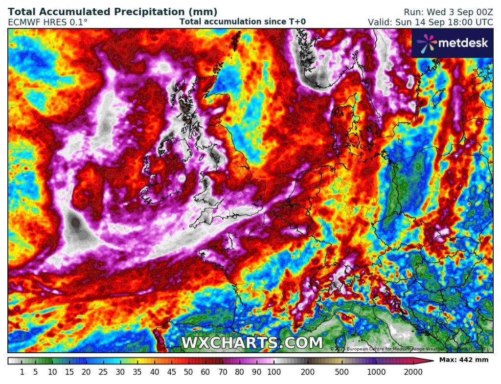
After Saturday’s horrendous rainfall (40-80mm) and chilly wind, our weather turned colder but thankfully drier with some decent sunny spells. We also saw our first ground-frost of the season (grass temp -1.3°C here) with a few localised pockets of air-frost, which is not unusual for the time of year.

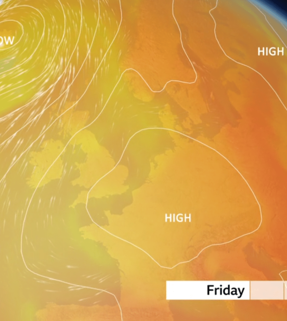
High pressure is in charge of our weather, but there will be a bit of a hiccup this weekend before drier weather and high pressure returns into next week. No sign of any significant torrential rain like we saw to start last weekend and no sign of any significant cold or warmth.

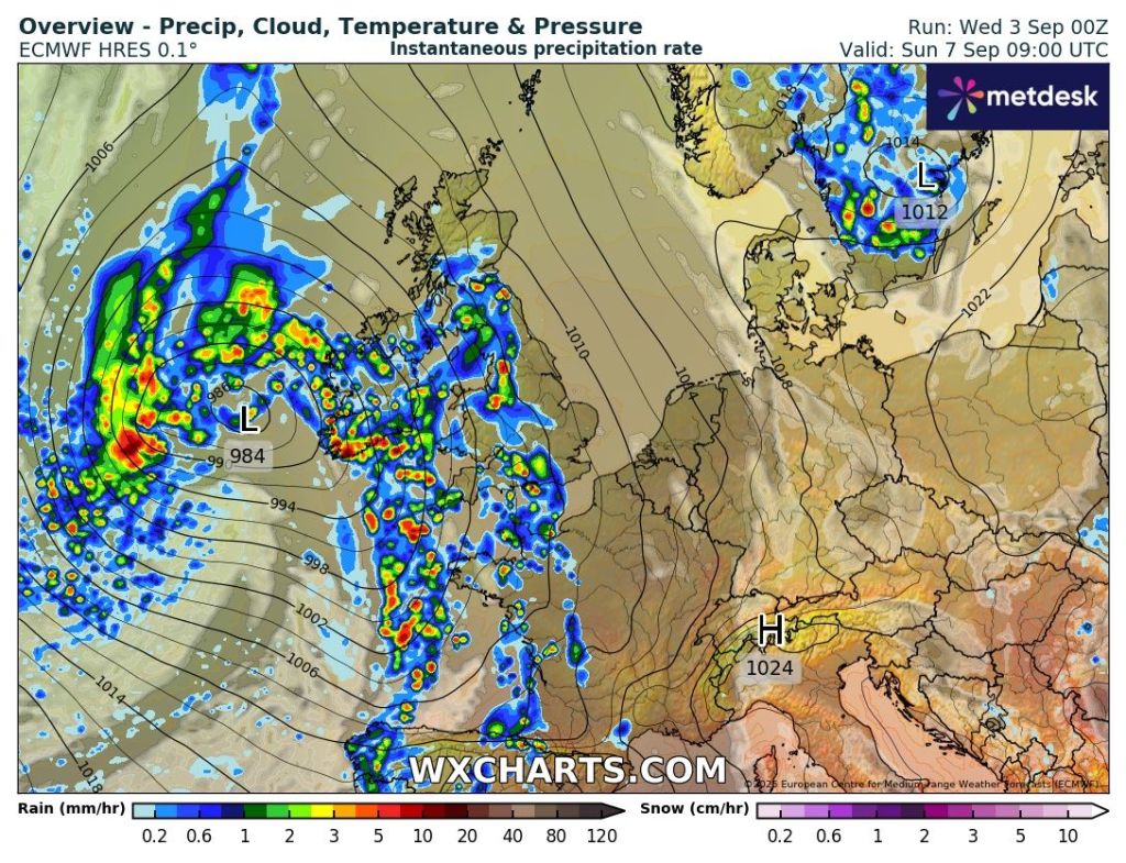
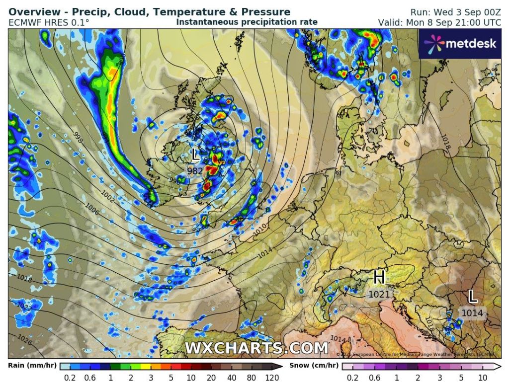
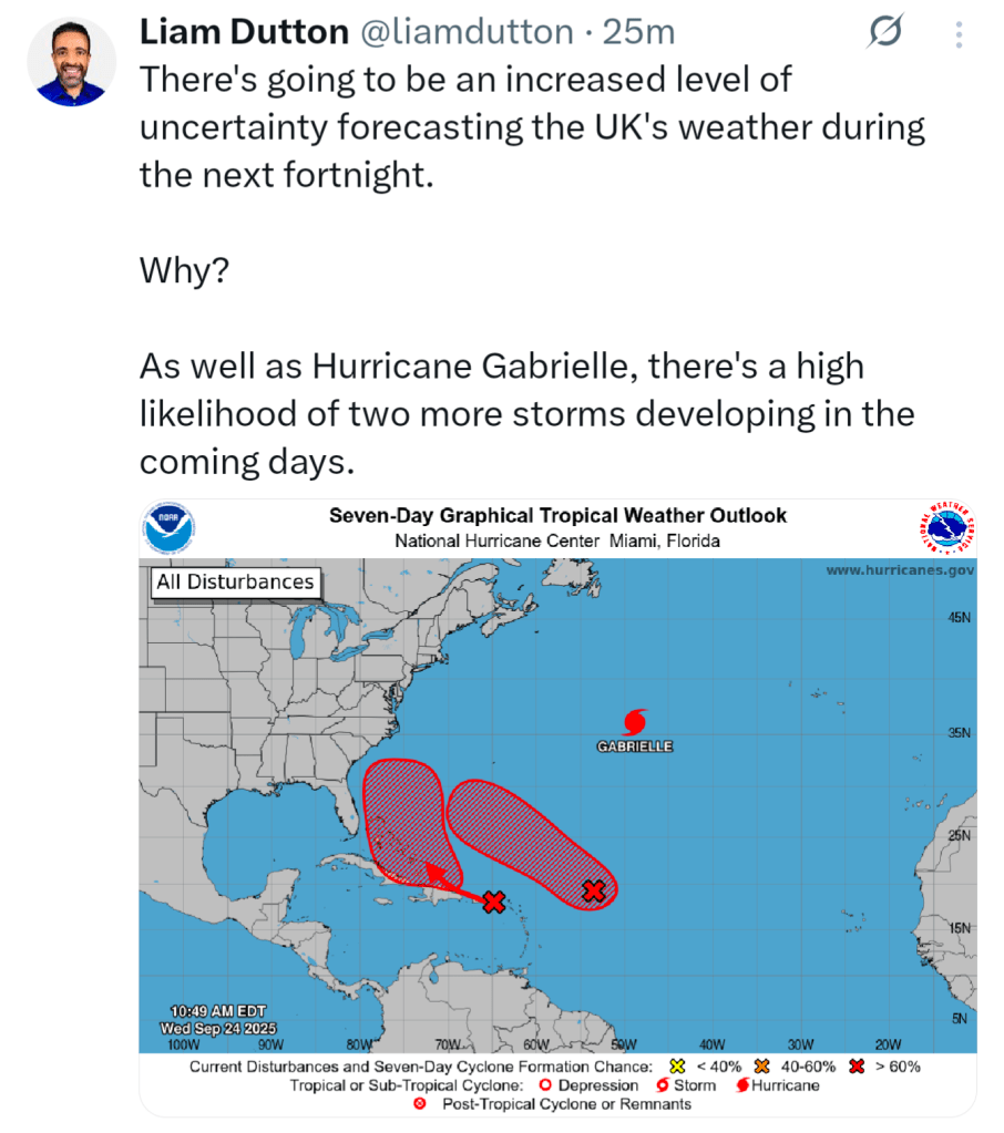
Ex-hurricane Gabrielle (later this week) will influence the Jet Stream so our weather will be hard to predict as we go into next week.

Uncertainty to pin down forecasts going forward

Thursday: Any early mist and fog clearing to a decent day. Dry with sunny spells. A fresh easterly breeze. Pleasantly warm in the sunshine and UV levels are still medium. Max 19°C Min 6°C

Friday: Sunny spells and cloud increasing later in the day. Dry and still a little breezy. Max 17°C Min 8°C

Weekend: High pressure replaced by low pressure.

Low pressure brings a more unsettled weekend

Saturday:  Feeling cooler than recently with cloudy skies and rain coming in from the west, turning patchy later. Max 15°C Min 8°C

Sunday: A better day with early rain fizzling out to a day of sunny spells and a few isolated showers. Chilly overnight.  Max 17°C Min 5°C

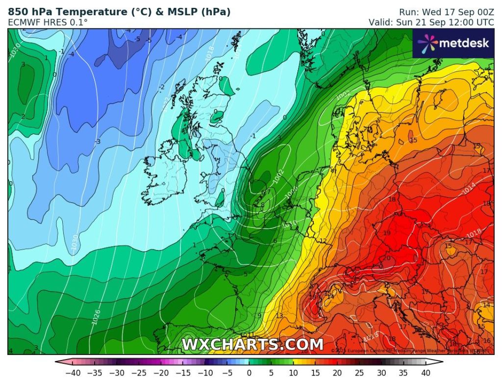
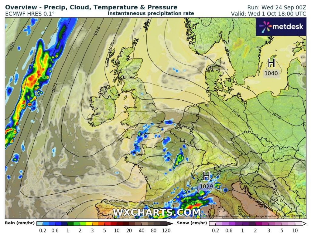
Outlook: High pressure to just stay in control, albeit situated across eastern Europe. Plenty of dry weather with sunny spells, fresh nights, and with temperatures into the mid-teens. Later in the week turning a little cooler but as mentioned earlier there will be a lot of uncertainty.

High pressure to the east will help settle the weather down a bit more after the weekend

Follow @ChadWeather on X and Bluesky for the latest forecasts and warnings.

Thanks,

Jon

Forecast Issued: Wednesday the 24th of September 2025 at 5:20pm.

Images: http://www.wxcharts.com & Liam Dutton on X.

Warm then much cooler with a risk of heavy persistent rain over the weekend – Thursday 18th September 2025 – Sunday 21st September

Hi all,

Are you all still wanting rain? September has been a very wet month and in fact is now the second wettest month of the year and will probably supersede January 2025 after the rain that’s coming this weekend.

We will end up with more rain in September than we did in March, April, May and August combined! Even though that’s taking into account the rest of September, we are likely to surpass the total for those 4 months this weekend. It’s been that wet.

It’s that time of year again where the tabloids start to write articles which are complete and utter nonsense. There’s been the mention of snow flurries and temperatures down to 0° C across England and Wales which is utter rubbish. Even though it is going to get colder on Sunday, the only snow that will be around will be for the tops of the highest Scottish mountains.

Ahead of low pressure this weekend, we will be dragging up some warm and muggy air and temperatures into the southeast of the UK will be into the mid-20s with a late burst of summer heat. We will be in this warm air on Thursday and Friday, but it will be slowly turning cooler during the weekend as well as being wet. Here are the daily details.

Thursday: A weather-front will move north through the region during the morning bringing a little bit of rain. The afternoon should tend to be cloudy but mostly dry bar the odd shower and becoming quite humid. It will also be windy. Max 20°C Min 14°C Max Gusts 30mph

Friday: We remain in the warm air and it will be breezy. There might be a few splashes of rain around, but it will tend to be mostly cloudy with a few bright spells until later in the day when rain starts slipping in from the west. Max 20°C Min 13°C Max Gusts 25mph

Weekend: Turning colder and wet at times.

Saturday: Cloudy with light rain becoming heavier. There will be a weather-front straddled across the country and it is uncertain where this will be at this stage but it is likely to be across our region which means the rain will continue into the afternoon and the amount of rain we see could be worthy of a warning. As this band of rain slowly sinks southwards, now as a low pressure system, cooler air will be filtering down as winds switch to a more northerly direction. Max 16°C Min 8°C Max Gusts 25mph

Wet over the weekend

Sunday: It is likely that there will be some rain around still during the morning. This will clear away to the south and colder air will filter down. Becoming quite chilly in the breeze but a drier end to the day. Max 13°C Min 6°C Max Gusts 20mph

Turning colder into Sunday

Outlook: At the moment there’s quite a bit of uncertainty for next week, but it looks likely that high pressure will be around from Monday to Wednesday. This will settle the weather down with temperatures in the late-teens and with some sunny spells. Uncertainty towards the second half of the week with perhaps a few showers breaking out and low pressure drifting up from the south. No sign of any snow.

Thanks as always for reading and please follow @ChadWeather on X and Bluesky if you would like frequent weather forecasts.

Thanks,

Jon

Forecast Issued: Wednesday the 17th of September 2025 at 5:40pm.

Images: http://www.wxcharts.com

Further unsettled weather to come and the theme continues into next week. Named-storm potential? – Thursday 11th September 2025 – Sunday 14th September 2025

Hi all,

The rain continues to fall at times as the drier-than-average months come to an end. Local reservoirs are still well below where they should be at this time of year. Levels should start to rise over the next 10 days as rain arrives courtesy of more low pressure systems. There is no sign of high pressure returning to bring settled conditions or any early-autumn warmth. We do need the rain but at least there will be some drier and brighter spells in between.

Thursday: Feeling cooler on Thursday, especially with a strong and gusty wind. After a sunny start convection will soon get going and heavy thundery showers will break out and move from west to east. Some of the downpours could be torrential. A chilly one overnight as winds ease slightly and showers decay. Max 16°C Min 6°C Max Gusts 30mph

A showery theme on Thursday and this will be the case for the following days

Friday: A day of sunshine and showers, some still heavy. Windy and feeling cool at times. Max 16°C Min 8°C Max Gusts 25mph

Weekend: Unsettled, low pressure nearby.

Saturday: Yep, you’ve guessed it. Bright spells and showers. Still relatively cool and windy. Max 16°C Min 9°C Max Gusts 30mph

Sunday: Some prolonged rain possible for the morning.  This will turn showery later. A windy one, and how windy it becomes later depends on where a deep area of low pressure tracks. At this stage it’s likely to track to the northwest of the UK. More updates via X/Bluesky. Max 18°C Min 11°C Max Gusts 35mph

Stormy for parts of the UK Sunday/Monday

Outlook: The Jet Stream stays in charge so further bouts of wind and rain via low pressure systems with some brightness in between.

Thanks as always for reading.

Follow @ChadWeather on X and Bluesky for the latest forecast and warnings.

Thanks,

Jon

Forecast Issued: Wednesday the 10th of September 2025 at 7:46pm.

Images: http://www.wxcharts.com & The Met Office

Improvements towards and over the weekend but low pressure and rain will be back next week – Thursday 4th September 2025 – Sunday 7th September 2025

Hi all,

Rain is back with a vengeance. After 20 dry days in-a-row, by dry I mean no measurable rainfall, the trend has broken and I have recorded rainfall on the last 6 out of 7 days, with nearly an inch falling.

Now of course we all don’t want cloudy, miserable and wet weather, but we were in desperate need of rain. Apart from January, this year every month has seen below-average rainfall and I have a feeling that September is going to make up for this and who knows, possibly a wet autumn will follow our dry spring and summer.

First off, we have a weather warning in place for Thursday, but after this the weather will improve as high pressure nudges in for a few days before rain returns next week. Here are the details for the next 4 days.

Thursday: It’ll be a dry start apart from a chance of showers in the northwest, but cloud will soon thicken as a small feature drifts up from the southwest. This will be very lively and will introduce some rain at first and then some heavy slow-moving downpours and localised thunderstorms (especially to the southeast). As always, the thunderstorms will be hit-and-miss for some but catch one and it will be heavy and there is a potential for some flash-flooding hence the warning in place. We look most at risk between 11am and 4pm. Max 17°C Min 10°C

Weather warning in place for Thursday

Friday: A few showers around during the morning but as high pressure ridges in these should ease away and sunny spells will develop as well as it turning drier. Max 19°C Min 11°C

Image BBC Weather: high pressure for a couple of days

Outlook: Not a bad weekend but changes waiting in the wings.

Saturday: It will be breezy but this will be from a warm direction so temperatures will be rising a couple of degrees. Dry with sunny spells and just the outside chance of a rogue shower. Warm night. Max 22°C Min 14°C Max Gusts 20mph

Sunday: The weather will start to change once again. So a cloudier day with a few bright spells and then showers developing into the afternoon. Still breezy but unlikely to be as warm as Saturday. Max 20°C Min 12°C Max Gusts 25mph

Outlook: It will turn unsettled into next week and a little bit cooler with showers or longer spells of rain on most days. Several low pressure systems will rule the roost. Temperatures returning to the mid-teens and certainly no sign of a heatwave like you are seeing being reported from some media outlets. Plenty of rain expected, especially in western parts.

Low pressure after low pressure next week = plenty of rain

Thanks as ever for reading and if you did read this post on social media please give the post a like or even a repost to spread awareness of my forecasts.

Follow @ChadWeather on X and Bluesky for the latest forecasts and warnings.

Thanks,

Jon

Forecast Issued: Wednesday the 3rd of September 2025 at 5:10pm.

Images: http://www.wxcharts.com and BBC Weather.