
Hi all,
The rain continues to fall at times as the drier-than-average months come to an end. Local reservoirs are still well below where they should be at this time of year. Levels should start to rise over the next 10 days as rain arrives courtesy of more low pressure systems. There is no sign of high pressure returning to bring settled conditions or any early-autumn warmth. We do need the rain but at least there will be some drier and brighter spells in between.
Thursday: Feeling cooler on Thursday, especially with a strong and gusty wind. After a sunny start convection will soon get going and heavy thundery showers will break out and move from west to east. Some of the downpours could be torrential. A chilly one overnight as winds ease slightly and showers decay. Max 16°C Min 6°C Max Gusts 30mph

Friday: A day of sunshine and showers, some still heavy. Windy and feeling cool at times. Max 16°C Min 8°C Max Gusts 25mph
Weekend: Unsettled, low pressure nearby.
Saturday: Yep, you’ve guessed it. Bright spells and showers. Still relatively cool and windy. Max 16°C Min 9°C Max Gusts 30mph
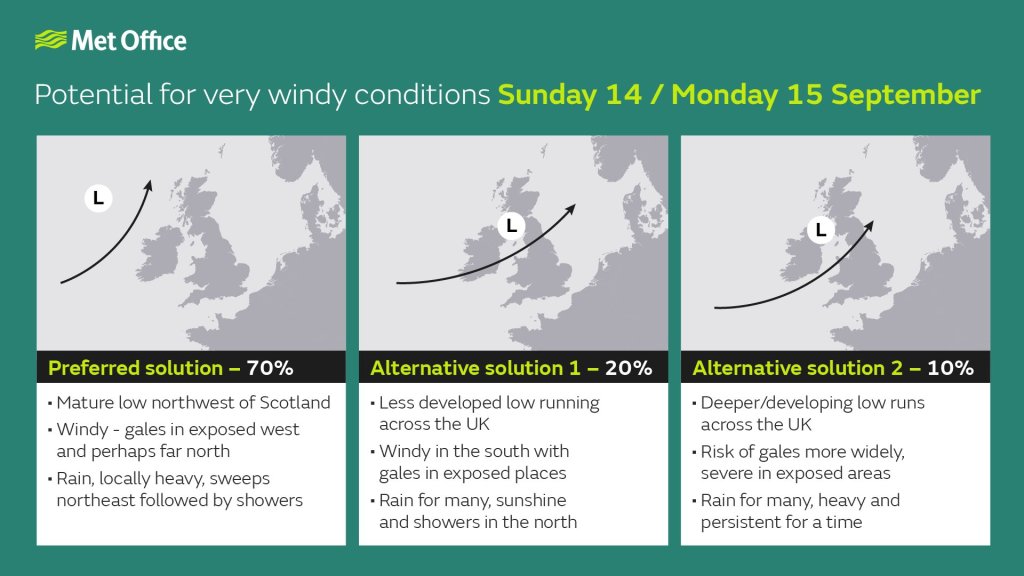
Sunday: Some prolonged rain possible for the morning. This will turn showery later. A windy one, and how windy it becomes later depends on where a deep area of low pressure tracks. At this stage it’s likely to track to the northwest of the UK. More updates via X/Bluesky. Max 18°C Min 11°C Max Gusts 35mph
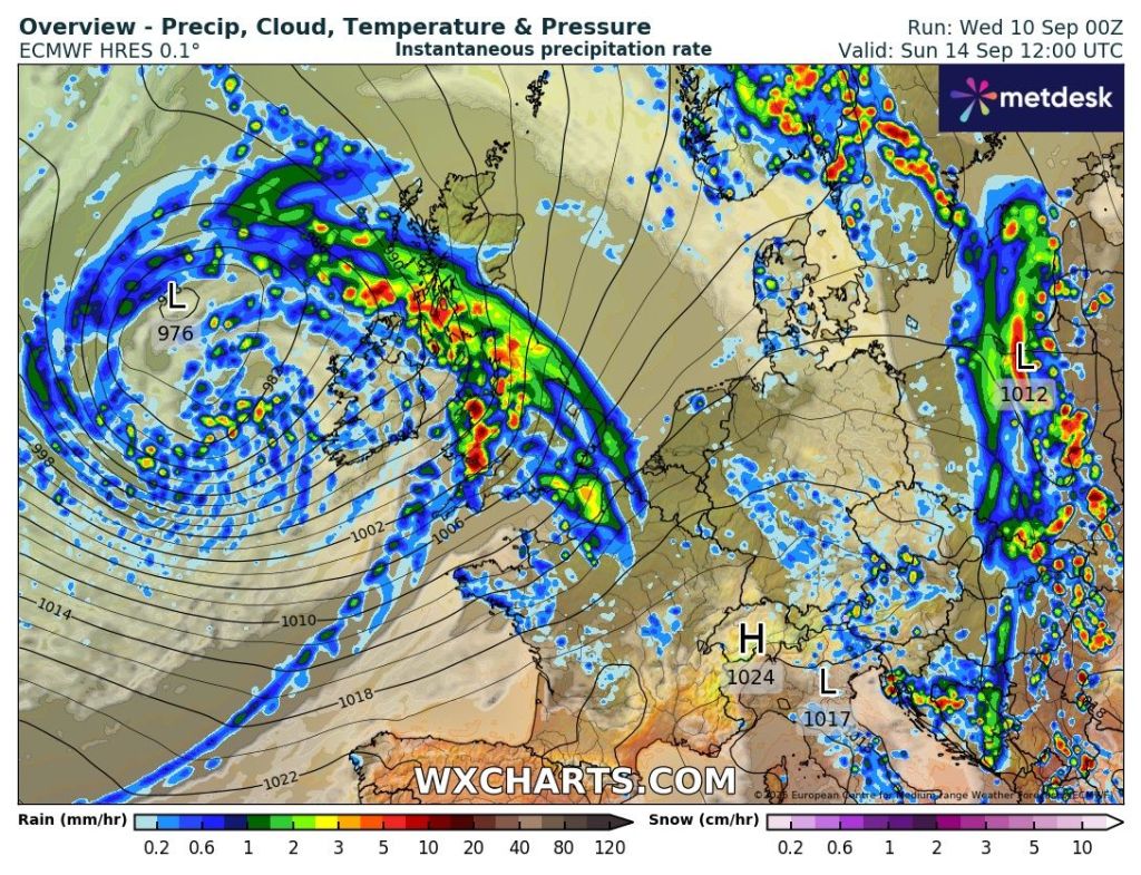
Outlook: The Jet Stream stays in charge so further bouts of wind and rain via low pressure systems with some brightness in between.
Thanks as always for reading.
Follow @ChadWeather on X and Bluesky for the latest forecast and warnings.
Thanks,
Jon
Forecast Issued: Wednesday the 10th of September 2025 at 7:46pm.
Images: http://www.wxcharts.com & The Met Office
