
Hi all,
Are you all still wanting rain? September has been a very wet month and in fact is now the second wettest month of the year and will probably supersede January 2025 after the rain that’s coming this weekend.
We will end up with more rain in September than we did in March, April, May and August combined! Even though that’s taking into account the rest of September, we are likely to surpass the total for those 4 months this weekend. It’s been that wet.
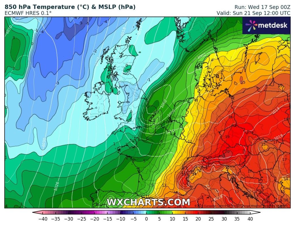
It’s that time of year again where the tabloids start to write articles which are complete and utter nonsense. There’s been the mention of snow flurries and temperatures down to 0° C across England and Wales which is utter rubbish. Even though it is going to get colder on Sunday, the only snow that will be around will be for the tops of the highest Scottish mountains.
Ahead of low pressure this weekend, we will be dragging up some warm and muggy air and temperatures into the southeast of the UK will be into the mid-20s with a late burst of summer heat. We will be in this warm air on Thursday and Friday, but it will be slowly turning cooler during the weekend as well as being wet. Here are the daily details.
Thursday: A weather-front will move north through the region during the morning bringing a little bit of rain. The afternoon should tend to be cloudy but mostly dry bar the odd shower and becoming quite humid. It will also be windy. Max 20°C Min 14°C Max Gusts 30mph
Friday: We remain in the warm air and it will be breezy. There might be a few splashes of rain around, but it will tend to be mostly cloudy with a few bright spells until later in the day when rain starts slipping in from the west. Max 20°C Min 13°C Max Gusts 25mph
Weekend: Turning colder and wet at times.
Saturday: Cloudy with light rain becoming heavier. There will be a weather-front straddled across the country and it is uncertain where this will be at this stage but it is likely to be across our region which means the rain will continue into the afternoon and the amount of rain we see could be worthy of a warning. As this band of rain slowly sinks southwards, now as a low pressure system, cooler air will be filtering down as winds switch to a more northerly direction. Max 16°C Min 8°C Max Gusts 25mph

Sunday: It is likely that there will be some rain around still during the morning. This will clear away to the south and colder air will filter down. Becoming quite chilly in the breeze but a drier end to the day. Max 13°C Min 6°C Max Gusts 20mph
Outlook: At the moment there’s quite a bit of uncertainty for next week, but it looks likely that high pressure will be around from Monday to Wednesday. This will settle the weather down with temperatures in the late-teens and with some sunny spells. Uncertainty towards the second half of the week with perhaps a few showers breaking out and low pressure drifting up from the south. No sign of any snow.
Thanks as always for reading and please follow @ChadWeather on X and Bluesky if you would like frequent weather forecasts.
Thanks,
Jon
Forecast Issued: Wednesday the 17th of September 2025 at 5:40pm.
Images: http://www.wxcharts.com
