
Hi all,
Winter is here and December has started as November ended, with plenty of rainfall. We only had 8 days without measurable rain in November and 169mm of rain. This is the second wettest November I have recorded since records begin in 2012. The wettest being 2015.
There are a lot of clickbait, attention-seeking posts everywhere about copious amounts of snow coming and bitter-cold. Utter nonsense. It’s always around at this time of year but this year it is worse than ever as local media search for clicks and likes.
Thursday: Rain from overnight will continue early on with some heavy bursts. It will clear eastwards slowly but we should see it drier into the afternoon with perhaps some brightness before dark. Cool and windy at first. Clear skies overnight leading to some patchy ice and a local ground-frost. Max 8°C Min 1°C Max Gusts 25mph
Friday: A chilly start with some patchy frost and fog. Dry with sunny spells for most for the morning but cloudier into the afternoon with more rain arriving in time for the evening. Feeling cold, especially later on and into the evening as winds strengthen from the south-east, possibly gale-force at times. Max 8°C Min 5°C Max Gusts 45mph
Weekend: Low pressure in charge.
Saturday: Showery rain will be coming and going but winds do look lighter than late on Friday. Slightly milder too but it’s the overcast, dull and dank conditions that are so depressing. Max 11°C Min 7°C Max Gusts 20mph
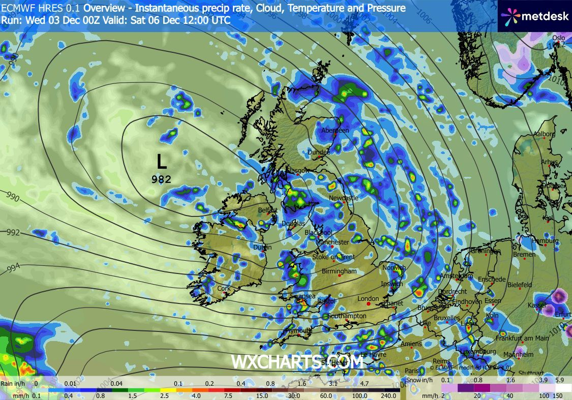
Sunday: A few showers around for the morning but these should ease away for a time with some brightness. Cloud thickening once again ahead of rain forecast for the afternoon and evening. Some uncertainty on the timing and position of this rain-band so look out for forecasts on social media. Max 11°C Min 4°C Max Gusts 25mph
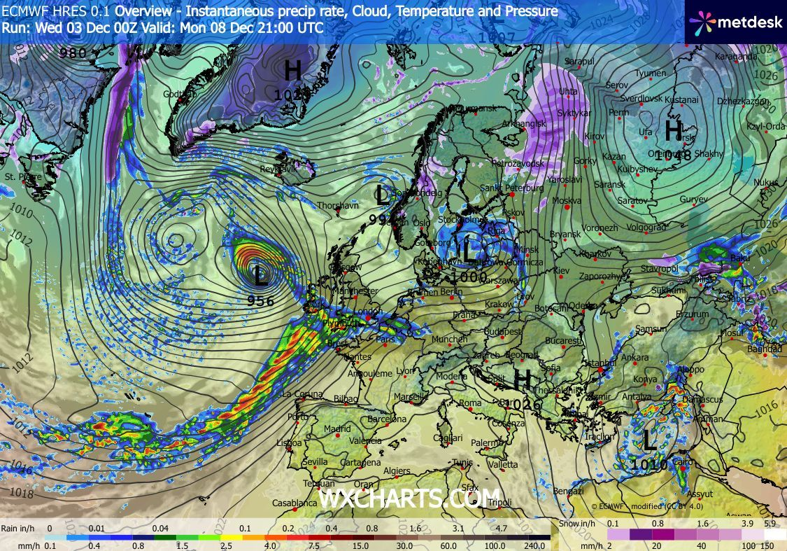
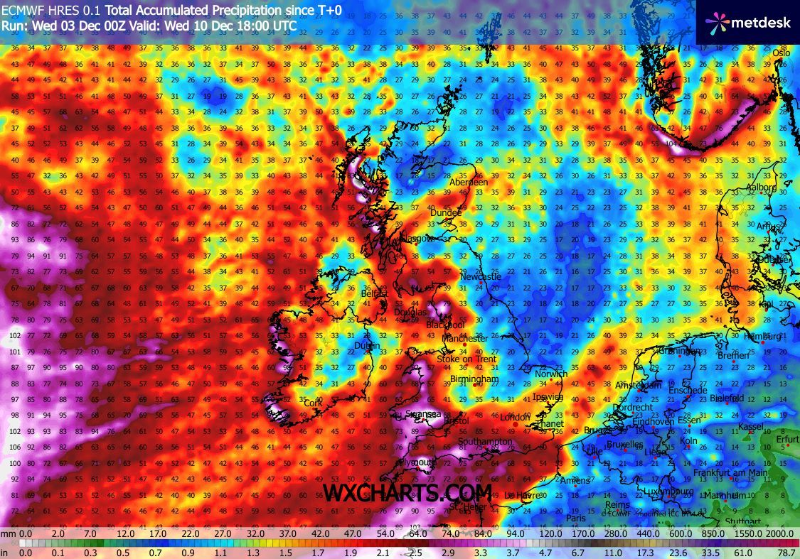
Outlook: It looks like an unsettled week I’m afraid. Plenty of low pressure systems, bringing wind and rain at times. Some drier spells in between. No sign of any high pressure yet, to settle things down and bring some frosty days back. No snow/significant cold expected. Lets hope we’re saving all the snow for Christmas Day.
Follow @ChadWeather on X and Bluesky for the latest forecasts and warnings.
Thanks,
Jon
Forecast Issued: Wednesday the 3rd of December 2025 at 5:34pm.
Images: The Met Office & http://www.wxcharts.com.
