Hi all,
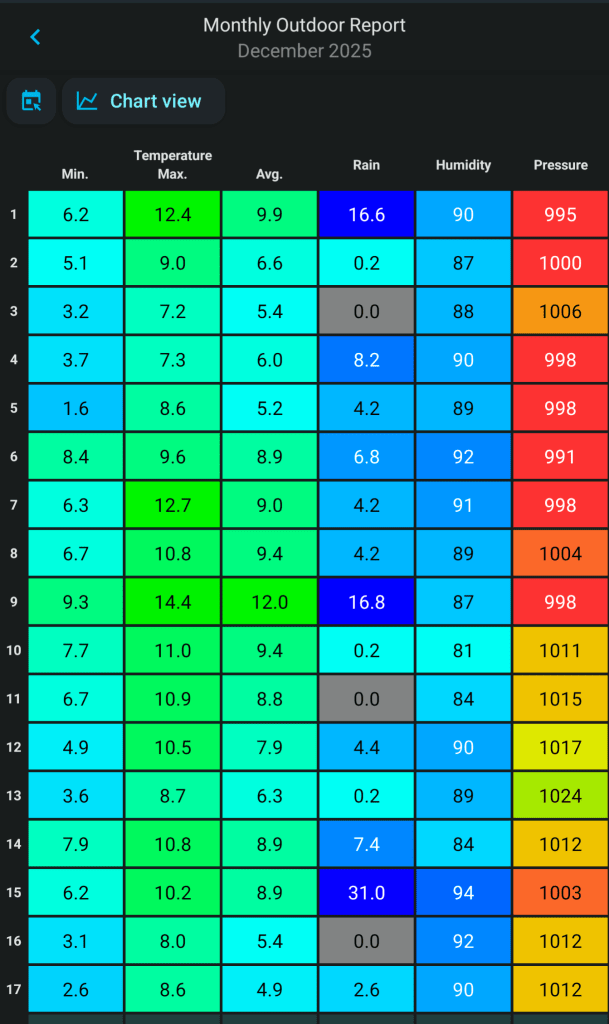
What a terrible month it’s been so far. We’re used to mild and wet Decembers and 2025 is no break from the norm. We’ve had a handful of dry days and just over 100mm of rain. Half the month so far has seen a maximum temperatures of 10°C or above and a few ground-frosts.

A plunge of cold air in the US has produced a stark temperature contrast which has helped the Jet Stream fire-up weather systems across the Atlantic to the UK. This has brought wind and rain via a conveyor-belt of low pressures. However, this west or southwesterly airflow looks set to be broken as we head towards Christmas with hints of colder air developing. Nothing too significant yet but with an easterly wind you never know what could follow. But, before we commence changing the weather pattern, we will see more rain and wind with mild temperatures.
Thursday: A dry start but cloud thickening and rain heavy at times will spread up from the southwest. Breezy but not that windy. Reasonably mild for the time of year. Max 10°C Min 4°C Max Gusts 20mph
Friday: A better day. Windy with bright or sunny spells and just the odd shower possible. Max 9°C Min 5°C Max Gusts 30mph
Weekend: A change to more of an easterly influence.
Saturday: Sunny or bright spells for the morning and then the wind increasing as rain tries its best to push in from the west decaying all of the time. A keen southeasterly wind developing. Max 9°C Min 5°C Max Gusts 25mph
Sunday: Any rain should begin to ease away but it will remain overcast with a steady but notably chillier breeze. Max 8°C Min 5°C Max Gusts 20mph
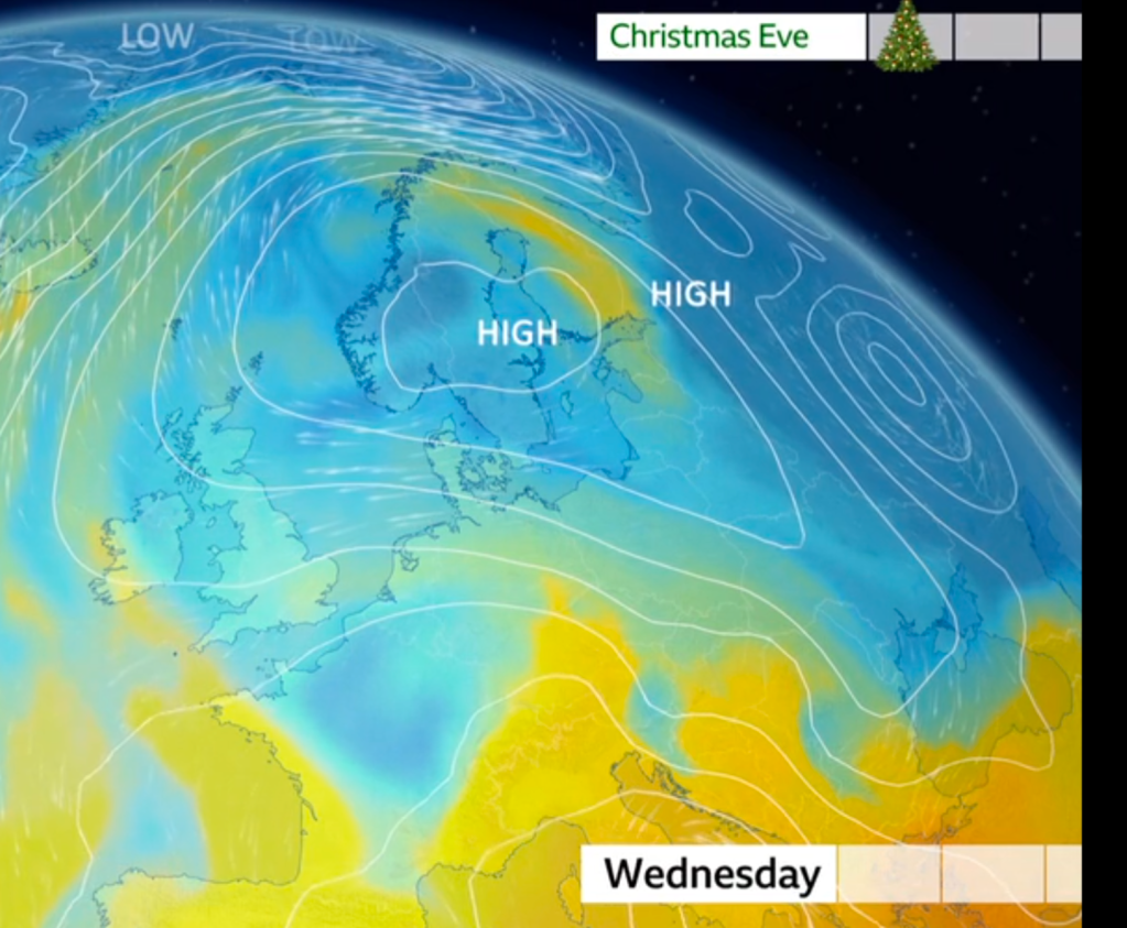
Outlook: High pressure is going to build across Eastern Europe meaning temperatures will start to return to the December average. Plenty of cloud is expected at this stage which could be thick enough for pockets of drizzle. Not cold enough for snow and as we head towards Christmas Day the clouds should begin to break slightly. So the big day is set to be dry with a few bright spells but cold especially in the wind which will continue to be from the East. Variable amounts of cloud cover will mean some nights will be frost-free but the odd one could see pockets of frost developing.

Thanks as always for reading. Follow @ChadWeather on X and Bluesky for the latest forecasts and warnings.
Thanks,
Jon
Forecast Issued: Wednesday the 17th of December 2025 at 6:10pm
Images: BBC Weather, http://www.wxcharts.com.
