Hi all,
How fast has this year progressed so far! Crazy!
Winter, meteorologically-speaking, ends on Saturday. It’s been a poor show for snow-lovers, but it hasn’t exactly been very mild through the 3 months. I’ve not checked the stats but my gut feeling is that it will be cooler than previous winters. We will see.
It’s not been very wet, compared to the last 3 winters, but we have seen rainy days but rainfall amounts haven’t been too high. It’s the relentless cloud and lack of sunshine that frustrates. Not many foggy, frosty then sunny mornings to enjoy.
Rain-free Days
December 2025: 14
January 2026: 9
February 2026: 4 (up to and inc. 24th)
The lengthy spell of high pressure blocking to our east in February brought prolonged rainfall to parts of the UK which helped to contribute to the day-after-day of cloud across the region.
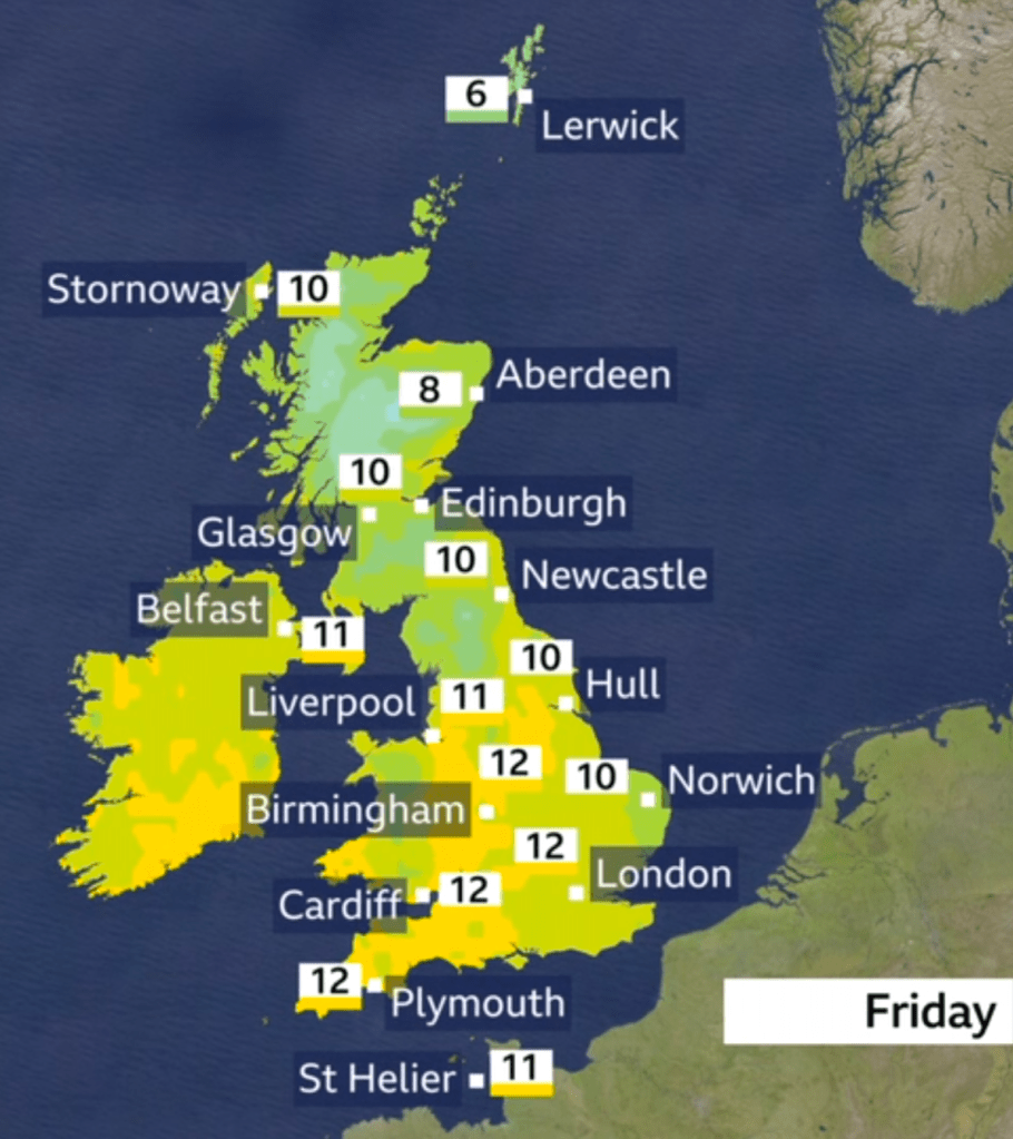
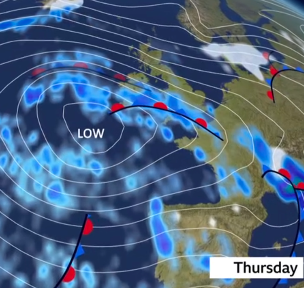
Thursday: It’ll be a cloudy but dry start and then the cloud will thicken and rain will arrive from the west with southwesterly winds. Some of the rain will be heavy into the afternoon and quite prolonged. It won’t be as mild as recently but temperatures still in double-figures. Max 11°C Min 8°C Max Gusts 30mph
Friday: Unfortunately another cloudy day with rain at times, although the rain will be light and patchy. Still mild for the time of year, but as the rain moves away later and the wind swings to a northwesterly, colder air will arrive leading to a patchy frost overnight. Max 11°C Min 2°C Max Gusts 20mph
Weekend: Saturday looks the better day of the two.
Saturday: A clear and in places frosty start. Plenty of sunny spells on offer, but like recent days where we’ve had a sunny start, the skies will turn milky and hazy into the afternoon as high-cloud arrives ahead of yet more rain. Hopefully we should stay dry throughout the day. Cooler but pleasant in the sunshine. Max 8°C Min 5°C Max Gusts 20mph
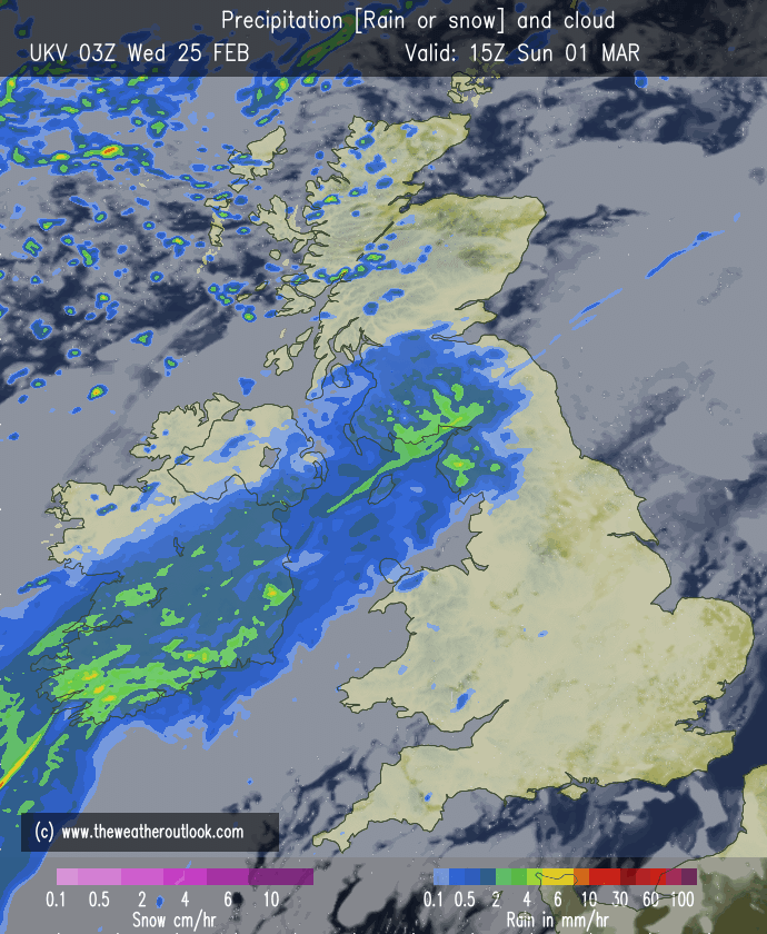
Sunday: The first day of spring won’t be spring-like. At this stage there is some uncertainty on where a band of rain will sit. But at the moment it looks like it’ll be pretty much over us. So we can expect a cloudy day with rain at times, some of which could be heavy. Milder and windy. Max 11°C Min 7°C Max Gusts 30mph
Outlook: Any rain from Sunday should slowly ease away on Monday and then most places will become dry and mild with temperatures, possibly, into the teens. An area of high pressure is possible for Tuesday so expect dry conditions and some sunny spells but also slightly cooler air. After that, it will be a case of seeing if the high pressure can hold on and keep weather systems from the Atlantic at bay. If it can then we should enter a decent spell of weather.

Follow @ChadWeather on X and Bluesky for the latest forecasts and warnings.
Thanks for popping by to read. I hope this helps you plan your days.
Thanks
Jon
Forecast Issued: Wednesday the 25th of February 2026 at 4:27pm.
Images: http://www.wxcharts.com & http://www.theweatheroutlook.com