
Hi all,
It’s been a dismal few weeks of weather, but to be fair we have missed the worst of it compared to other places across the UK, especially the south and southwest. That said, I have recorded rainfall everyday so far in February, just not significant amounts.
There is a change on the way which will bring some welcome sunshine one day this weekend but rain will return next week as the Jet Stream kicks into gear. But at least the blocking high in eastern Europe has gone.
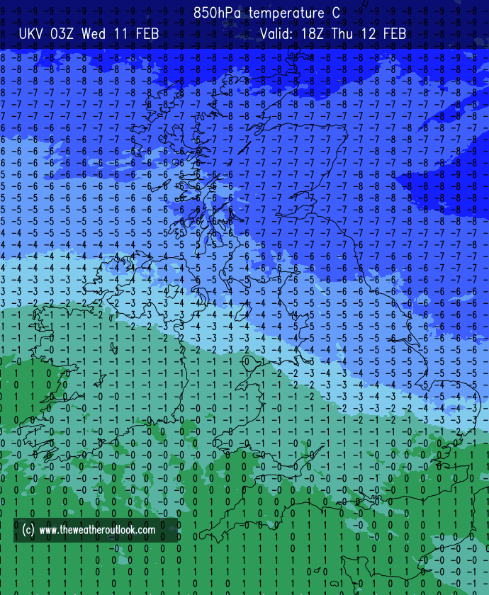
Thursday: By the time we get to Thursday morning, winds will have turned to more of a northeasterly direction. This will be filtering in colder air over the next 24 hours. A cloudy start with some rain around but this should tend to peter out and then it will be a mostly cloudy day with rain returning later. As temperatures drop later the rain will turn to snow over high ground for which there is a warning in place. A couple of centimetres of snow-cover cannot be ruled out on the highest routes. Some snow could fall to lower levels during the night, but accumulations are not expected, although I wouldn’t rule out a slushy deposit or two. Max 5°C Min 0°C Max Gusts 20mph
Friday: There could well be some early rain, sleet and hill-snow around on Friday but it will soon push away to the south. Once cleared, we can expect a cold day with bright spells. Skies will tend to clear overnight, leading to a widespread frost and ice. Breezy to start the day but winds easing later. Max 4°C Min -3°C Max Gusts 20mph
Weekend: Sunny Saturday. Back to the norm Sunday.
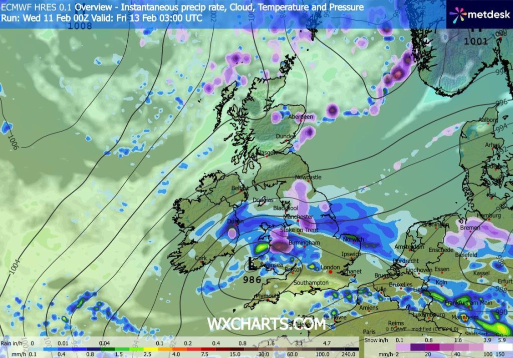
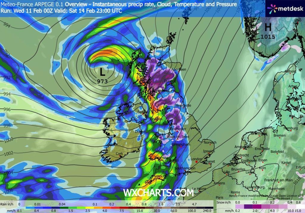
Saturday: It looks set to be a lovely day after a frosty start. There will be plenty of sunny spells around and blue skies as our airmass is now coming from the north. Unfortunately this is not set to last. The sunshine is likely to turn hazier later as cloud spills in from the west into the evening. Overnight the winds will increase and rain will spread across the region, some will be heavy at times, and likely to be preceded by some snow which will be short-lived and mostly on the hills. Max 4°C Min 0°C Max Gusts 15mph
Sunday: A wet and windy start with any falling snow on the hills soon turning back to rain. In the afternoon the rain will turn more showery and some bright spells will develop as well. The strong winds from the morning will ease a touch and temperatures will become less cold as winds turn back to a southwesterly. Max 6°C Min 4°C Max Gusts 35mph
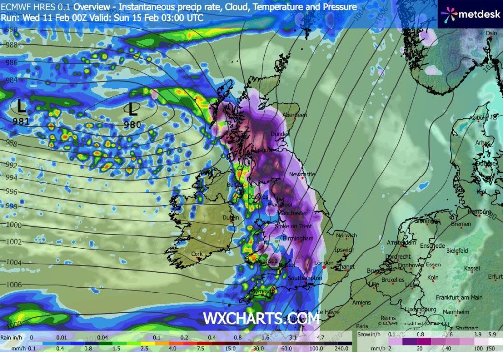
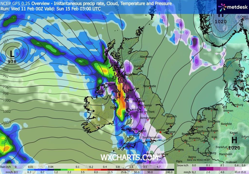
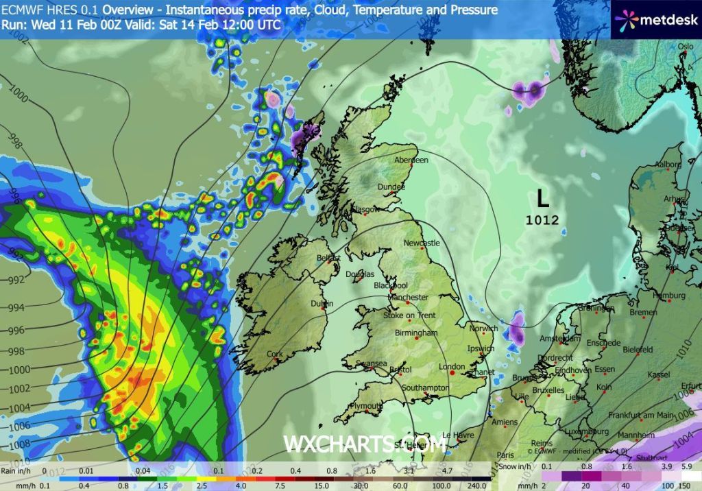
Outlook: It would be nice to keep the winds from the north and the weather remain more seasonal but unfortunately the Jet Stream will be back in charge and low pressure systems will come in from the Atlantic throughout the week. The weather will not be stuck in a rut like it was last week where the low pressure systems will slow and anchor themselves across the UK due to high pressure blocking to the east. This time they will move from west to east across the UK. So once rain moves through, there should be some brighter spells in between the bands of rain. Temperatures will be around average but perhaps a little bit milder towards next weekend. Sunshine or brightness again will be limited, but this is what we can expect with a westerly or southwesterly airflow at this time of year.
Follow @ChadWeather on X and Bluesky for the latest forecasts and warnings.
Thanks,
Jon
Forecast Issued: Wednesday the 11th of February 2026 at 4:45pm
Images: http://www.wxcharts.com & http://www.theweatheroutlook.com
