Unknown's avatar

About Oldham Weather

This is a weekly blog with a 4-day weather forecast (THU-SUN) for Manchester, and its surrounding areas. Weather statistics from the dedicated Vantage Pro 2 weather station in Chadderton, Oldham. Live statistics are updated every 1 minute here, https://www.wunderground.com/personal-weather-station/dashboard?ID=IOLDHAMC2. Follow me on Twitter, @ChadWeather and follow the statistics account, which updates hourly at @OldhamWXStats.

Thursday 27th February – Sunday 2nd March

Hi,

We have had some mild temperatures recently but as we enter the meteorological Spring it looks set to turn slightly cooler with some night-time frosts.

Thursday sees any rain from overnight quickly clearing away eastwards on a fresh breeze. This then leaves a day of sunshine and some wintry showers with possible hail or thunder for the afternoon. Feeling cooler than recently, especially in the breeze, with highs of 7’C.

Generally a day of bright spells and the odd shower for Friday. However, there is a risk of some rain pushing up from the south which may give some wet-snow on the hills. It looks frosty and icy overnight. Highs of 6’C.

Cold start on Saturday with some places below freezing as we enter March. Some isolated showers are expected during the day but also with some bright spells. Highs of 6’C.

Sunday looks a reasonable day. Drier and a little milder. Bright spells across the region after an early shower-risk. Highs of 8’C.

Looking ahead temperatures look to stay around average and we will continue to see some showers at times but not as unsettled as recent weeks.

To keep up-to-date on your local weather, follow Jon, @ChadWeather on Twitter.

Cheers
Jon
Thursday 20th February – Sunday 23rd February

Hi,

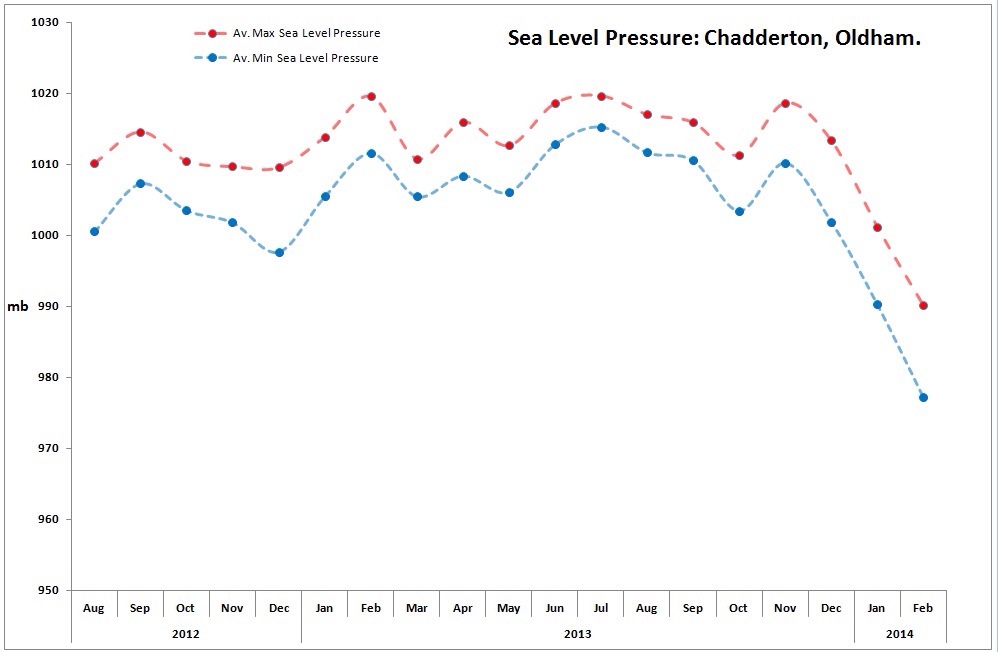
Well that was quite a week, in which a couple of my weather records were broken. Firstly a gust of 72mph was recorded during Wednesday’s storm and then late on Friday night with another deep area of low pressure sitting over us, I managed a record low pressure of 961.16mb.

Thursday sees the return to unsettled wet and windy weather after the recent respite. The morning looks wet with rain early on, turning showery as the day goes on. Highs of 9’C.

After a mild night, Friday will be breezy with showers at times across all parts especially into the afternoon. Highs of 8’C.

If you are planning something for the weekend then Saturday looks the better day at the moment.

Saturday sees us under a westerly airflow bringing the odd isolated shower but these easing so slightly drier by evening. Highs of 7’C.

Sunday sees a mainly cloudy day with some rain and breezy conditions spreading in from the south-west. Highs of 7’C.

Looking ahead, the weather looks to remain unsettled and dominated by systems coming in off the Atlantic giving rain or showers at times but remaining mild. No sign of any snowfall this month.

To keep up to date with your local weather, follow Jon, @Chadweather on Twitter.

Cheers
Jon

20140219-170655.jpg

Thursday 13th February – Sunday 16th February

Hi,

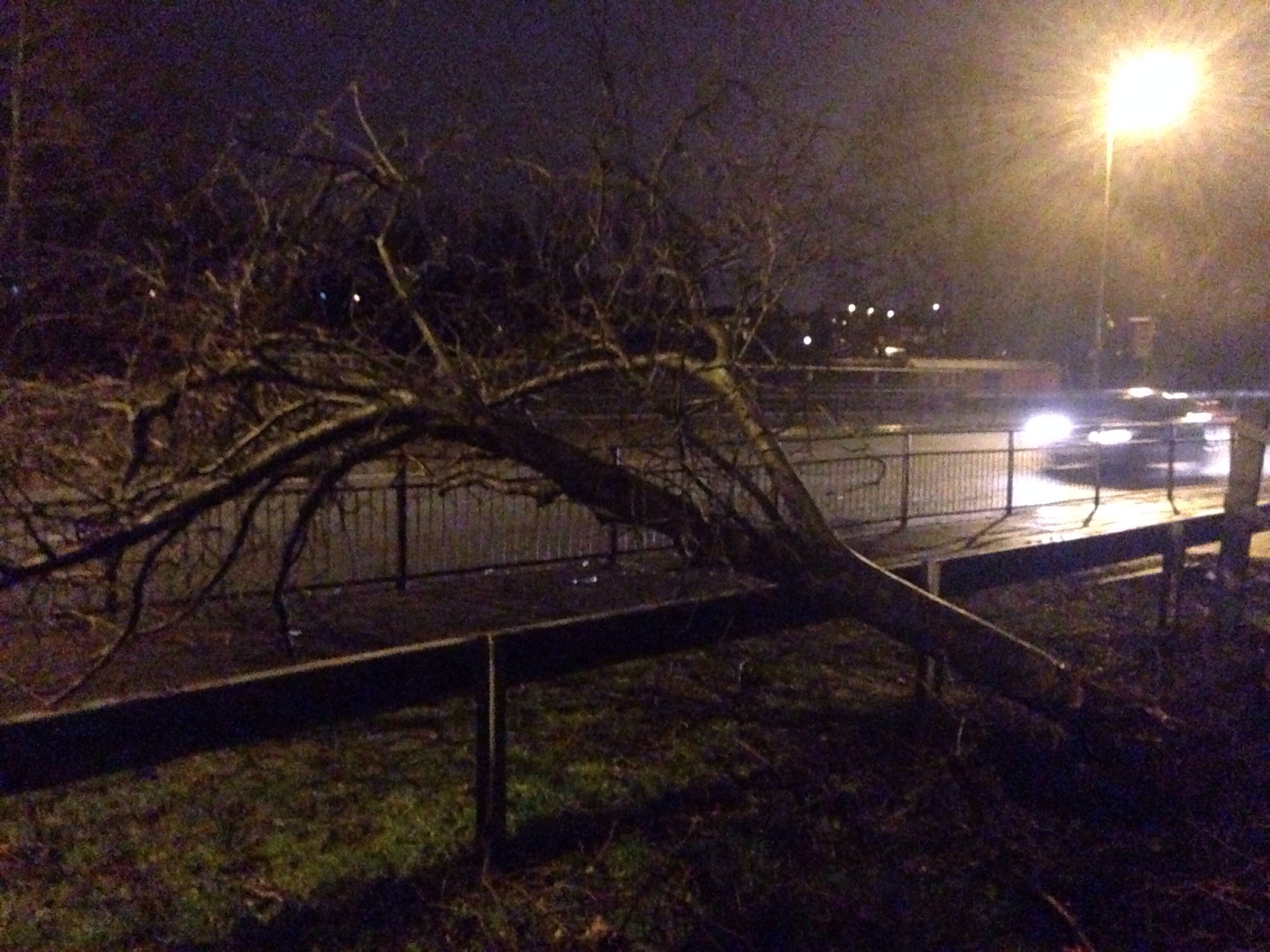
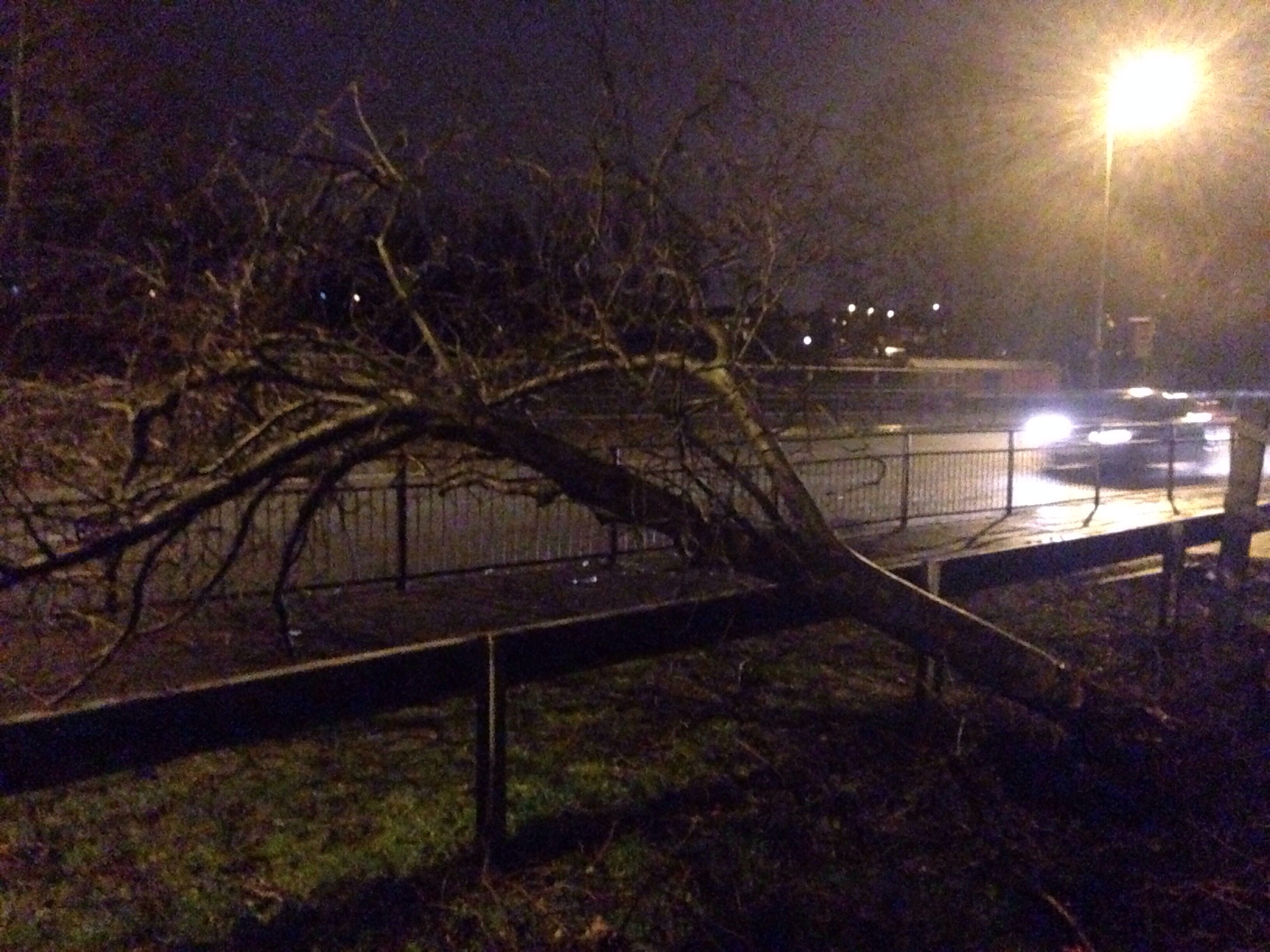
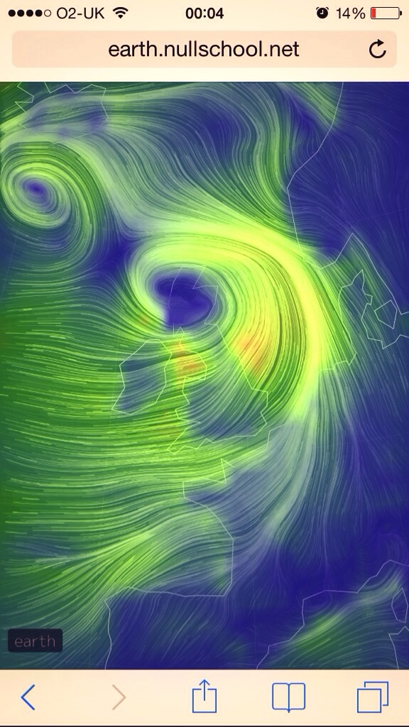
After severe gales yesterday and some snow in the 24 hours previous, the weather has been all-go recently.

Thursday will still be a very windy day with some scattered wintry showers which may fall as hail and snow on the hills. Feeling cold and turning chilly overnight with a slight frost and ice-risk. Highs of 5’C.

Friday starts cold and bright for much of the morning but soon becoming overcast with rain pushing up from the south during the afternoon with a strengthening south-easterly wind. Highs of 6’C.

Any early rain clearing on Saturday after giving some hill-snow for a time. Following on, bright spells and heavy wintry showers. Windy. Cold. Highs of 5’C.

Sunday looks the best day of the weekend. Bright spells and generally dry but don’t rule out the odd shower. Feeling cold though with highs of 5’C.

Generally drier and more settled next week after some rain early and late.

To keep up to date with your local weather, follow Jon, @ChadWeather on Twitter.

Cheers
Jon
20140212-204907.jpg

Thursday 6th February – Sunday 9th February

Hi,

So we are now into February after a very wet and windy January and the new month seems to be following the same pattern.

After a wet and windy day yesterday, Thursday promises a somewhat better day with less wind with some early showers around but with a drier afternoon. Cloudy later with some rain into the evening. Highs of 7’C.

Early rain on Friday followed by bright spells and still the risk of a scattered shower. This risk will ease away and turning chilly during the evening but short-lived as cloud increases. Highs of 6’C.

More wind and rain is set to spread across the region again on Friday night and into Saturday via a deep area of low pressure. Heavy rain will soon clear to frequent, blustery showers with winds gusting to gale-force especially around the coasts. Feeling cold with highs of 6’C.

Sunday sees low pressure still in charge, so a windy day with some showers, these maybe wintry on the hills and Pennines. Highs of 6’C.

Looking ahead, we see the unsettled weather continue and apart from some Pennine wintry showers there seems no sign of any significant snow giving us a taste of winter. Could we even go the whole winter without a regional snow-cover? Time will tell.

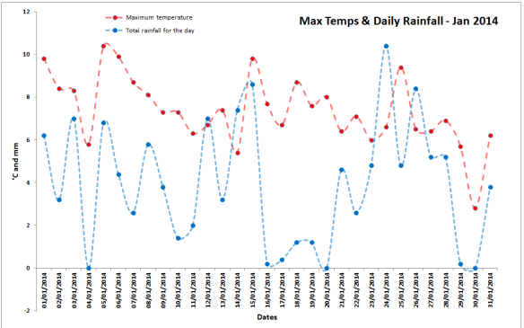
January 2014 Stats: Warmest: 10.4’C; Coldest: 0.2’C; Wettest Day: 10.4mm; Windiest: 45mph; Total Rainfall: 122.4mm (wettest for 13 months)

Cheers
Jon

Thursday 30th January – Sunday 2nd February

Hi all,

Some colder weather around on Thursday but not lasting long as we again look to the Atlantic for our weather.

Thursday is probably going to be the coldest day of the winter so far. Generally cloudy, some bright spells but with a raw easterly breeze and don’t rule out the odd snow flurry especially towards the Pennines. Highs of 3’C.

Friday will dawn with a slight frost in most places after a cold night. The morning looks dry but turning cloudy and rain will soon spread in from the west, maybe preceded by a little snow on the Pennines. Turning milder later. Highs of 6’C.

The weekend is looking showery and windy. Some showers maybe wintry on the highest hills.

Saturday sees any early rain clearing to sunshine and blustery showers. Feeling cold in the wind which may produce gale-force gusts at times. Highs of 6’C.

Sunday looks a similar day as low pressure is nearby. Fewer showers as the day progresses. The wind still making it feel cold. Highs of 6’C.

Looking ahead the weather remains unsettled with further rain or showers being fed in on a breezy, southwesterly or westerly wind. Much to my disappointment, no sign of wintry, snowy conditions on the horizon.

To keep up to date with your local weather, follow Jon, @ChadWeather on Twitter.

Cheers
Jon
Thursday 23rd January – Sunday 26th January

Hi All,

More unsettled weather on the way but maybe something a little more wintry at times especially into next week.

Thursday sees a band of squally rain race through during the morning. Turning colder as it clears away later with bright spells and the odd wintry shower afterwards which will be of snow on the Pennines. Feeling colder. Highs of 5’C.

Friday is likely to be icy with patchy frost and fog to start before more cloud and rain spreads from the west. Highs of 6’C.

Saturday will start cloudy with some bright spells. Windy with blustery showers and slightly milder air during the day. Highs of 7’C.

Sunday will be cloudy with rain at times spreading in from the west. It will be particularly heavy at times. It will also be very windy with gale-force gusts likely in exposed places. Turning colder later with a chance of hill-snow. Highs of 6’C.

Looking ahead, it looks likely, for a few days, that we will see an increasing risk of seeing some wintry showers. So hill-snow becomes a possibility with a chance of it being seen at lower levels. Certainly one to watch.

To keep up to date with your local weather, follow Jon, @ChadWeather, on Twitter.

Cheers
Jon

Thursday 16th January – Sunday 19th January

Hi,

So still we await some real wintry January-like weather with some snow. Like me, snow-lovers will have to remain patient for now. I will be tweeting at the first sign of the white stuff that’s for sure!

Thursday looks like a day of bright spells with well-scattered heavy showers. The showers will be heavy with possible thunder if you catch one but some places may be lucky enough to escape all together. Relatively mild with highs of 8’C.

Friday is a similar day. Low pressure close by so occasional showers are likely but not as heavy as Friday. Temperatures a little chillier with highs of 6’C.

Saturday will start chilly but with some nice bright spells. These short-lived as more cloud and rain spreads in again from the west bringing a damp and wet day especially over the hills with hill-fog. Highs of 7’C.

Sunday looks a cloudy day with further showers possibly easing later as drier and cooler weather comes in from the west. Temperatures around 6’C.

Looking ahead, some models point towards a colder spell around the 20th but only time will tell if we eventually slip into something wintry.

Here are some yearly statistics for 2013: Av. Temp = 9.1°C; Av. Max Temp = 12.3°C; Av. Min Temp = 5.9°C; Max Temp = 29.9°C; Min Temp= -5.5°C; Wettest Month = October; Driest & Windiest Month = April

To keep up to date with your local weather, follow Jon, @ChadWeather on Twitter.

Cheers
Jon