Hi all,
Snow is on the way which could be disruptive in places on Thursday, especially so on trans-Pennine routes and areas >300M.
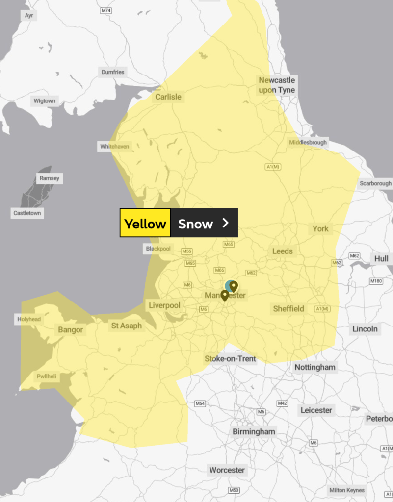
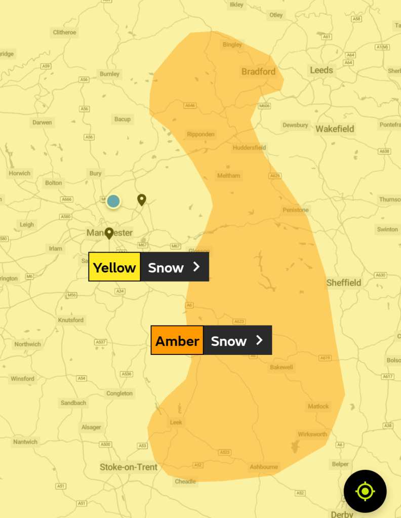
There are two warnings in place. Yellow and Amber.
Yellow from THU 6am to FRI 6am.
Amber from THU Noon to THU 6pm.
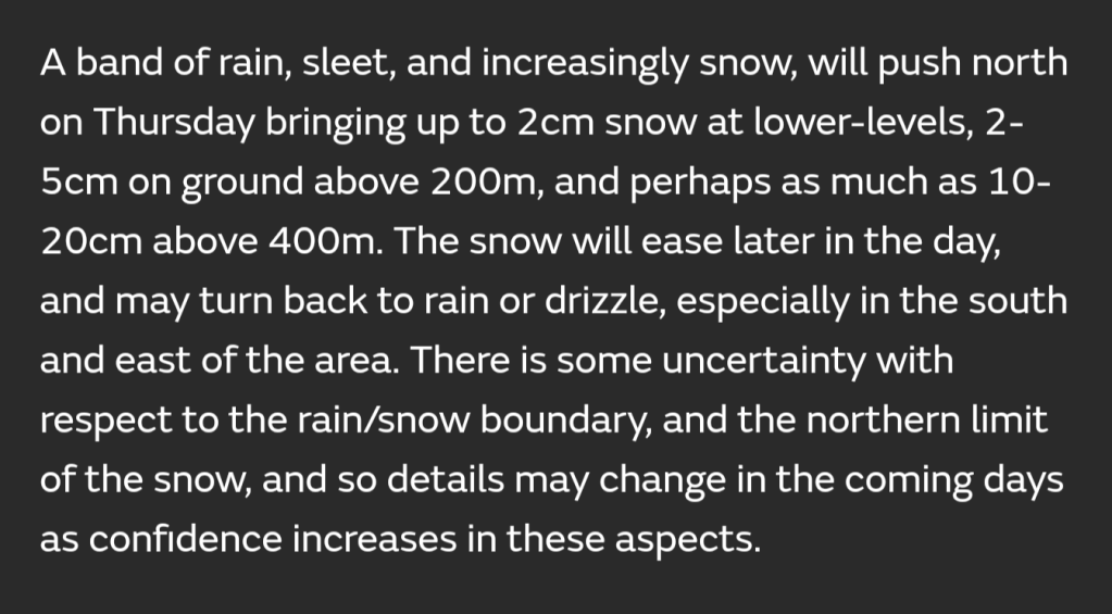
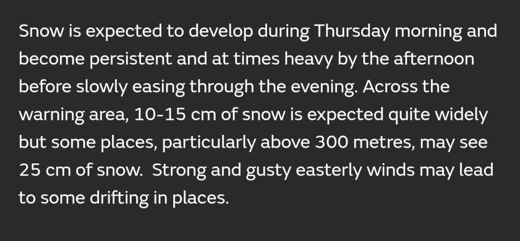
Snow is still possible to low-levels with 1-3cm not out of the question. The current Met Office warning has up to 25cm on those higher routes so stay tuned to the forecast.
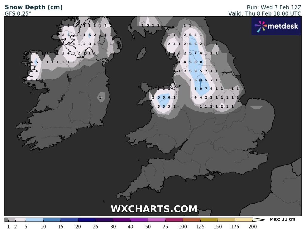
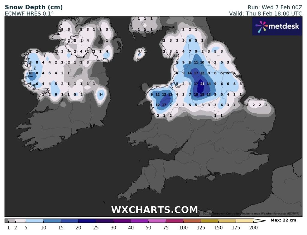


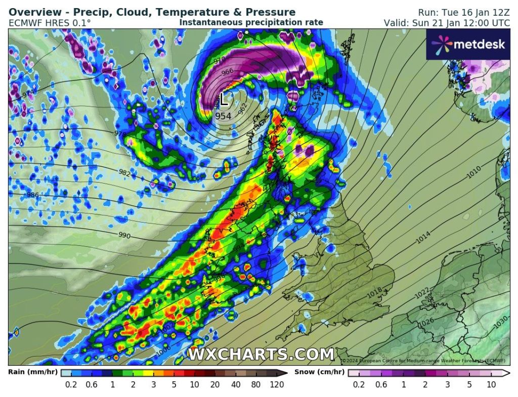
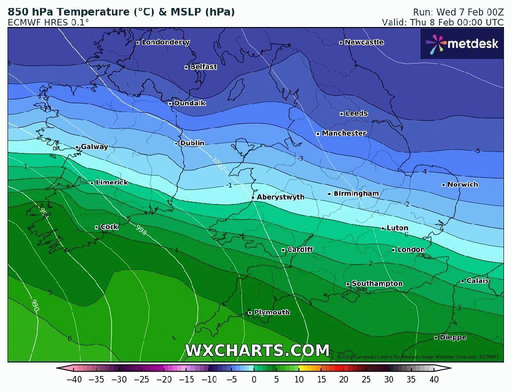
From the charts above I’m swinging towards chart 3, 4 or 5. I think snow-lovers west of Manchester will be disappointed. I do expect to see some big flakes of snow which are always nice to see even if they don’t stick. So look out for Prawn Cracker snowflakes.
Thursday: Cloudy with rain, sleet and snow pushing up from the south. It is expected to start around 7am. Not too windy for the first half of the day but later on and overnight 50mph gusts are possible with a bitter, sub-zero windchill.
Most areas will see a spell of snow for several hours leading to accumulations even at low-levels but with the intensity varying west of Manchester, here is likely to see rain, sleet and snow, so I can’t guarantee a snow-cover everywhere.
As the day wears on into the afternoon, the snow will continue above 250M, but on lower-lying areas it is expected to become a bit more patchy and we’re likely to see rain and sleet.
A further spell of rain, sleet and snow will arrive overnight, but the snow is expected to be confined to the highest hills and Pennines as temperatures rise.
As always, forecasting snow can be a nowcast situation so look out for my posts on X during Thursday. I expect quite a contrast between lower-levels and areas with elevation above 250-300M.
The Amber warning is there for a reason. If you do plan to travel over the tops, then you might want to consider your travel arrangements as disruptive snow is expected on higher routes. Max 3°C Min 0°C
Friday: The low pressure bringing the rain, sleet and snow will have moved further north now, meaning we are in the milder air. Most areas will have rain at times with any snow being confined to the tops of the Pennines. A thaw of any lying snow will begin. Again, especially during the morning it will be windy with 40mph gusts making it feel cold. Max 6°C Min 1°C
Weekend: Low pressure anchored across the UK.

Saturday: Cloudy with showers here and there and misty to start. Some bright spells are possible in the afternoon. Quite breezy but not as strong as recent days. Milder. Max 9°C Min 4°C
Sunday: Little change. If anything, more in the way of rain. Perhaps a little cooler later as winds switch direction. Max 7°C Min 3°C
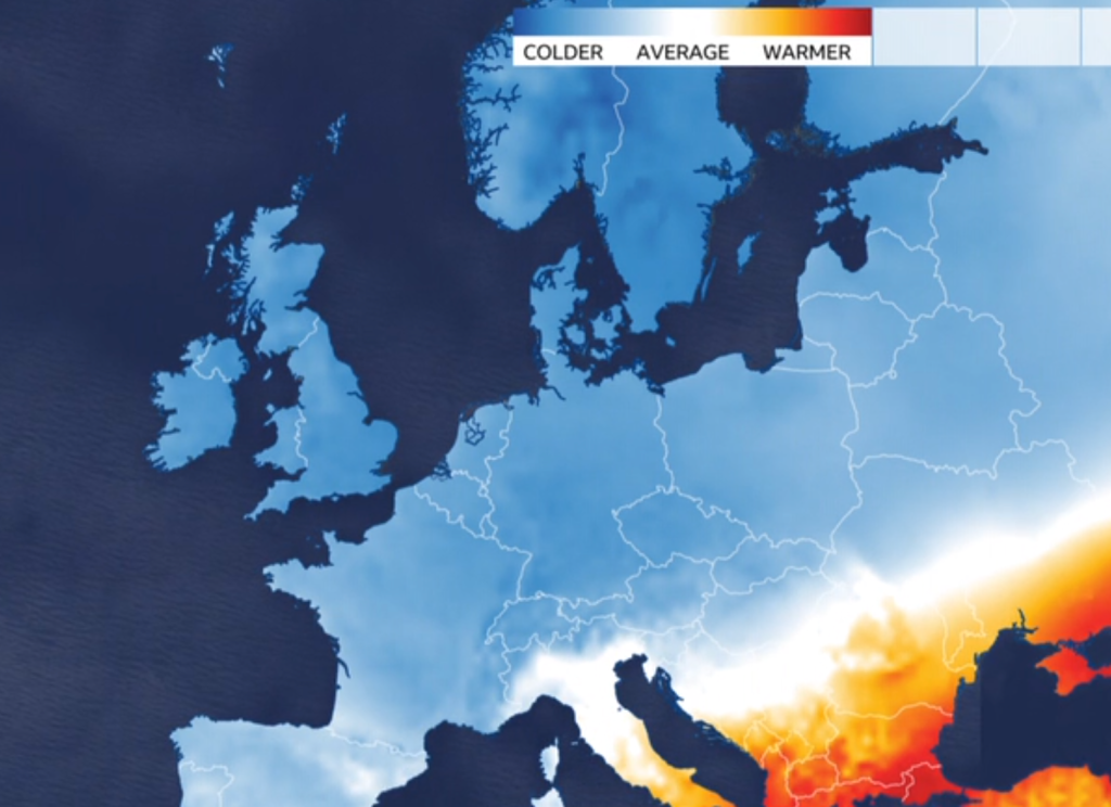
Outlook: Mostly cloudy with temperatures around average for the time of year or just above. There will also be patchy rain or showers, but perhaps a brief ridge of high pressure midweek will bring a brighter day. No sign of any significant cold or snow.
Follow @ChadWeather on X for the latest forecasts and warnings.
Thanks,
Jon
Forecast Issued: Wednesday the 7th of February 2024 at 5:45pm.
Images: http://www.wxcharts.com & http://www.theweatheroutlook.com