Hi all,
August, a month never to be trusted. We’ve had an unsettled week of weather with some conditions more like early Autumn. There is more wind and rain to come, but there could be light at the end of the tunnel just in time for the Bank Holiday Weekend.
Thursday: Showers on a northwesterly wind to start the day but these will eventually fade by the afternoon. So, a drier and better end to the day with sunny spells. Max 19°C
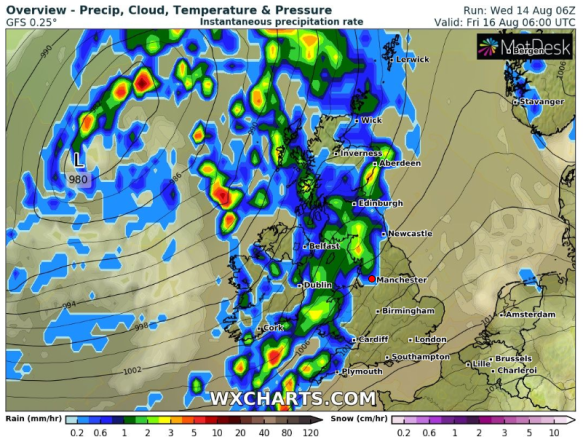
Another Autumnal-like low arrives on Friday
Friday: An unsettled day, as a band of rain, some heavy, comes in from the west. It will also turn breezy. The rain will turn showery later in the day but some of these will be heavy and perhaps prolonged. Max 18°C
Weekend: Breezy with showers
Saturday: Low pressure anchored to the northwest of the UK, so it will be windy with some showers. Some uncertainty on how many showers at this stage, but hopefully not too many and some sunny spells in between. Max 19°C
Sunday: A dry start for most with bright or sunny spells. It will become increasingly windy as the day progresses, gusts to 35mph and bands of showers will arrive leading to a wet afternoon and evening. Max 18°C
Outlook: A slightly unsettled start but from midweek the weather looks set to improve as the Jet Stream buckles and this gives high pressure a chance to build. As we head towards Bank Holiday it’s currently looking good with settled conditions, sunny spells and temperatures recovering to the early 20s. As always, this time-frame is in the unreliable window so look out for updates on Twitter.
Follow @ChadWeather on Twitter for the latest weather forecasts.
Thanks,
Jon
Forecast Issued: Wednesday the 14th of August 2019 at 11am.
Image: wxcharts.com