Hi all,
What a week of weather. A heatwave, the highest temperatures recorded for years and then unprecedented rain on Sunday. Last week saw hot air pump up from France and if 30°C wasn’t enough on the Tuesday we hit the dizzy heights of 33°C on the Thursday. Combined with the humidity, for me, it felt awful.
The heatwave broke down into the weekend and a weather front stalled over the region with places recording a staggering 70-100mm of rain. That’s over a month’s worth in 24 hours.
Thursday: The recent unsettled weather was down to a low pressure which is now decaying out in the North Sea. Expect sunny spells and a few thundery showers, more so over the Pennines. Warmer. Max 21°C
Friday: A similar day with sunny spells and a few showers but fewer than yesterday. Max 21°C
Weekend: Saturday’s the better day.
Saturday: A decent day by the looks of it. Sunny spells, fair-weather cloud bubbling up, warm and it should stay dry. Max 22°C
Sunday: A bright start then mostly cloudy with showers or longer spells of rain arriving in the afternoon. Breezy. Humid. Max 22°C
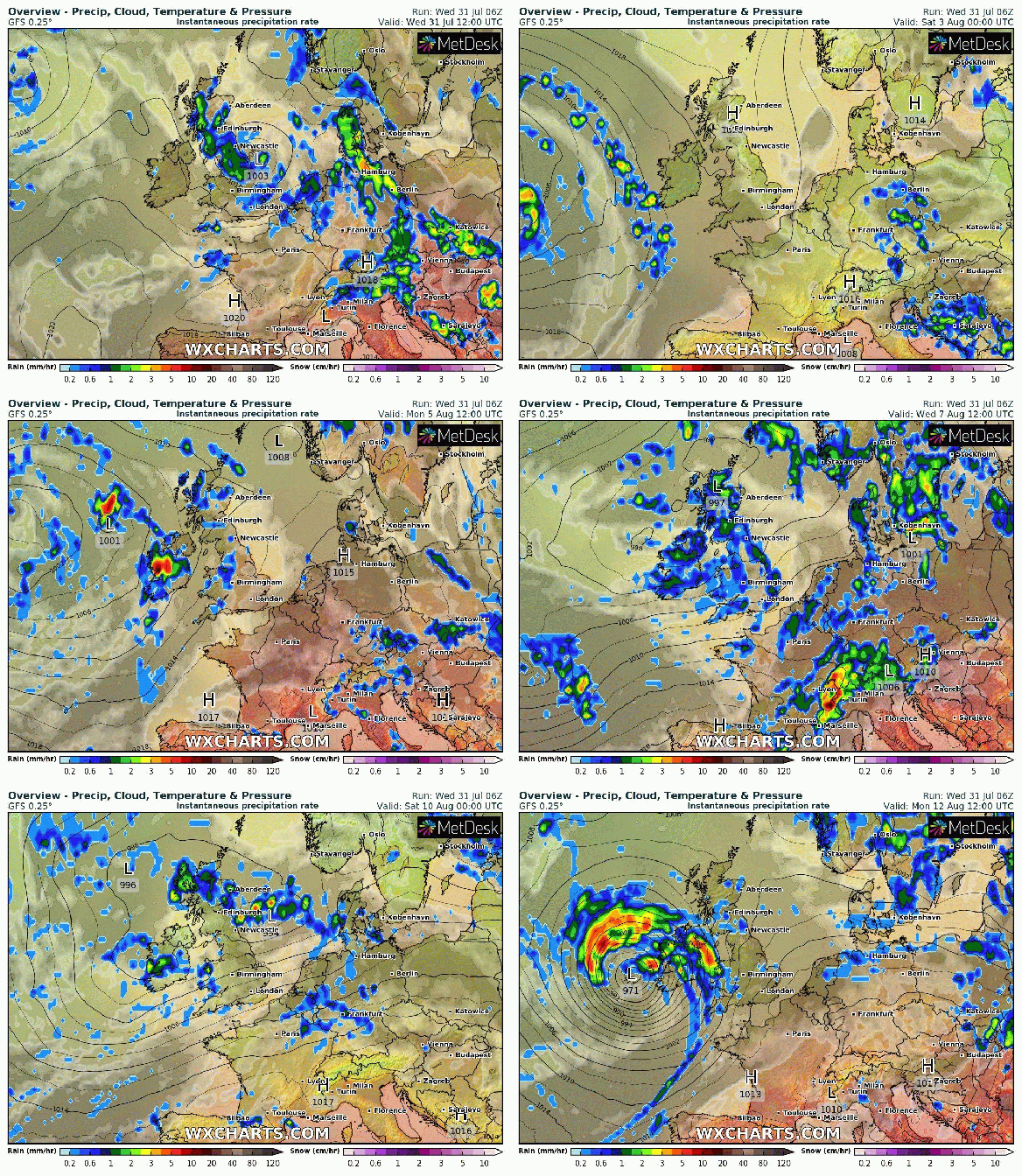
Outlook: After a nice Monday the rest of the week looks unsettled with showers or longer spells of rain as the Jet Stream slips South. No sign yet, of a decent August.

Most of the first half of August looks below average with low pressure bringing showers or longer spells of rain
July 2019 Stats
Max 33.4°C (25th)
Min 7.8°C (3rd)
Av. 16.7°C
Av. Dew Pt 12.6°C
Wettest 77.2mm (28th)
Highest UV 8.3
Av. Humidity 78%
Av. Barometer 1016.1 hPa
Max Gust 31mph (24th)
Av. Wind Direction W
Rain 155.2mm
Rain Registered Days 18
Dry Days 13
Follow @ChadWeather on Twitter for the latest weather forecasts.
Thanks,
Jon
Forecast Issued: 9pm on Wednesday the 31st of July 2019
Images: netweather.tv and wxcharts.com


