
Hi all,
I hinted at some heat last week and it certainly arrived with 28.4°C recorded on Tuesday. To follow, we had a decent thunderstorm with some much-needed torrential downpours. Record-breaking temperatures across the UK await.
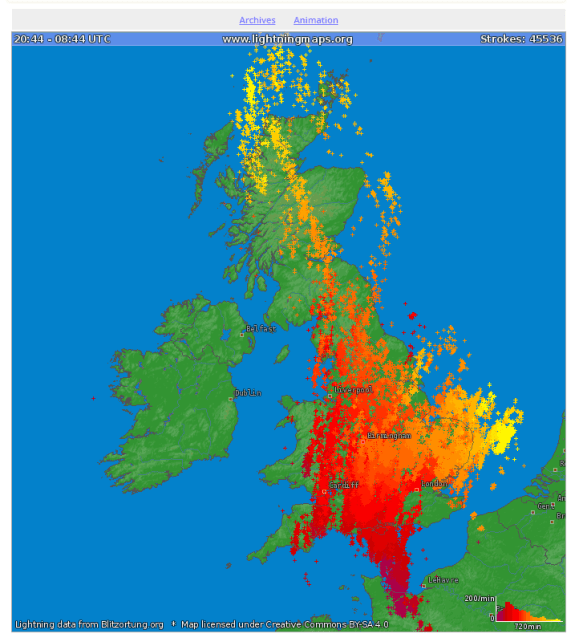
There were over 45,000 lightning strikes across the UK on Tuesday night
Thursday: The hottest day for many years looks on the cards. I only have local records since August 2012, so my maximum temperature to beat is 30.4°C. Plenty of sunshine and high UV levels. A steady southeasterly breeze dragging in intense heat from France. Somewhere in the UK could see 38-39°C. That’s insane. Cooler further west. Risk of storms later. Max 31-33°C
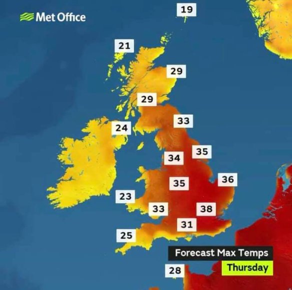
Blazing Heat: Predicted maximum temperatures on Thursday
Friday: Change arrives. A cold front will slowly push east, mostly just a band of cloud but it will introduce cooler and fresher air during the day. Some sunny spells. Temperatures some 8-10°C lower. Max 23°C
Weekend: Disappointing
Saturday: Mostly cloudy with some rain especially in eastern parts. Cooler. Max 19°C
Sunday: Again cloudy and with low pressure in the east this will mean we continue to feed some rain in at times. There is some uncertainty for the forecast at this stage so look out for updates on Twitter. Max 19°C
Outlook: Drier and brighter weather returns into next week with warm sunny spells and temperatures above normal and into the early 20s.
Follow @ChadWeather on Twitter for the very latest forecasts.
Thanks,
Jon
Forecast Issued: Wednesday the 24th of July 2019 at 1:05pm
Images: http://www.lightningmaps.org; http://www.metoffice.gov.uk
