Hi all,
Winter isn’t coming just yet, but the feel of it is. Lots of media “articles” (which I hinted would be the case after I posted that chart last week) about snowfall.
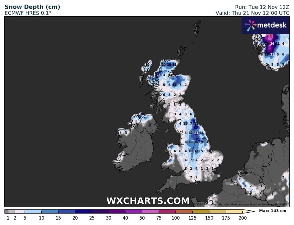
Colder, yes. Much colder-than-average, yes. The coldest weather for 8 months, yes. Risk of wintry showers here, yes. Snow for the hills and mountains of Scotland and parts of Northern England, yes. Widespread snow for most of the UK? Unlikely and impossible to say this far out.
Thursday: High pressure still in charge but it’s now a bit similar to what we had last week. Plenty of cloud, low-cloud at that with hill-fog. Light winds and perhaps some brightness early on. Max 11°C Min 8°C

Friday: Generally cloudy but much windier as weather-fronts start to gather out to the northwest Atlantic bringing a squeeze in the isobars. Can’t rule out some drizzle, especially late-on and on higher ground. Max 11°C Min 7°C
Weekend: A change in airmass is coming.
Saturday: Any bright spells fading as cloud thickens and a weather-front comes down from the northwest. This will bring a narrow band of rain and it will feel cool, exaggerated by the gusty wind. Colder air slips in overnight. Max 10°C Min 3°C
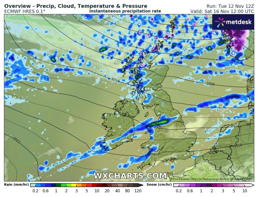
Sunday: Some bright spells and feeling colder, especially in the wind. Chance of showers, as a low pressure builds, which could be wintry on higher ground. Any clear spells overnight will lead to a patchy frost. Max 8°C Min 1°C
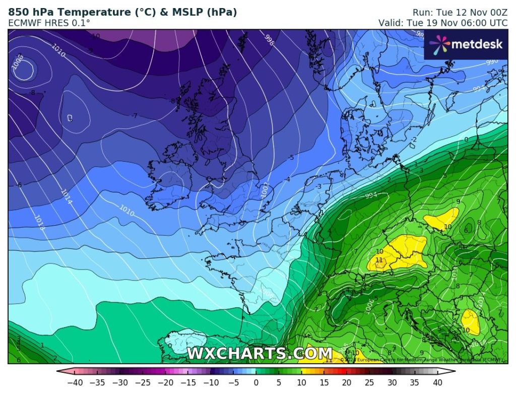
Outlook: Even colder air continues to dig in as we enter the new working week. Straight from the Arctic. The weather pattern is then uncertain as we have no defined high or low pressure over us. We can expect cold days, frosty nights and where we do see the odd shower during the day, it will be wintry.
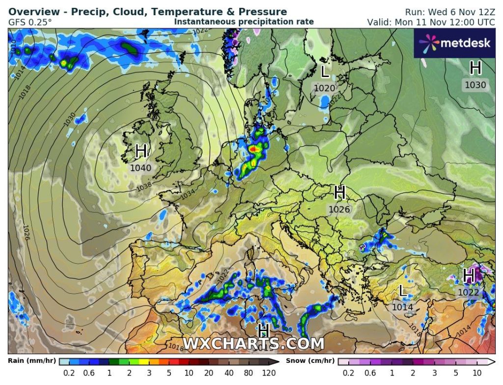
As for more of a chance of some persistent snow, then we would need all the ingredients to come together. In other words, a low slipping in across the region bringing more general heavy rain to southern England but snow on its northern edge. Fine margins, especially since we’re still in November and autumn.
There were hints of a low pressure bringing snow on its northern edge for next Wednesday or Thursday but the latest trend suggests the precipitation will stay further to the south into France.
So for now, ignore any media reports of several inches of snow coming next week. Look out for my posts on X. I can’t see it happening myself. I would expect us to stay in the cold weather for all of the week with sub-zero nights and well below-average temperatures during the day with wintry showers. Then, as we head towards the end of next weekend, a slow change to something less cold.
Follow @ChadWeather on X for the latest forecasts and warnings.
Thanks,
Jon
Forecast Issued: Wednesday the 13th of November 2024 at 4:43pm.
Images: http://www.wxcharts.com