Hi all,
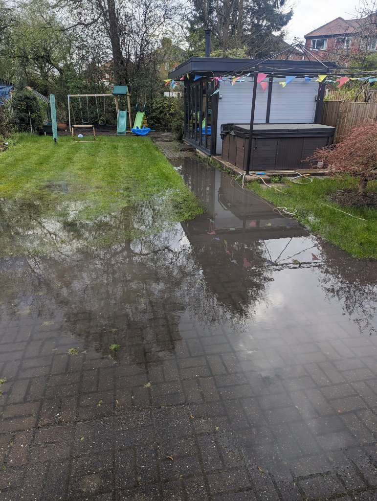
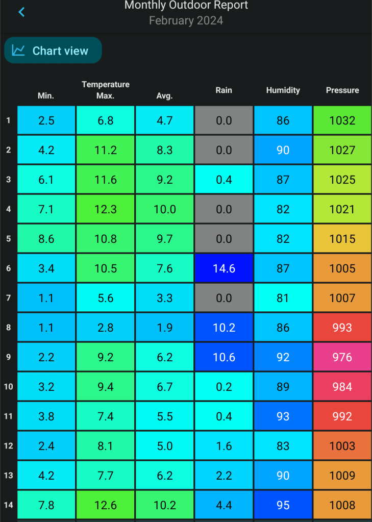
I don’t know about you but I’m glad to get April out of the way. It will go down for a lack of sunshine but also for how wet it was in the first half of the month especially. You’d think it was colder-than-average but this was down to the cloudy and windy days and below average sunshine hours. Temperatures actually came out at around average.

Despite the poor temperatures, the sun is now gaining strength and is as strong as August, with the UV levels soon stepping up into the high category. So when we do have sunny days and you are out and about, take note, it does not have to be very warm or hot for you to get sunburnt.

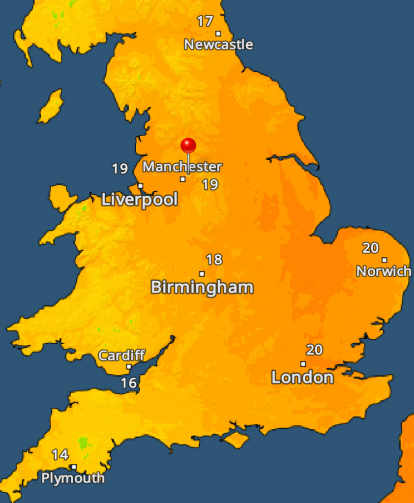
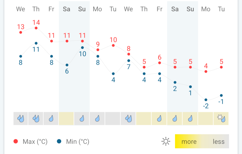
Thursday: After a calmer day on Wednesday, Thursday will be a windy day once more. The north-easterly breeze will not be as cold as it normally is, as it is sourcing air from the warmer continent to the south-east. It will however, drag some cloud in from the east which will be slow to clear, but it should break and it should be a decent day with some warm sunny spells sheltered from the wind. There’s a chance that a few eastern areas could hang on to some stubborn cloud. In sheltered spots and the further west you are, we will likely reach 20°C. Max 19°C Min 11°C
Friday: After a dry start, cloud will increase from the south and we are expecting some pulses of rain to arrive which could be quite heavy and thundery. With the cloud and rain it will be cooler especially in the breeze. Max 16°C Min 10°C
Long Weekend: Could be worse. Sunday perhaps the best day. Staying on the warmish side.
Saturday: Likely to start off cloudy with a few showers or spots of rain/drizzle. Slowly, as we head into the afternoon, some brighter spells should drift up as cloud clears from south to north. Max 16°C Min 9°C
Sunday: Sunny spells are expected after early mist and cloud slowly lifts. A slight breeze into the afternoon but with more in the way of sunshine temperatures will lift a little and it will feel pleasant but some home-grown showers threaten for later. Max 17°C Min 10°C
Bank Holiday Monday: Some uncertainty this far out, but it looks like low pressure will begin to develop across the UK, albeit quite slack. This means relatively light winds and apart from the odd bright spell, we’re expected to grow some beefy slow-moving showers into the afternoon which could be thundery. Max 17°C Min 9°C
Outlook: Low pressure to take control of the weather then possibly drift away to the North Sea. Unfortunately, high pressure that was looking like it might build across the country, will only build out into the Atlantic, meaning we will be in a showery airflow with west to north-westerly winds and temperatures remaining around the same. So, in any drier spells with sunshine, pleasant enough but equally some showers.
Small hint that high pressure will drift in later in the week. No sign of any heatwave or “summer blast” as the media keeps reporting but if the high pressure builds then temperatures can slowly rise, day-on-day, but how high all depends on the direction of the wind.


Follow @ChadWeather on X for the latest forecasts and warnings.
Thanks as ever for reading. I hope you find my weekly blogs useful.
Thanks,
Jon
Forecast Issued: Wednesday the 1st of May 2024 at 4:55pm.
Images: Met Office, BBC Weather & http://www.wxcharts.com