Hi all,
So at last, it feels like winter; well January at least. To me it’s not winter until we see some snow and hard frosts. So, snow, where is it, and can we expect some? A tough question to answer as we hover close to “cold-enough-to-snow-temperatures”. It has turned colder this week and some of the tops have seen a covering of snow, albeit slushy and temporary but most of our showers have continued as rain.
As promised the Jet Stream slipped south allowing colder air to feed in from the north. This will remain the case for another 5-7 days. It turns colder at the back end of this week, so the chances of seeing some snow increases and the areas it could fall in, may include lower areas, rather than just the locations above 300M.
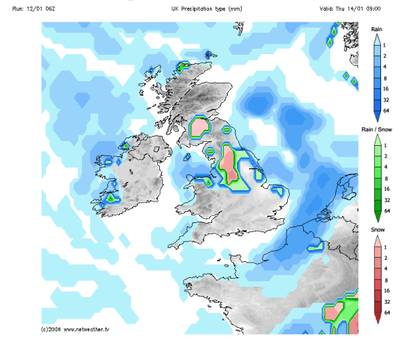
Wednesday night sees showery rain come in from the west and as this bumps into the cold air we could see some snow especially above 300M. Therefore, Thursday will start with some rain, sleet and snow. As this moves away colder air digs in and any rain could turn to snow for a time before brighter skies and the odd wintry shower feed in. Risk of snow showers overnight, even to lower levels. Max 4°C.

Snow risk Wednesday night into Thursday
Friday will be a day of wintry showers and bright spells. Some of these showers will be of hail and snow. Again most of any snow will be for higher ground but not exclusively. Feeling raw in a bitter wind. In fact, Thursday and Friday will have a sub-zero wind-chill. Frosty and icy night ahead as showers fade. Max 4°C.

Bitter on Thursday and Friday with a sub-zero wind-chill
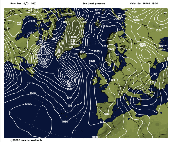
The weekend promises to be a largely dry affair as high pressure builds over the UK. This means plenty of sunshine but very cold nights with a risk of fog and widespread sharp frosts.
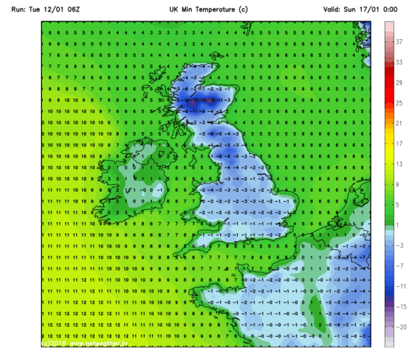
Saturday and Sunday look very similar. Cold frosty mornings and nights with sunny spells during the day. There could be some freezing fog slow to clear and where it lingers on, the daytime maximum temperature will not rise above zero. Staying cold throughout with night-time temperatures even as low as -8°C especially in rural spots. Daytime Maxes 3°C.

Sharp frosts this weekend

High pressure over the weekend
Looking ahead and it will remain cold to start next week but it then looks likely that milder air will return from the southwest bringing rain which might be preceded by snow for a time.

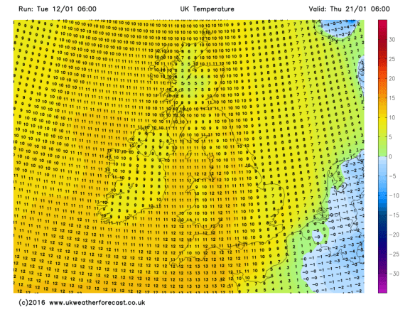
Milder air looks likely to return from midweek next week

Perhaps temperatures will return to double-figures?
It is tricky to pinpoint snowfalls, especially when temperatures are 50/50 for snow to occur. My advice would be to keep a watch on my tweets this week for the very latest on the snow-risk.
Follow @ChadWeather on Twitter to catch all the latest weather updates for Manchester and its surrounding boroughs.
Photos/Data: http://www.ukweatherforecast.co.uk and http://www.netweather.tv
Thanks for reading,
Jon
Forecast issued at 14:00 on Tuesday 12th January 2016
