
Hi all,
Last week’s blog stated that last weekend would be dry and sunny with severe frosts as high pressure took hold. High pressure did arrive but only briefly and the forecast was shaken up, because from Friday, a system developed to our north-west. This came south-eastwards on Saturday and brought a spell of snow for most with 4-6cms of lying snow reported. Now don’t get me wrong, I like to get a forecast bob-on but it’s very welcome to spoil my plans if it delivers some snow.
A cold and frosty start to Thursday, with some isolated freezing fog patches. Cloud soon spreads in from the west with a freshening breeze later in the day. Some rain will develop into the afternoon or evening. Slowly milder. Max 5°C.
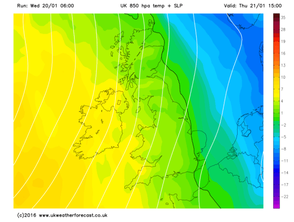
Milder air pushing out the cold air that we have been experiencing recently
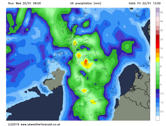
Heavy rain expected during Friday morning
More cloud is likely into Sunday with bright spells limited. Some rain possible and temperatures remain on the mild to very mild side just like we were in December. Not winter-like at all. Max 12°C.
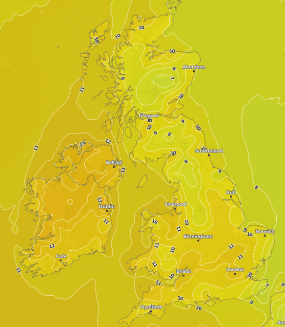
The UK under the influence of a very mild airmass by Sunday
Follow @ChadWeather on Twitter to catch all the latest weather updates for Manchester and its surrounding boroughs.
Photos/Data: http://www.ukweatherforecast.co.uk
Thanks for reading,
Jon
Forecast issued at 14:00 on Wednesday 20th January 2016
