
Hi all,
From snow a week ago, to some welcome Spring warmth. The beauty of the British weather.
Thursday will be a decent day across the region with warm sunny spells breaking out. Some of the sunshine is likely to turn hazy later on but it will be dry throughout. Feeling very nice and temperatures will respond. Sunshine levels are now showing a UV level of 5 to 6 so sun cream needed if you’re out and about. Max 18°C.
Little change into Friday. Another warm day and with the winds coming from the south-east, the humidity will start to rise slightly. Another dry day with some hazy sunny spells. Max 19°C.
Rising temperatures into the weekend as well as the humidity
As we enter the weekend it does become a little tricky to forecast where we might see thunderstorms.
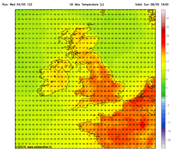
Saturday and Sunday will both be very warm days with some sunny spells. We are now in the humid air from the near Continent and this will increase the risk of some heavy, and possibly thundery showers to break out. Hard to forecast where and when, but something to bear in mind. A good chance we will see a Max of 21°C widely this weekend, maybe even a localised 23°C. Can’t grumble!
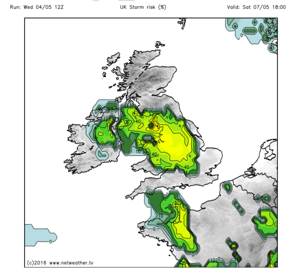
High humidity and very warm temperatures means a thunderstorm risk on Saturday and even into Sunday
Looking ahead, it will remain very warm into next week with pleasant sunny spells and the odd shower early on. It is set to turn cooler and fresher from midweek though, as winds turn back to a more westerly direction but still pleasant enough.
April 2016 Stats
Av. Temp 6.6°C
Max Temp 16.4°C (20th)
Min Temp -1.3°C (17th)
Wettest Day 13.4mm (9th)
Highest Gust 39mph (6th)
Rainfall 83.8mm
Rainy Days 23
Follow @ChadWeather on Twitter to catch all the latest weather updates for Manchester and its surrounding boroughs.
Photos/Data: http://www.netweather.tv.
Forecast issued at 17:30 on Wednesday the 4th of May 2016
Thanks for reading,
Jon

Yep, thinking about Henley to Maidenhead walk on Sat