
Hi all,
July has been another decent summer month, warmer and much drier than average. Recently we’ve had some welcome rain and now there are signs that the very warm to hot weather will return.
Thursday: Any sunny spells to start will fade and cloud increasing with a chance of a few showers. Very warm and a little humid. Max 24°C
Friday: A cloudy morning with perhaps a few spots of rain. Cloud breaking into the afternoon with some bright spells breaking through. Feeling hot in any sunshine. Max 24°C
Weekend: Settled, very warm to hot.
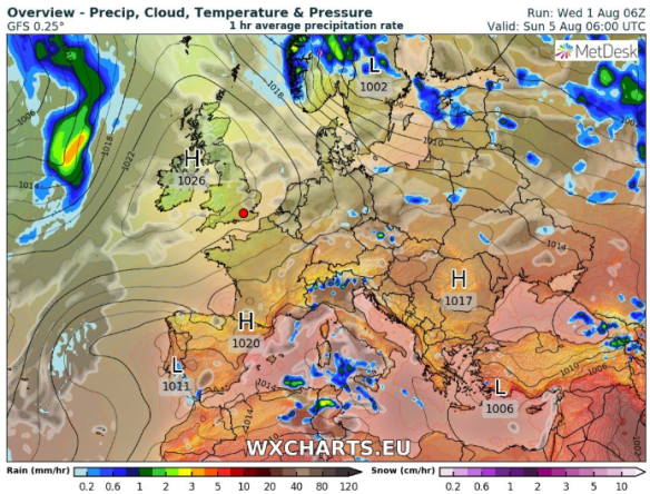
High pressure builds this weekend but it is Southern England that gets another heatwave
Saturday: A pleasant day. Sunny spells, mainly dry and again temperatures well above average. Max 24°C
Sunday: Hot with sunny spells with a risk of an isolated shower which could be thundery. Max 25°C
Outlook: High pressure in charge but its position is crucial depending on how warm/hot we get. I’m expecting the week to start with temperatures into the mid-20s in a few spots, then cooler air will arrive during the week with temperatures remaining in the early-20s.
July 2018 Stats
Max 28.4°C (26th)
Min 10.3°C (25th)
Av. 18.2°C
Wettest 18.0mm (29th)
Windiest 34mph
Rain 44.2mm (55% of average)
Rain Days 11
Dry Days 20
UV levels are still high so don’t forget sun-cream!
Follow @ChadWeather on Twitter for the very latest forecasts.
Thanks,
Jon
Forecast Issued on Wednesday the 1st of August at 2:45pm
Image: http://wxcharts.eu
