
Hi all,
Well that’s it, summer is over. And although August was a little disappointing sunshine-wise, it was a fantastic summer. The Met Office confirmed this week that England had its hottest summer ever! It was also very dry with all months bringing us below average rainfall. I will get round to producing some stats for Summer 2018 and compare it to previous years. My guess is September will be about average. Our reservoirs certainly need rain.
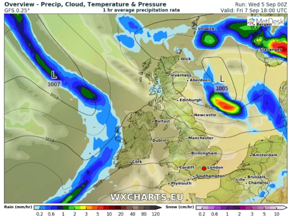
Thursday: It looks like low pressure will develop and take control of our weather for a few days. So, after early sunshine we can expect showers developing, some heavy and cooler. Max 15°C
Low pressure close by Thursday-Saturday
Friday: Cloudy with some sunny spells. Initially it looked like a very wet day but the thoughts are that we will escape the rain (it will be to our north-east) for most of the day. Showers arriving late-evening and overnight. Max 15°C
Weekend: Sunday looks best.
Saturday: Showery rain during the morning clearing leading to some bright spells later on. Max 16°C
Sunday: The low will start to fill allowing some drier weather to take hold. Still a risk of showers but mainly to our north-west and especially in the morning. Feeling a little warmer with sunny spells. Max 18°C
Outlook: Breezy with rain in north-western parts of the UK. Drier and sunnier to the south-east. We’re sandwiched in between so drifting in and out of both conditions. Temperatures about average.
August 2018 Stats
Max 25.6°C (5th)
Min 6.8°C (30th)
Av. 15.4°C
Wettest 9mm (26th)
Windiest 28mph
Rain 48.4mm (only 53% of average)
Rain Days 17
Dry Days 14
Follow @ChadWeather on Twitter for updates.
Thanks,
Jon
Forecast Issued on Wednesday the 5th of September at 10:15am.
Image: http://wxcharts.eu
