Unsettled and wet at times – Thursday 26th October 2023 – Sunday 29th October 2023

Hi all,

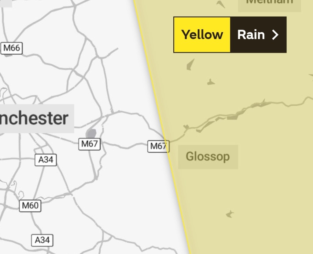
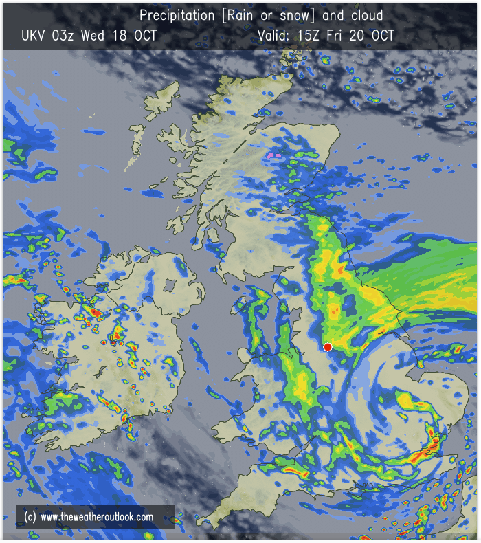
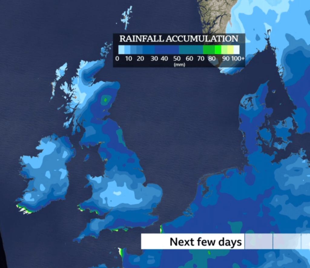
October is certainly delivering a wet one, with plenty of flooding across the UK. So far we’ve seen 105mm of rain, and we’ve escaped the worst of it. The average for the whole of October is 107mm so we’ll be exceeding that before month-end. As we enter November little change is expected overall. More unsettled weather to come.

Thursday: Rain from overnight will drift away to the northeast during the morning. Some bright spells follow but with showers from the southwest and a steady breeze. A little milder than recently. Max 12°C Min 7°C

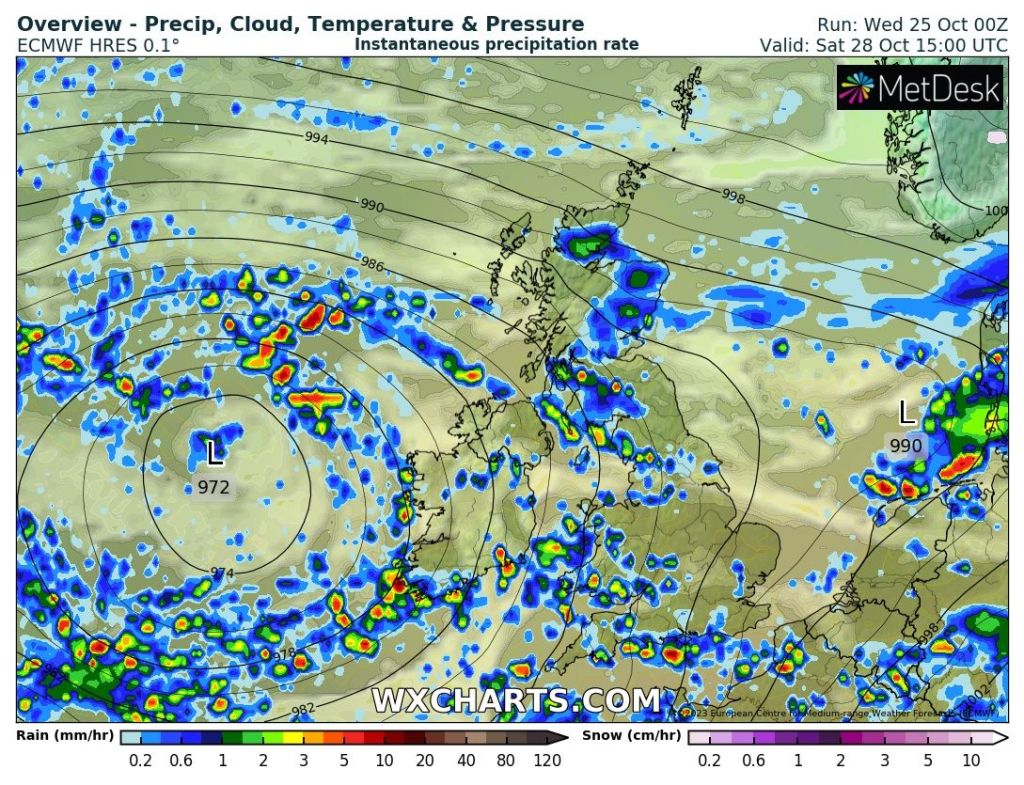
Friday: Low pressure anchored to our west feeding up bands of showers at times. Not all doom and gloom with some bright intervals in between. Max 13°C Min 8°C

A wet few days ahead. Image: BBC Weather

Weekend: Low pressure rules again.

Saturday: Showers at times, some heavy and perhaps thundery and slow-moving. But like Friday, there will be slots of drier and perhaps brighter conditions. Max 12°C Min 7°C

Bands of showers Friday and Saturday

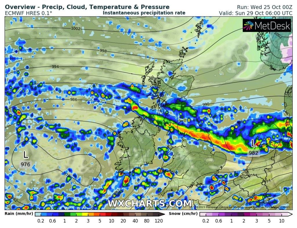
Sunday: A little uncertainty for this particular day with a band of persistent and heavy rain likely during the morning. This moves away to the north leaving an afternoon of scattered heavy showers. Max 12°C Min 7°C

Heavy rain due Sunday morning – some uncertainty on its exact location

Outlook: Into next week Monday sees further showers but these should be fewer and further between and with clearer skies later a chilly night follows. Tuesday looks the best day with a brief ridge of high pressure bringing a drier and sunnier day. Wind and rain to return as the week progresses. No sign of any drastic change in the daytime temperatures but they will drop a little next week making it feel a little chilly at times.

Follow @ChadWeather on X for the latest forecasts and warnings.

Thanks as ever for reading and I hope you find this weekly blog useful.

Thanks,
Jon

Forecast Issued: Wednesday 25th October 2023 at 12:46pm.
Images: http://www.wxcharts.com & BBC Weather.

Missing the worst of Storm Babet – Thursday 19th October 2023 – Sunday 22nd October 2023

Hi all,

I’ve been out and about today so a quick blog tonight. Storm Babet is battering the UK, but we will miss the worst of the conditions. I am expecting it to very windy, which will be more noticeable coming from the east and southeast. 40-50mph gusts can’t be ruled out during Wednesday and Friday and yes it will be wet at times but the warning for the rain only just brushes the region.

Eastern areas will see the most rainfall from Thursday to Saturday (inc.)

Thursday: Cloudy with some rain to start. Brighter spells for the afternoon but also some showers at times. Mild for the time of year and with lighter winds some of the showers could be slow-moving and thundery. Max 17°C Min 13°C

Friday: A dry start then rain is expected to move in from the east. A little uncertainty on the positioning of the low to our east so details might change. Otherwise a wet afternoon and also a strong and gusty north-easterly wind. Cooler. Max 14°C Min 9°C

Rain will spread in from the east on Friday but still some uncertainty on how far west it gets

Weekend: Turning cooler.

Saturday: Low pressure in charge and some showery rain at times. Not as windy but feeling colder. Max 11°C Min 8°C

Sunday: Hopefully not too bad of a day and the calm after the storm for the UK. Mostly cloudy some brightness and lighter winds. Still cool with some isolated showers later. Max 12°C Min 7°C

Outlook: Temperatures around average and generally unsettled with showers at times.

Follow @ChadWeather on X for the latest forecasts and warnings.

Thanks,
Jon

Forecast Issued: Wednesday the 18th October 2023 at 9pm
Images: http://www.wxcharts.com and The Met Office

Colder but sunnier days are coming – Thursday 12th October 2023 – Sunday 15th October 2023

Hi all,

We’ve been enjoying warmer-than-average temperatures recently with a mixture of some warm bright days and then muggy wet ones. Our weather pattern is changing over the next few days and the thermometer is dropping but that doesn’t necessarily mean we won’t be seeing any sunshine. In fact, the total opposite as high pressure looks to visit our shores for a week or so.

Thursday: After a horrid Wednesday it will be a much-improved day with widespread sunny spells developing. Perhaps even wall-to-wall sunshine in places. But, we are now in a much cooler air-mass and after a chilly start, temperatures will only rise into the teens. Cloud will return into late-evening so not as fresh overnight with heavy rain moving in. Max 13°C Min 9°C

Another bout of heavy rain expected during the first half (especially early hours) of Friday. Otherwise it’s a decent outlook.

Friday: Cloud and rain again return on a milder southwesterly airflow. Similar to Wednesday, this rain will eventually sink away to the southeast and we look to the northwest for our weather as colder air arrives leading to a chilly night with clearing skies. Max 14°C Min 6°C

A colder air-mass arrives from the NW later on Friday.

Weekend: Plenty of sunshine but cold nights.

Saturday: Sunny spells and just the odd afternoon shower feeding in from some Irish Sea convection. Feeling colder after Friday’s milder spell and with clear skies overnight a widespread ground-frost will form. Max 10°C Min 2°C

Sunday: It’s looking like a stunning Autumnal day with a ground-frost to start and again forming overnight. During the day it should remain dry with plenty of sunshine on offer. Despite the temperature it will still feel pleasant in the sunshine with light winds. Max 9°C Min 1°C

Ground-frost is expected on Sunday and Monday mornings.

Outlook: It looks likely that high pressure will control the week’s proceedings bringing some cool nights and dry days with some glorious sunshine on offer. With a slight easterly flow temperatures will be around average for the time of year; maximums of the early-teens and into single figures overnight. Some patchy ground-frost and fog can’t be ruled out. The following week is likely to see a return to more unsettled conditions.

Higher pressure than normal expected for most if not all of next week with an easterly flow developing.

Follow @ChadWeather on X for the latest forecasts and warnings.

Thanks,

Jon

Forecast Issued Wednesday the 11th of October 2023 at 2:45pm.

Images: http://www.wxcharts.com & http://www.theweatheroutlook.com

Nice little warm-up for the weekend but no heatwave – Thursday 5th October 2023 – Sunday 8th October 2023

Hi all,

It’s looking likely that we will see temperatures rise well above normal as we enter the weekend but there is no heatwave expected across the north-west.

Conditions seem set to be warmer and sunnier the further south you are and the hottest weather will be reserved for south-eastern parts of the UK, which is generally the case when we have a waft of heat from France or Spain.

Thursday: Low pressure to our west will swing in some weather-fronts bringing rain at times, especially later with some heavier bursts. Cool and windy. Max 15°C Min 12°C

Friday: Cloudy with rain for the morning. It will tend to become drier into the afternoon with some warmer bright spells. Breezy. Max 19°C Min 13°C

Weekend: Waft of warmth. More cloud on Sunday.

Plume of warmer air: It doesn’t get that far north but just enough north to bring us a pleasant weekend with well above-average temperatures.

Saturday: High pressure edges in from the south and brings some clearer skies and a warmer airmass. A day of pleasant, very warm sunny spells looks on the cards with temperatures rising. Max 23°C Min 12°C

Sunday: Another warm day is expected but it is also favourable to be cloudier with bright spells. Max 21°C Min 13°C

Maximum temperatures expected on Saturday.

Outlook: Remaining pleasant to start the week with temperatures into the late-teens. Cooler from midweek with showers or longer spells of rain. Chilly weekend.

Looking much cooler next weekend with chilly nights.

Thanks for reading and for up-to-date forecasts and warnings, follow @ChadWeather on X.

Thanks,

Jon

Forecast Issued: Wednesday the 4th of October 2023 at 4:45pm.

Images: http://www.wxcharts.com