Thursday 28th April 2016 – Monday 2nd May 2016

Hi all,

Yes it’s nearly May, yes the Bank Holidays are coming, yes it is still cold, so where is the warm weather? The search continues…….

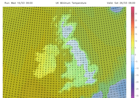
Another Arctic blast of cold air gave some wintry showers this week with plenty of hail, sleet and even snow showers peppering the region but as we head into this forecast, the northerly air supply is set to be cut off as the weather pattern changes.

It will be a cold start on Thursday and as well as a frost in places there is a risk of some localised sleet or snow around, especially above 200M. This will ease away quickly to give a dry slot with bright spells. The cloud will increase into the afternoon and into the evening and overnight there will be some rain with a chance of this turning to sleet and snow on the hills. One to watch and a late bite from the current cold spell. Max 8°C.

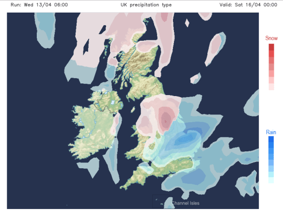
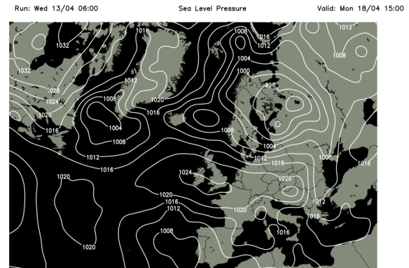
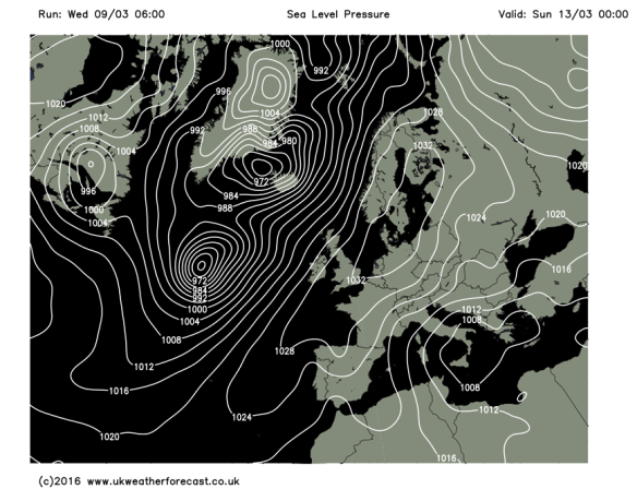
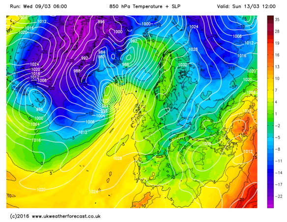
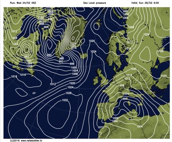
The low pressure bringing the rain, sleet and snow will be in charge of the weather on Friday. A cold windy day with further wintry showers which will tend to turn more to rain as the day progresses. Max 8°C.

Low Pressure for Friday

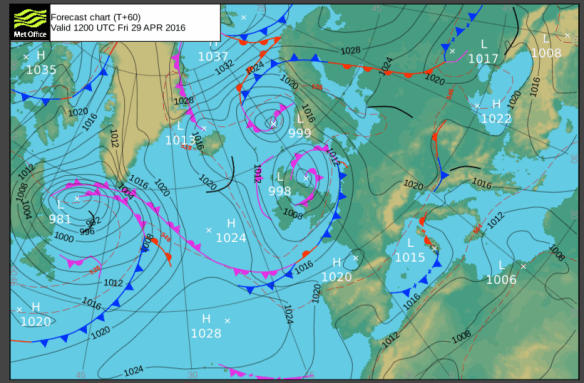
Low pressure in charge this Friday

The good news about the weekend is that temperatures will start to recover and we will get a reasonable day out of it.

A chilly start on Saturday with a ground frost, but hopefully a good day ahead with plenty of sunny spells and mainly dry conditions. We’d be very unlucky to catch a shower but with the ridge of high pressure only weak, they can’t be ruled out. Slightly milder and with the sunshine’s UV levels now at 5 it will feel pleasant. Max 11°C.

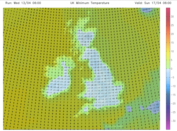
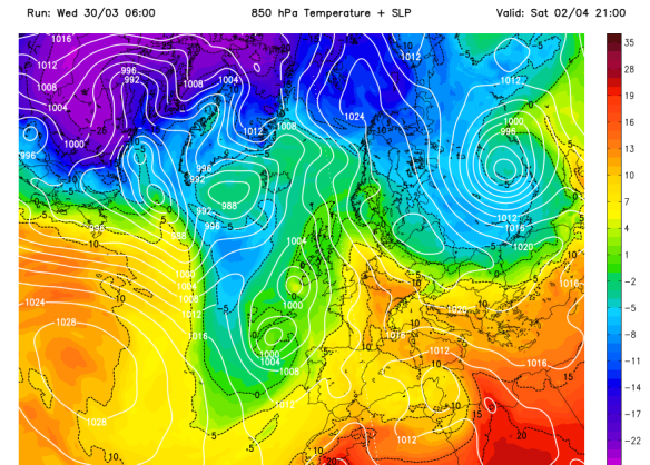
All change on Sunday. The Atlantic returns as cloud thickens from the west bringing outbreaks of rain, some heavy. Max 10°C.

Rain arrives into Sunday

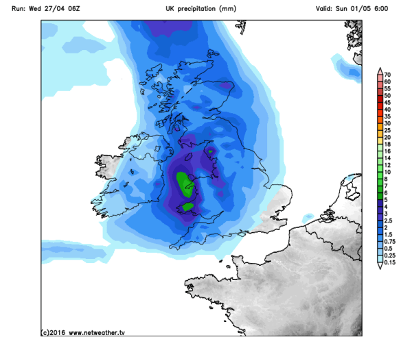
It’s looking wet on Sunday with rain from the west

As for Bank Holiday Monday it looks showery, as do the following few days, with temperatures slowly returning to normal. It looks likely that another cold spell won’t arrive, ruling out the chance of any snow in May! That’s my thinking anyway! 🙂

Long-range there is a sign of some warmth, week commencing the 9th of May, especially later on in the week, with temperatures getting close to, or into the 20s. Watch this space.

Finally some warmth

A long way off – but is this our first warm spell?

Follow @ChadWeather on Twitter to catch all the latest weather updates for Manchester and its surrounding boroughs.


Photos/Data: http://www.metoffice.gov.uk, http://www.netweather.tv.

Forecast issued at 13:25 on Wednesday the 27th of April 2016

Thanks for reading,

Jon

Thursday 21st April 2016 – Sunday 24th April 2016

Hi all,

It’s a late blog today because I’ve spent the day enjoying the warmest day of the so far with some strong Spring sunshine. Is it going to continue? Of course not. No more topless sunbathing for me!

Thursday will be a dry day and again warm with plenty of sunny spells. The sunshine will tend to turn hazy later on as high-cloud arrives. Max 15°C.

A change as we go into Friday. It promises to be a cloudier day with some bright spells but the temperature will be much lower as we’ve picked up a north-easterly breeze. Feeling chilly and just maybe some light rain later on. Max 10°C.

colder air again

Another cold Arctic plunge this weekend and the cold lasts into next week

It will turn even colder as we enter the weekend. High pressure builds to our west, low pressure to the east and this allows another cold Arctic feed of air to develop over the country. Similar has occurred recently. It is a set-up we wanted back in late-winter to bring us the snow we all (well me!) wanted.

Both Saturday and Sunday will be cold with a keen north to north-westerly wind. Bright or sunny spells are expected but also some showers, which could, at times, give some hail or sleet or wet-snow to higher ground. A big contrast to earlier in the week. The nights will also become cold with frosts returning. Max 8-9°C.

frosts

The cold nights with frost return this weekend

Looking ahead it looks likely to remain cold with temperatures below average, some showers and a risk of localised frosts. Not what we want to hear as we head towards May!

Follow @ChadWeather on Twitter to catch all the latest weather updates for Manchester and its surrounding boroughs.


Photos/Data: http://www.ukweatherforecast.co.uk; www.tropicaltidbits.com.

Forecast issued at 19:30 on Wednesday the 20th of April 2016

Thanks for reading,

Jon

Thursday 14th April 2016 – Sunday 17th April 2016

Hi all,

As I write it’s a decent day out there with the sun now feeding us some warmth as we approach mid-April. It is now registering UV levels at 3-4 which is enough to start building up your sun tan. But, April is a funny month. It can see temperatures close to 20°C but also be cold enough for wintry showers or even snow as we saw last Saturday. In true fashion we have another change on the way.

After a lovely Wednesday, Thursday will be cooler with more cloud. As well as bright spells some showers are likely especially during the early afternoon. Max 12°C.

snow risk

A risk of some snow Friday into Saturday

Friday sees the weather go downhill as rain develops across the region. It will feel cooler and then later in the day even cooler as Arctic air arrives. There is a chance that some of the rain could turn to sleet and even wet-snow. This is most likely over the higher ground, a bit similar to last Saturday. Max 8°C.

The weekend will slowly improve as high pressure nudges in from the west or north-west.

Saturday will see early rain, sleet or snow clear, then slowly drier with some bright spells. Certainly a cool feel to the day and a frost with some mist or fog likely overnight. Max 8°C.

Turning Colder from the North this weekend

Arctic air arrives meaning temperatures will be below average this weekend

After a cold start, Sunday seems to be the best day of the weekend with sunny spells. It should remain dry and although cool it will feel pleasant if you’re out in the sunshine. Another frost overnight with some fog likely. Max 9°C.

frosts this weekend

Frosts expected this weekend

Next week looks settled, cool and mainly dry as high pressure slips in and temperatures slowly recover.

HP

High Pressure for early next week keeping it settled

Follow @ChadWeather on Twitter to catch all the latest weather updates for Manchester and its surrounding boroughs.

Thanks for reading,

Jon

Photos/Data: http://www.ukweatherforecast.co.uk; www.tropicaltidbits.com.

Forecast issued at 13:50 on Wednesday the 13th of April 2016

Thanks for reading,

Jon

Thursday 31st March 2016 – Sunday 3rd April 2016

Hi all,

March is coming to an end and although it has been a month with a lengthy dry spell, it has still been wet overall and cold. In fact the average day and night temperature is on a par with January. It has been quite lively recently with some thundery showers with hail and even some hill-snow but we’re heading into a slightly more settled spell.

Thursday sees a little ridge of high pressure over the region, meaning light winds and some sunny spells especially into the afternoon but with the odd shower. The morning could see some fog patches and a frost. Max 10°C but feeling pleasant in March’s strengthening sunshine.

A cold start to Friday, again some mist and a patchy frost possible. After early brightness it will cloud over and the wind will freshen from the south-west. Rain will slowly arrive late in the day. Max 8°C which is chilly for the time of year.

drag in warmer air

A south-easterly airflow over the weekend

A little uncertainty about the weekend. If things go to plan and our wind direction swings to a southeasterly then we could drag in some warmer air from the continent.

Early rain clears north-westwards on Saturday then brighter and hopefully even sunnier skies from the south and south-east for the afternoon. In areas that stay cloudy then we’ll see a max of 10°C but in any sunnier spots and with the milder airflow then 13°C may be possible.

warmer temps

Some warmer air from the continent possible this weekend especially towards the SE

Sunday will be mainly cloudy with a risk of patchy rain to start. Some bright spells breaking through and overall a drier afternoon. Mild again and it could feel warm in any sunshine. Max 12-14°C.

Looking ahead and into next week, and it looks like the cooler air will return from the west with plenty of showers. No real sign of any Spring-like warmth for us with temperatures approaching 20°C.

Jetstream

The Jet Stream looks set to return into next week – cooler & showery

Follow @ChadWeather on Twitter to catch all the latest weather updates for Manchester and its surrounding boroughs.

Thanks for reading,

Jon

Photos/Data: http://www.ukweatherforecast.co.uk

Forecast issued at 15:00 on Wednesday the 30th of March 2016

Thanks for reading,

Jon

The Easter Holiday Outlook

Hi all,

All change ahead. Someone is about to turn the tap back on after pretty much two weeks’ worth of dry, cool and mainly cloudy weather. The lack of rain has been a much needed spell of weather for all gardens and sport pitches.

Thursday sees the high pressure, which was established over the country for the prolonged dry spell, a distant memory as rain pushes in from the west. After a dry start a wet afternoon on the cards but the rain will ease into the evening. Max 8°C.

thursday pressure chart

Change arrives Thursday as fronts pile in from the west


A temporary ridge of high pressure slips in for Good Friday so the best day of our holidays. Sunny spells and milder. Mainly dry too so not a bad day at all. Max 12°C.

Hmmmmm, I think the weather knows it’s not only the weekend but also a Bank Holiday one.

Rain during Saturday and windy too with gusts possible to 40mph for a time. Feeling cooler. The rain should turn showery later. Max 9°C.

rain pushes east

A wet Saturday is on the cards as rain spreads east

A slightly better day on Easter Sunday. Bright spells and showers. The odd one could be heavy with thunder and lightning. Breezy. Max 10°C.

Quite an active low pressure could arrive on Bank Holiday Monday which would bring rain or showers after a dry morning. The windiest of the weather at the moment looks likely to stay further south but one to watch as details are still uncertain. Cool. Max 9°C.

windy monday

An active low pressure possible for Monday – eyes peeled

Looking ahead and it will remain cool with showers at times. No sign of some Spring warmth yet.

Follow @ChadWeather on Twitter to catch all the latest weather updates for Manchester and its surrounding boroughs.

Thanks for reading,

Jon

Photos/Data: http://www.ukweatherforecast.co.uk, www.metoffice.gov.uk

Forecast issued at 14:15 on Wednesday the 23rd of March 2016

Thanks for reading,

Jon


Thursday 17th March 2016 – Sunday 20th March 2016

Hi all,

In my terms, we are in a pattern of settled but boring weather. Not too warm, not too cold, no frost, no snow, no rain, some dull days, some bright days but nothing to keep an eye on. The only positive, is it gives me a bit of a well-earned, much-needed rest.

With the settled pattern set to continue I will have a look at the outlook for Easter and give a ‘most likely’ forecast rather than the media tripe that has already been published.

easter media bull

A usual Daily Express headline rears its ugly head again – No signs of a heatwave

A chilly start on Thursday, and if we have had clear spells for long enough then perhaps a touch of frost and some fog patches. These will lift into low-cloud but sunny spells expected during the day. Max 8°C.

We have high pressure firmly in charge of our weather hence the dry and settled spell but as we enter Friday this will slip to sit to the northwest of Ireland meaning we drag in a cold northerly breeze. However, another dry day with bright spells is on the cards. Some areas may keep some stubborn cloud. Feeling chilly. Max 7°C.

saturday pressure chart

High pressure that’s giving us settled weather drifts into the Atlantic

The weekend will be mostly dry but I can’t promise wall-to-wall sunshine.

Saturday and Sunday will be similar. A cool breeze from the north and with it plenty of cloud floating around. Some of this may be thick enough to bring some drizzle or light rain to unlucky spots but quite localised. It will remain feeling cold but pleasant in any sunshine. Overnight frost will be possible where we have clearing skies. Max 8°C.

Looking ahead and little change for most of next week but there are signs that we will see the high pressure drift away as we approach Easter. This will allow some rain to push in from the northwest followed by a chilly southeasterly breeze. No heatwave on the radar, with it even being cold enough for some frost over Easter Weekend. Of course look out for updates on Twitter as it is still 10 days away.

frosty start to easter weekend

Possibly a frosty start to the Easter Weekend

risk of a wet easter sunday

A risk of rain on Easter Sunday

easter sunday max temp

Predicted maximum temperatures for Easter Sunday – certainly no heatwave

Follow @ChadWeather on Twitter to catch all the latest weather updates for Manchester and its surrounding boroughs.

Thanks for reading,

Jon

Photos/Data: http://www.ukweatherforecast.co.uk, www.metoffice.gov.uk, www.netweather.tv

Forecast issued at 13:30 on Wednesday the 16th of March 2016


Thursday 10th March 2016 – Sunday 13th March 2016

Hi,

One of my easiest forecasts for a while as the weather slips into a settled spell which is welcome news to most and rainfall totals will remain low in the next 5-7 days.

After rain in the past 24 hours there is a risk of some localised ice along with a frost on Thursday morning. Any morning sunshine should be replaced by more in the way of cloud from the east with some light rain showers or drizzle possible in places. Overall much drier in most areas after the rain of Wednesday. Milder. Max 8°C.

high_pressure

High pressure builds from Friday and lasts into the weekend bringing drier conditions

On into Friday and high pressure builds in across the UK and with it a lot of dry weather. Bright spells and feeling a little more pleasant. Just a risk of some hill-drizzle hanging around. Max 9°C. A big contrast compared to last Friday’s widespread snowfall.

A similar theme continues into the weekend. Winds are from a southwesterly direction so milder air covers England and Wales with temperatures into double-figures.

milder air

Out with the cold blues and in with the milder greens and yellows as temperatures rise

Saturday and Sunday looking dry across the region with a fair amount of cloud. Some bright spells are possible during the day and if we see them, we might have temperatures up to 12°C. Otherwise generally a Max of 10°C and with the cloud-cover it looks likely that we escape frost-free.

Easterlies

An easterly wind will peg temperatures back slightly next week

Next week it will turn slightly colder again as we drag in an easterly wind but the mainly dry theme continues with very little rain expected. Good news for Oldham Athletic’s football pitch which could do with a breather.

Follow @ChadWeather on Twitter to catch all the latest weather updates for Manchester and its surrounding boroughs.

Thanks for reading,

Jon

Photos/Data: http://www.ukweatherforecast.co.uk

Forecast issued at 13:45 on Wednesday 9th of March 2016

Thursday 3rd March 2016 – Sunday 6th March 2016

Hi,

Well here we are; welcome to Spring. **ha ha**. After the weather of the past couple of days, you will be right in thinking that it is far from feeling like Spring. Storm Jake blew by today bringing hill-snow and some gusty winds over the tops.

Thursday doesn’t look too bad of a day across the region with bright spells and a scattering of showers, these likely early on. Cold and breezy. Max 6°C. Late-evening and into Friday morning there is a chance of some sleet or snow across the region which could give a covering in places. One to watch on my Twitter feed.

Risk of Snow

Another snow-risk, especially above 200M, Thursday into Friday

Friday itself will remain cold and cloudy with the morning rain, sleet and snow (especially above 200M) slowly fizzling out into the afternoon. There is a possibility of 5-10cm of snow above 250M which could be disruptive to travel. Feeling very cold under the doom and gloom. Max 4°C.

The weekend is set to remain very cold with low pressure to the east dragging northerly winds down across the country but an improvement on Friday. Therefore, we remain under a pool of cold air. So in summary, both days will be cold with a chance of some hail, sleet or snow showers but generally a drier theme overall. Night-times will see some ice, where showers have fallen, and localised frosts. Max 5°C with a biting breeze especially on Saturday.

Northerly Winds

A cold northerly airflow this weekend bringing a bitter breeze

Looking at next week and it looks to remain cold with some wintry showers and overnight patchy frosts. Although it looks a touch milder towards the end of the week, there is no sign of Spring and I can see March panning out to be a cold month overall.

February 2016 Stats

Av. Temp: 4.3°C
Max Temp: 12.6°C (21st)
Min Temp: -2.8°C (16th)
Wettest Day: 31.4mm (8th)
Highest Gust: 51mph (1st)
Rainfall: 119.2mm
Rainy Days: 21

Remember to follow @ChadWeather on Twitter to catch all the latest weather updates for Manchester and its surrounding boroughs.

Thanks for reading and feel free to share.

Jon

Photos/Data: http://www.ukweatherforecast.co.uk and http://www.netweather.tv

Forecast issued at 2:20pm on Wednesday 2nd of March 2016.

Thursday 25th February 2016 – Sunday 28th February 2016

Hi all,

OK, I’m not getting the snow I’m hanging desperately on to this winter for, but at least it feels more like winter now, with frosty mornings and some wintry sunshine.

It looks like the current cold spell is set to continue into March with just the odd milder day thrown in, so this keeps the door open for a snow-risk.

Thursday will start with a widespread frost and some rural spots may have had their coldest night of the winter with -6°C possible. There is also a risk of some patchy dense freezing fog, so something to be aware of on the roads in the morning. Once this clears we’ll have a day of sunny spells and it will be dry. Cold though. Max 4°C.

NEW Thu AM

A freezing start to Thursday – coldest temperatures of the winter possible

Another frosty morning possible on Friday but not as severe as cloud is expected to push in from the west. Chance of some wintry showers later in the day from the south-west but the focus remains on a mainly dry picture but with more cloud than yesterday. Max 5°C.

Finally a weekend without a washout day and non-stop rain. I promise.

Saturday and Sunday similar actually, with a lot of dry weather around as high pressure builds over the UK. It will also introduce a bitter easterly breeze at times. OK, we might see the odd sleet or snow flurry, or spot of rain but overall it will be dry with sunny spells and some frost to start the mornings. Max 5-6°C.

high pressure

Settled Conditions – A ridge of high pressure over the UK at the weekend

Looking ahead and as we enter March, meteorologically-speaking the start of Spring, it remains cold at first, but there are some signs that the Atlantic will try to come back to bring slightly milder conditions and some rain. If so, it could be preceded by some snow. One to watch next week.

Remember to follow @ChadWeather on Twitter to catch all the latest weather updates for Manchester and its surrounding boroughs.

Thanks for reading and feel free to share.

Jon

Photos/Data: http://www.netweather.tv

Forecast issued at 2:00pm on Wednesday 24th of February 2016.

Thursday 18th February 2016 – Sunday 21st February 2016

Hi all,

Welcome to another weather outlook for across our region.

Finally we managed some dry weather. Last Friday (12th) to this Tuesday evening we managed almost 5 dry days. Quite an achievement after 19 days of consecutive registered rainfall, but as I write this, we are again plagued by persistent rainfall.

The weather is heading back into a topsy-turvy flow with the Jet stream back in charge as we head towards the weekend and then introducing colder air when it dips away to the south next week.

After we experienced a miserable, wet and cold Wednesday, we will see a much improved day on Thursday. However, with clear skies to start the day we must be aware of ice after all of yesterday’s rain. During the day, plenty of sunny spells with the risk of a light afternoon shower but well-scattered. Max 6°C.

A chilly start to Friday with another localised frost but cloud will soon thicken, and rain, some heavy is expected to arrive as the day progresses giving us a wet afternoon. Temperatures will lift as winds turn south-westerly introducing milder air. Max 9°C.

milder air returns

Milder air returns from Friday and into the weekend


We head into the weekend with grim prospects.

Any early brightness on Saturday doesn’t last long and rain will move in from the Atlantic. It will also be mild and breezy at times. Max 10°C. 

I wish I could say something better about Sunday but I can’t. More rain is expected and windy for a time too. The exact timing of the rain over both weekend days is not nailed on but it’s not a weekend that will be remembered for decent weather. Later in the day, the rain is likely to move away towards the south-east and be replaced by much colder weather and wintry showers, with snow on the hills above 250M. Again, some uncertainty on timing and it might not even happen until we enter Monday. Max 12°C.

Snow Showers

Colder later on Sunday and into Monday; could mean hail, sleet & snow showers to follow


A lot of rain fell today (Wednesday the 17th) and with more rain between Friday and Sunday; there could be a concern again for local football matches to have waterlogged pitches.

Total Rainfall

Another inch of rain expected between now and Monday


Looking ahead and next week will be colder than the mild weekend with wintry showers at times and some chilly nights with a risk of localised ice and frost.
Remember to follow @ChadWeather on Twitter to catch all the latest weather updates for Manchester and its surrounding boroughs.

Thanks for reading,

Jon

Photos/Data: http://www.ukweatherforecast.co.uk; http://www.netweather.tv and http://www.weatheronline.co.uk

Forecast issued at 15:00 on Wednesday 17th of February 2016