Thursday 30th July 2015 – Sunday 2nd August 2015

Hi all,

Apologies for the delay today. It’s been a busy one and I’ve just managed to sit down to collate the forecast. A lot are asking when will summer reappear, or even appear you could argue. Signs of something a little warmer later in the weekend and early next week but it won’t last and any BBQ weather still can’t be seen on the horizon. 

Thursday will be a chilly start for the early-risers and some eastern parts might see a morning shower. Otherwise, the best day of this week. Plenty of sunny spells and feeling pleasant. We might sneak a 17°C.

Some early bright spells on Friday. These won’t last as cloud increases from the west and a breeze develops. It should remain dry until later when showers could develop. Rain is expected overnight. Max 17°C

Not a bad weekend ahead. Could be worse and it does warm up slightly later on. 

Early cloud and any rain quickly moves away and then we have a dry day on Saturday with bright spells. Temperatures similar to Friday. Max 17°C.

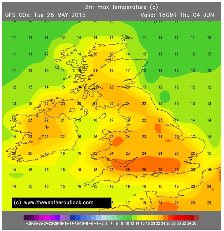
We drag in some warmer air into Sunday. Bright spells but cloud building more and more later in the day. I’m hopeful it stays dry during daylight hours. The SE of the UK will see some summery temperatures into the mid-20s. For us, it’s an 18 or 19°C on the cards. 

Looking ahead into next week; the SE remains very warm for a while but after Monday we will turn cooler again and likely to be unsettled with showery rain. The search for summer continues. 

For your local weather follow @ChadWeather on Twitter. For weather statistics follow @OldhamWxStats.

Thanks for reading. 

Jon

Thursday 23rd July – Sunday 26th July

Issued Tuesday 21st July 10:45pm

Hi all,
Hope you’re all well. I’m currently away on holiday in Cornwall and apart from one morning of rain we’ve had great weather with strong sunshine. The tan is progressing nicely. Back home though, it’s not been as nice and although the next 4 days aren’t too bad it looks cool next week and no sign of any heat in the remainder of July. 

Thursday looks a lovely day. A chilly start but a day of some prolonged sunny spells. Remaining dry. Perhaps a little breezy. Max 17°C.

Maybe some showers to start Friday. These should clear and another day of bright or sunny spells. Again, temperatures below average. Max 17°C.

High pressure builds in from the west for Saturday. However, as well as sunny spells we can’t rule out a shower. Max 17°C.

Sunday morning and early afternoon looks good with sunny spells. This will turn hazy later in the day. Cloudy into the evening with rain likely either late evening or overnight and into Monday. Max 18°C.

Looking ahead, a wet start to next week with fresh winds. Temperatures remain below the average. On the positive side there are hints, albeit a long way off, that August will turn warmer. Fingers crossed. 

Thanks for reading. 

Jon

Thursday 16th July – Sunday 19th July

Hello all,

More talk of the weather heating up, but for now, that chance of occasional heat is reserved for the south and southeast of the UK. 

After a lovely, albeit not a scorcher of a Wednesday; we start Thursday with a morning of pleasant sunny spells. More cloud is expected into the afternoon and with it the breeze will pick up. Late evening and overnight there is a chance of some isolated heavy thundery showers and becoming windy. Quite muggy. Max 21°C.

Into Friday and a cloudy morning with some showers around. Brighter into the afternoon with sunny spells but notably and unseasonably windy with 35-40mph gusts possible in exposed parts. Fresher. Max 19°C.

The low pressure responsible for the windy weather slips away into the weekend and it settles down. 

Saturday will still be breezy with bright or sunny spells at times. Apart from an early shower it should remain dry and the breeze easing later on. Max 17°C.

A little more humid on Sunday but with variable cloud at times, still some bright spells and overall a fine day. Can’t rule out an early shower. Temperatures not really going anywhere. Max 18°C.

Looking ahead we look to stay under the influence of westerly winds. This means bright spells and no hot weather. Temperatures about average with some showers or showery rain possible. So changeable and not a heatwave in sight. 

Thanks for reading. 

Jon

Thursday 2nd July – Sunday 5th July

Hi all,

Well summer finally arrived and with it some record-breaking temperatures for my weather station. Tuesday the 30th of June was my hottest June day with the maximum at 27.5°C and the night’s minimum, also a record, was an unbearable 20.1°C with high humidity. 

For those of you, like me, not a fan (no punt intended) of the muggy, sticky air then good news for Thursday. The horrid air is squeezed away and it will feel fresher but still with very warm temperatures and sunny spells. One or two showers are possible. Max 23°C.

However on Friday the heat, but not as intense as Wednesday, returns giving us a hot day with sunny spells. The heat and humidity might see some thunderstorms set-off later in the evening and overnight with torrential downpours possible. Max 26°C.

The weekend starts with some leftover thunderstorms or heavy showers on Saturday which clear to fresher conditions once more and sunny spells. Max 23°C.

Sunday promises to be fresher again with sunny spells and some afternoon showers likely. Temperatures lower. Max 20°C.

The outlook for next week is for temperatures to return to normal with sunny spells & some scattered heavy showers. 

For your local weather updates and forecasts follow @ChadWeather on Twitter. 

Thanks for reading. 

Jon

Thursday 25th June 2015 – Sunday 28th June 2015

Hello all,

The media are hinting at a heatwave again and this time, it does look like next week temperatures will rise especially across the southern and southeastern parts of the UK with values approaching 30°C possible. Parts of France and Spain will be into the 40s, so some serious heat around over Europe. 

Back home, what can we expect the over the next 4 days. 

Thursday will start cloudy with some hill-fog and with it feeling quite humid throughout the day. Bright spells should develop as the sun gets to work but more cloud into the evening is likely to bring some showery rain which sets up Friday’s weather. A muggy night. Max 19°C.

It is expected to be generally cloudy and feeling humid on Friday as showery rain spreads east. Behind it turning fresher into the evening. Max 19°C.

A ridge of high pressure sneaks in on Saturday so apart from some showers, especially early on; it will be fresher with bright spells at times. Max 18°C.

Any early brightness replaced by cloud and some showery rain on Sunday, mostly in the afternoon or evening. A little breezy. Max 18°C.

Still some uncertainty regarding next week but all eyes on warmer or even hotter air coming up from the south. Temperatures on the rise but how high we see them still hangs in the balance but we could approach 23-25°C. For updates on next week’s heat and your local weather updates follow @ChadWeather on Twitter. 

Thanks for reading. 

Jon

Thursday 18th June 2015 – Sunday 21st June 2015

Hi all,

We’re still waiting for “that” heatwave and signs are we won’t be seeing one in June. The emphasis is on a settled spell of weather coming up with about average temperatures and nothing major from hot to wet. 

Thursday will generally be a cloudy morning with a fresher feel to the weather. Some brighter spells are possible later in the day. Max 16°C.

As we enter Friday high pressure is close by to our west but cloud and cool air are feeding around it from the northwest. A mainly cloudy day. Some bright spells possible but also some hill-drizzle. Max 15°C.

The weekend promises similar. 

Saturday and Sunday won’t be too different. Plenty of cloud about. Don’t be surprised to see the odd patch of light rain or drizzle especially in the mornings but during the day a lot of dry weather but with it plenty of cloud. If bright spells do pop up now and again it will feel pleasant with the strong sunshine. Max 17°C.

Next week looks to have little change until later in the week where we could return to unsettled conditions from the west. No sign of a heatwave. 

Follow @ChadWeather on Twitter for your local updates. 

Thanks for reading.

Jon

Thursday 11th June 2015 – Sunday 14th June 2015

Hi all,

An early blog this week. Signs of a change after temperatures rise.

May was a disappointing month with plenty of rainfall. The overall average was cooler than April and we had 19 rainy days. After a very wet June the 1st, the weather has settled down into June with some welcome sunshine but unfortunately with no signs of the first summer heatwave on the cards.

High pressure has been in control all week, but with some cool air trapped in and around the high, we haven’t seen temperatures regularly into the 20s. 

On Thursday we start to see a change. The high pressure slips away allowing humid and warmer air to feed up from the continent. We can expect another dry day with warm sunny spells and temperatures up. Max 19°C.

On Friday morning, any early mist or low cloud will break up to give some bright spells. Feeling muggy and warm into the afternoon and cloud increasing. Rain, possibly thundery, late evening or overnight. Max 21°C.

The second half of the weekend and into next week slowly improves but Saturday sees low pressure close by. Any morning rain should turn showery and a generally unsettled day. Feeling fresher than recent days. Max 15°C.

Sunday should be a drier day as the low starts to slip away and any early rain is killed off. Plenty of cloud around but I’m hopeful of some bright spells. Definitely feeling cooler. Max 14°C.

Looking ahead, high pressure starts to edge back in from the southwest. So the outlook is mainly dry conditions but with cloud at times. Any bright or sunny spells making it feel pleasant but temperatures look to hold below the 20s.

Follow @ChadWeather on Twitter for your local weather forecasts.

May 2015 Stats: Av. Max Temp: 12.7°C; Warmest: 17.1°C; Coldest: 2.6°C; Wettest: 15.4mm; Windiest: 41mph; Total Rainfall: 107.4mm (wet).

Thanks,
Jon

Thursday 4th June 2015 – Sunday 7th June 2015

Hi,

Well June didn’t start well did it, with a deep area of low pressure bringing unseasonal gales and for some of us an inch of rain. At least the future holds better news. Not a heatwave as per the usual media nonsense but something warmer and drier. 

Thursday will be dry day with warm sunny spells which could be hazy at times. Feeling much warmer than of late as a southerly breeze feeds up some humid air. Max 19°C.

As we head into Friday we have a contrast across the UK with us in the middle. To our NW, cooler cloudier conditions with rain and to our SE, hotter conditions with some torrential thunderstorms likely. For us this means a settled day again with warm sunny spells. However, it might not stay dry as the cooler air edges east meaning some showers might be set off later in the day so watch out for those. Humid at times. Max 18°C.

So what’s for the weekend. Locally the annual Parklife Festival is on and conditions could be a lot worse but not the heatwave they were promising via media reports earlier in the week. 

Saturday might start off with a few showers but these will clear to leave a day of sunny spells and feeling fresher as the cooler air has pushed east. Max 15°C.

A dry day seems likely on Sunday with variable amounts of cloud and bright or sunny spells. Temperatures around average. Max 16°C.

Looking ahead sees high pressure become established across the country bringing dry days with sunny spells and temperatures might start to edge up a notch. Nothing too hot yet on the horizon, but the settled conditions will be welcome news for everyone. 

Follow @ChadWeather on Twitter for all your local weather information. 

Thanks for reading,

Jon

Thursday 28th May 2015 – Sunday 31st May 2015

Hi all,

Rumours of some summery weather on the way. More about that shortly, but what’s coming up in the next 4 days?

Thursday won’t be too bad overall but as well as sunny spells some showers are expected. A brisk cool westerly wind though and disappointing temperatures. Max 13°C.

On to Friday and it’s particularly unsettled. Low pressure to our northwest is in charge. Frequent showers during the day with some hail or thunder likely. Hopefully these showers ease off later in the day. Windy and cool once again. Max 12°C.

The weekend is split with Saturday your best day. 

We start the weekend with a ridge of high pressure nudging in from the southwest so a settled day with some sunny spells. Pleasant in the sun and a dry day but still temperatures  below average. Max 14°C.

The gardens will enjoy some more rain on Sunday. A wet morning with rain at times from the west. Later on, it will be more of a showery theme and remaining cool. Not a great day with another low pressure influencing. Max 13°C.


Looking ahead it remains unsettled with further spells of rain or showers and cool. However, at the moment, it looks like later next week high pressure builds from the south and as well as some drier weather with sunny spells, the temperatures should begin to rise. I’m hoping we see some into the 20s. In the current time-frame there’s still a chance for it to change. As always, keep in touch with @ChadWeather on Twitter for your local weather updates. 

Thanks,

Jon

Thursday 21st May – Bank Holiday Monday 25th May

Hi all,

Looks like we will have to wait and see what June brings before we see our first taste of summer. Our weather has been dominated by cooler-than-normal northwesterly winds bringing showers or longer spells or rain. The good news is, this is set to calm down and retreat to more northwesterly regions but some weather fronts will find their way southeastwards. 

Thursday will be a mainly dry day with bright spells. Plenty of cloud around at times which gives a low shower-risk but feeling much improved on recent days especially in any sunshine. Lighter winds. Max 15°C.

As we go into Friday we see more in the way of cloud. Some bright spells early but soon replaced by thicker cloud with the chance of seeing some light rain or drizzle. Cooler. Max 13°C.

Not bad on Saturday with cloud breaking to give some sunny spells and feeling warmer. UV levels high at 6 in any longer spells of sunshine. Max 16°C.

Cloud and light rain overnight into Sunday morning but this should break up and ease to give some bright spells for the rest of the day. However, cooler and breezy. Max 13°C.

A ridge of high pressure tries to build in from the southwest for Bank Holiday Monday so a dry day looks on the cards at the moment. Mainly cloudy at first with some light rain possible but hopefully breaks will appear and sunny spells will develop. Max 14°C.

Follow @ChadWeather on Twitter for all your local forecasts and weather news. For live weather conditions every hour follow @OldhamWxStats.

Thanks for reading. 

Jon