Hi all,
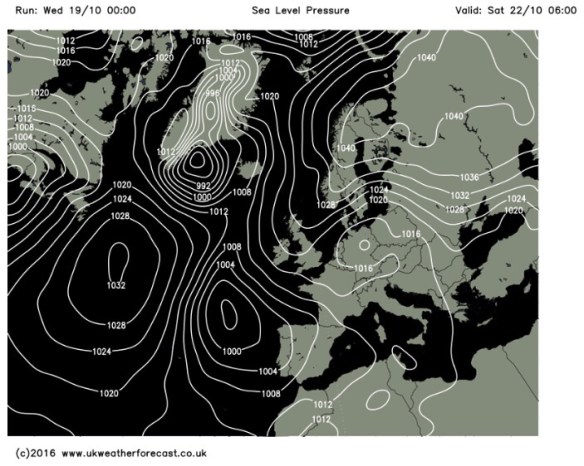
I had a feeling the second half of October would be “rain-fuelled”. After a few days of rain you would think the same, but another blocking high pressure is set to dominate our weather which could give some overnight mist or fog as well as localised pockets of frost.
Thursday: A chilly start but a mainly dry day ahead with some sunny spells. Risk of a very isolated shower in the afternoon. Light winds. Max 13°C
Friday: Possibly a misty start, then bright spells developing, but some thicker cloud from the east at times just might produce a light shower. The general theme is for mainly dry conditions. Max 12°C
Saturday: A cool easterly breeze starts to pick up during Saturday so feeling cooler. Another dry day though with bright spells after low-cloud to start. Max 11°CSunday: Little change from Saturday. Plenty of dry weather. Bright or sunny spells but a cold easterly wind. Max 11°C
Next Week: Low pressure to our southwest and high pressure to our northeast or east means we continue to be dry <October is turning out to be very dry indeed> and under the influence of a cool easterly airflow.
As always, follow @ChadWeather on Twitter for the very latest forecasts.
Thanks,
Jon
Forecast issued at 10:45am on Wednesday 19th October 2016
Images: http://www.ukweatherforecast.co.uk

