
Hi all,
All good things have to come to an end. We’ve had a great spell of sunny, dry and very warm to hot weather, which ended with us having the sunniest Spring on record. May was also the driest month I have ever recorded. At least the rain is welcome; we just don’t want it to hang around too long. Now Summer is officially here, will the decent weather return anytime soon?
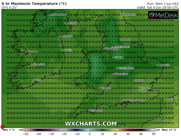
Thursday: Breezy with mostly cloudy skies, although a bright start is possible. Some showers filtering down on the northerly wind. Cool. Max 14°C
Friday: Bright spells and showers, some heavy and most frequent in the east. Cool and very windy later with 35-40mph gusts. Max 13°C
Weekend: Unsettled. Feeling cold on Saturday.
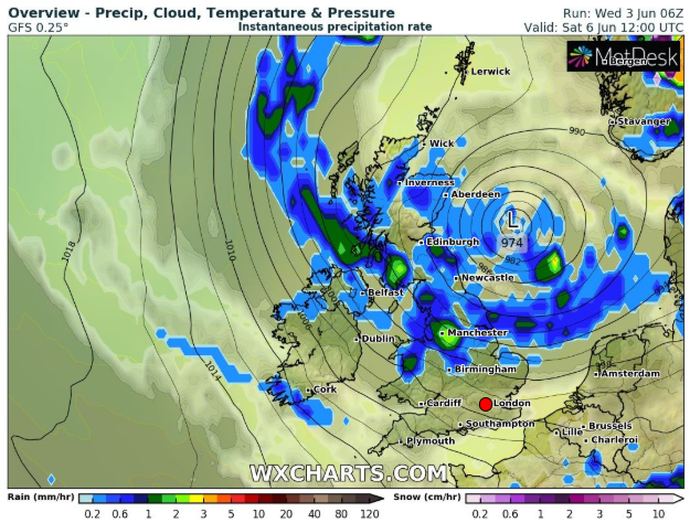
Saturday: Low pressure in charge so a completely different set-up to last weekend. Feeling cold in a strong wind with bright spells and showers. Some heavy with a rumble of thunder possible. 40mph gusts. Max 11°C
Sunday: Breezy but not as windy as yesterday and although there will still be some showers around, they are expected to be fewer and overall not as chilly. Max 14°C
Outlook: Looks like a couple of drier days on Monday and Tuesday but after that, sunshine and scattered heavy showers. Temperatures recovering and close to 20°C again.
May 2020 Stats
Max 25.2°C (20th)
Min 0.2°C (14th)
Av. 12.2°C
Av. Dew Pt 5.9°C
Wettest 2.4mm (22nd)
Av. Humidity 68%
Av. Barometer 1022.7 hPa
Max Gust 43.7mph (22nd) (record for May)
Av. Wind Direction W
Rain 7.4mm (overall record)
Rain Registered Days 5
Dry Days 26 (good work that!)
Air Frosts 0
Follow @ChadWeather on Twitter for the latest weather forecasts and information.
Thanks,
Jon
Forecast Issued: Wednesday the 3rd of June at 14:35
Images: https://www.wxcharts.com/
