
Hi all,
We are back to the heavy rain but it’s not as mild as we would normally expect it to be and with this comes the chance of some hill-snow.
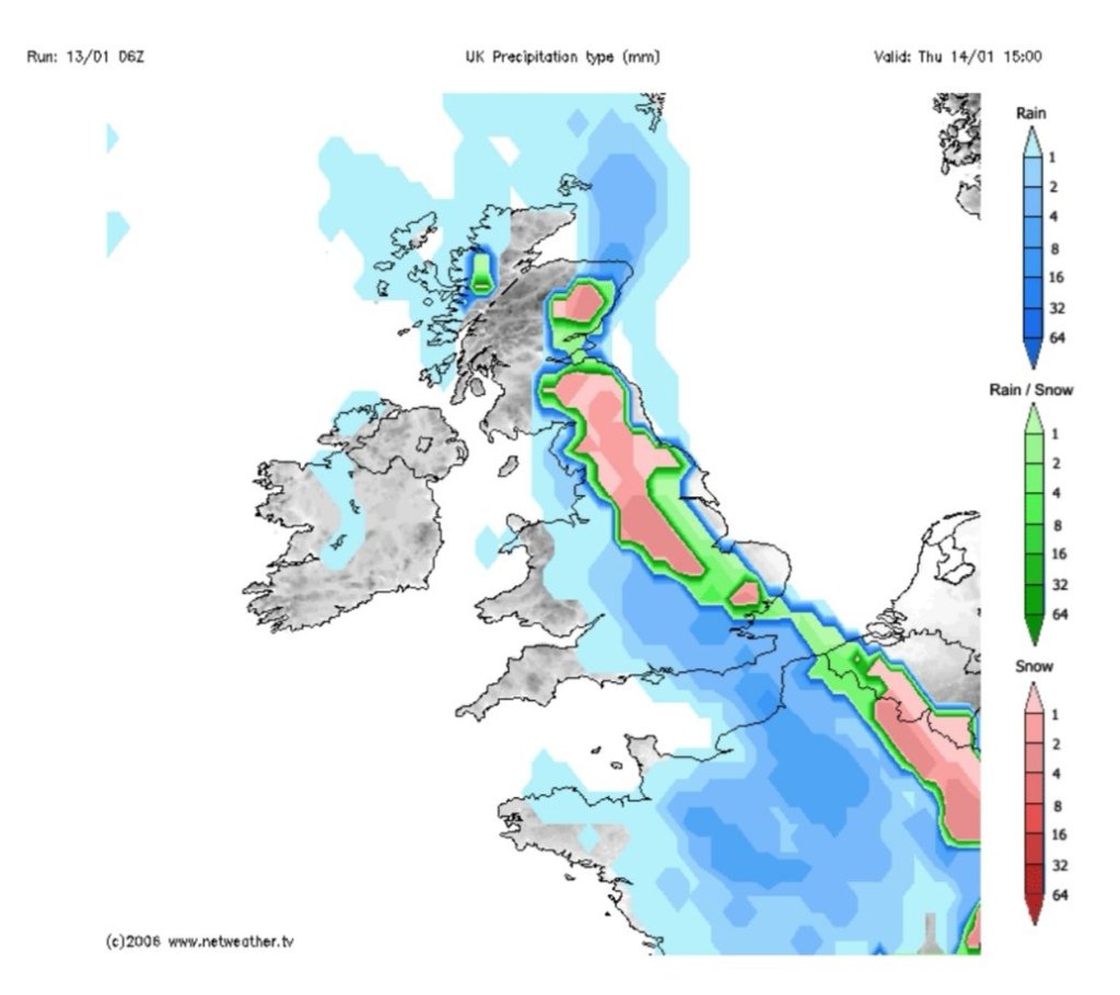
Thursday: Heavy rain with a risk of some sleet or snow above 250M as the low pressure sinks south. Any precipitation easing as the weather front weakens later in the day. Cold. Max 3°C
Friday: Rain, sleet and any snow will have eased away and we’re in a bit of a lull. Mostly cloudy with hill-fog and low-cloud. Early ice. Cold. Max 2°C
Weekend: Unsettled to start.
Saturday: Rain swings in from the west again and the wind will increase. As this rain bumps into the colder air there could well be some snow for a time, even to low-levels (warning in place). Milder later. Max 7°C
Sunday: I’m hopeful for a drier day as morning rain dies away leading to some bright spells and the odd isolated shower. Cool. Max 6°C
Outlook: Colder weather seems likely to return but not until after midweek with little change before then. As for the Beast From the East; time will tell but the ingredients are brewing.
Thanks,
Jon
Forecast Issued: Wednesday the 13th of January 2021 at 8:25pm
Image: http://www.netweather.tv
