Hi all,
We’ve quietly slipped into a decent spell of weather. Not quite an Indian Summer (yet!) although temperatures will rise before the weather breaks.
Thursday: A chilly start with some mist or fog patches then plenty of sunshine and feeling warm. Max 17-18°C
Friday: Little change. Sunny spells or even unbroken sunshine after a cold start. Temperatures creeping up so feeling warmer but it will become windy later. Max 20-21°C
Weekend: Very warm and windy then the breakdown.
Enjoy Saturday as it’s a different story on Sunday
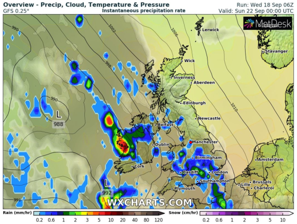
Saturday: Another lovely Autumnal day. Blue skies and sunny spells but the only downside is the wind. As the high pressure starts to drift away to the Continent it will become gusty with 30-35 mph likely, especially over the hills. Great temperatures for the time of year. There will be showers arriving late in the evening or overnight. Max 21-23°C
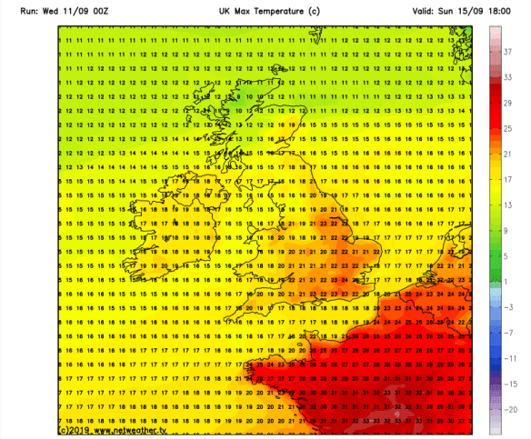
Sunday: I hope you had your BBQ yesterday. Breezy with frequent showers arriving from the west, some thundery. Feeling cooler especially later in the day. Max 18°C
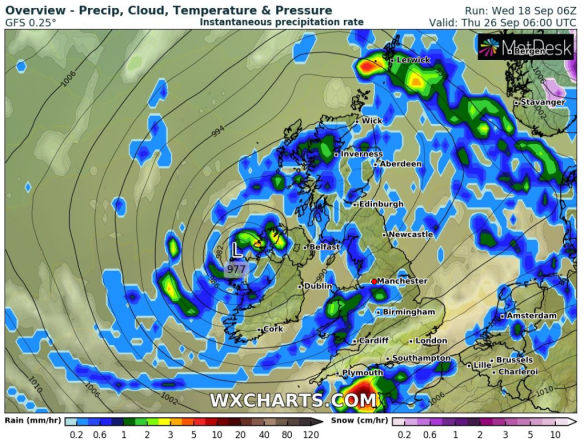
Next Week: Unsettled and very Autumnal
Outlook: Unsettled, windy (perhaps stormy in parts of the UK) with rain or showers at times. Temperatures back to normal, mid- to late-teens. There could well be the first named-storm of the Autumn.
Follow @ChadWeather on Twitter for the latest weather forecasts for Northwest England.
Thanks,
Jon
Forecast Issued: Wednesday the 18th of September 2019 at 12:30pm.
Images: https://www.wxcharts.com