
Hi all,
Welcome news. Summer is returning, after what has been a poor August to say the least. Warmer, drier and sunnier weather on the way. One last Summer BBQ is in order.
Thursday: Weather fronts still close by so a cloudy day with any patchy rain during the morning easing away. Max 20°C
Friday: Dry with a cloudy start. Sunny or bright spells will develop during the day. Starting to feel warmer. Max 22°C
Long Weekend: Summery
Saturday: Sunny spells, light winds and feeling very warm. There could be quite a few cloudy spells at times, so areas seeing more sunshine than others, will see the highest temperatures. Max 23-25°C
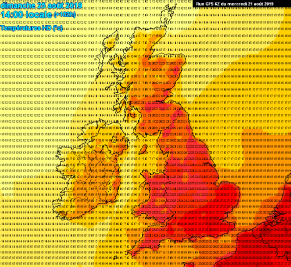
Sunday Afternoon Temps – Summer is back – for a few days at least
Sunday: A perfect summer’s day on the cards. Dry, plenty of sunny spells and hot. Max 24-26°C
Bank Holiday Monday: Perhaps a little cooler but still a great day for a Bank Holiday. Sunny spells and staying dry. Max 23-24°C
Outlook: Remaining very warm with temperatures close to the mid-20s. A showery breakdown is expected midweek, with a few thunderstorms possible. Eventually much cooler with temperatures returning to 19-20°C by the following weekend.
Follow @ChadWeather on Twitter for the latest weather forecasts for North West England.
Thanks,
Jon
Forecast Issued: Wednesday 21st August 2019 at 3:20pm
Image: https://www.meteociel.fr/
