Thursday 8th October 2015 – Sunday 11th October 2015

Hi all,

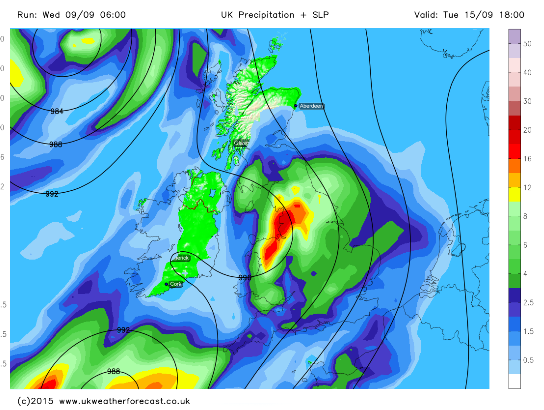
After a lengthy settled spell, some autumnal conditions returned earlier this week but as we enter this forecast period, high pressure slips over the UK. A lot of media have been banging on about ex-hurricane Joaquin racing across the Atlantic towards the UK. At this moment, the deep area of low pressure is likely to dart towards France and northern Spain, so not affecting the UK. 

After a muggy few days it’s now cooler and fresher and this will be felt on Thursday with a chilly start with local ground frost. A reasonable day follows with sunny spells and mainly dry. Low risk of a shower. Max 15°C.

The nice weather continues on Friday with it being dry with plenty of bright spells. Light winds as well so not feeling too bad. Max 15°C.

Mainly dry weather over the weekend but cloud amounts will be variable and a cool breeze from the east will pick up.

Saturday will be bright after a cold start with some mist or fog patches slow to clear. Feeling fresh in the afternoon breeze. Showers or rain could sneak in from the east overnight especially over the hillier areas. Max 14°C.

Sunday brings bright spells and turning dry after some early showers. Again a cool breeze. Max 14°C.

Looking ahead it seems the high pressure will stay close by keeping it mainly dry with bright spells. If Joaquin changes path then so will next week’s forecast, so keep your eye on Twitter.

September 2015 Stats: Warmest 20.5°C; Coldest 5.8°C; Wettest 16.8mm; Windiest 28mph; Total Rainfall 46mm.
To keep up to date with your local weather, follow @ChadWeather on Twitter.

Thanks,
Jon

Thursday 1st October 2015 – Sunday 4th October 2015

Hi all,

Just a quick one this week as I’m off to catch a plane to Spain to enjoy some sunshine and temperatures into the late-20s. 😉🍻☀️

High pressure has dominated our weather for ages and this will continue but a change is on the way next week. 

Thursday will dawn cold and possibly misty. Any cloud will break up to give another day of warm sunny spells. Max 16°C.

Not much change into Friday but the high will start to move a little and this means a bit more in the way of cloud but again bright spells coming through. Max 15°C.

The weekend will see more cloud get trapped under the high pressure. This will result in less cold nights but the days will contain less sunshine and therefore be cooler. 

Saturday and Sunday will see plenty of dry weather but also plenty of cloud. Not too bad in any sunnier spots but certainly chilly and feeling like October where the cloud persists. Max 13-15°C

Next week sees a slow change to unsettled conditions with rain coming in from the west and back to the more usual Autumnal conditions. 

Thanks for reading and follow @Chadweather on Twitter for local weather updates.

Jon

Thursday 24th September 2015 – Sunday 27th September 2015

Hello all,

Not much going on lately on the weather front and we look to end the month on a static note. It’s likely October will provide a more lively autumnal feel. 

Thursday will be a breezy day across the region with showers. Some of these possibly heavy with a rumble of thunder. These showers become more scattered later in the day. Feeling cool. Max 14°C.

High pressure starts to build from the southwest into Friday. This will give us a day of bright spells after some early showers. Max 14°C.

The high pressure centres itself over the country over the weekend so plenty of dry weather. 

A chilly start to Saturday with local mist or fog patches. A day of sunny spells to follow and dry. Pleasant in the sunshine. Max 15°C.

Not much change into Sunday. Some of the mist/fog might be slow to clear in some places and lift into low cloud. Bright spells and again dry. Max 16°C but cooler where low cloud persists. 

Into next week it looks like the high pressure stays put bringing dry bright days and cold nights where skies remain clear. These clear skies will also bring the risk of mist, fog and ground frost. Temperatures should pick up slightly during the week. Later in the week there is some uncertainty whether the Jet Stream takes control and the settled weather gives way to showers or longer spells of rain. Only time will tell. 

Follow @ChadWeather on Twitter for all your local weather updates.

Thanks for reading. 

Jon

Thursday 17th September 2015 – Sunday 20th September 2015

Hi all,

After a settled week last week with some welcome pleasant September sunshine our weather returned to the norm with some Autumnal conditions. These are set to continue but it does show signs of settling down for the weekend.

Thursday will start chilly with some local mist patches. These will clear away and leave a day of bright spells and with the odd shower. Max 15°C.

On to Friday and a similar outlook. Sunshine and showers. Some of these could be on the heavy side though with a rumble or two of thunder. They ease later in the day as a ridge of high pressure builds from the west. Max 16°C.

So how’s the weekend looking? Dry and settled, so we can’t grumble.

Saturday might be cloudy at first but bright or sunny spells will develop. Still a risk of an isolated shower in the morning. Overall a dry picture and lighter winds. Max 16°C.

As we enter Sunday, much of the same. Sunny spells and pleasant in any sunshine. Mainly dry and temperatures still a little cooler than they should be at this time of the year. Max 16°C

Any clear spells over the weekend would see some chilly nights with temperatures into single-figures and with a risk of localised mist or fog.

Looking ahead into next week and we have little change in the temperatures but maybe a change to more showery conditions once again, possibly as early as Monday. 

August 2015 Stats: Warmest 25.6°C (22nd); Coldest 7.7°C (16th); Wettest 28.8mm (14th); Windiest 30mph (4th); Total Rainfall 71.2mm.

To keep up to date with your local weather follow @ChadWeather on Twitter.

Thanks,
Jon

Thursday 10th September 2015 – Sunday 13th September 2015

Hi all,

We have been enjoying a decent spell of weather lately with light winds, pleasant sunny spells and more importantly dry. A couple more days to come but then the change to a more usual September pattern will begin.

Possibly a cloudy start to Thursday but with the breeze from a south-easterly direction we will drag in some drier air which will aid cloud breakages and more sunshine will follow. Plenty of sunshine arriving and although we will have a breeze it will feel warm. Max 20’C.

A similar day for Friday but a blustery wind. Remaining dry, plenty of sunshine and again we’ll see pleasant temperatures. Max 20’C

The weekend can only mean one thing. Rain returns.

A disappointing day on Saturday as we lose the dry and sunny weather. Rain spreads in from the west on a cool breeze with heavy showers following on behind. Max 17’C.

Sunday shouldn’t be too bad for most of the day. Bright spells and the odd shower during the day. However, more rain is due later in the day with breezy conditions. Cool. Max 16’C.

Looking ahead to next week and with the Jet Stream positioning itself back over us we can expect bands of showery rain throughout the week, as well as a cool and breezy set-up (see image, source http://www.ukweatherforecast.co.uk).

Low pressure and rain expected into next week.

To keep in touch with your local weather, follow @ChadWeather on Twitter.

Thanks for reading.

Jon

Thursday 3rd September 2015 – Sunday 6th September 2015

Hi,

Me again. Where on earth is this year going? My youngest is now 1. I’m now….. another year older…. and meteorologically speaking, summer is over. As one tweeter stated this week; “did it ever arrive?”.

It’s been a poor summer and after a reasonable start it eventually turned into a typical British one with plenty of rain and no notable lengthy warm spells. 

Roll on winter I say, I’m actually glad the nights are closing in and I am already thinking about will it, or won’t it. Yes the snow question. But first off, let’s do Autumn

We have high pressure to our west and this is set to eventually settle down our weather over the coming 7 days.

On Thursday we have a cool north to northwesterly airflow across the region. This, like the last few days, will introduce some showers. Some bright spells but not that many around to lift the temperatures. Max 14°C.

A cool start to Friday with most places in single-figures. A similar day to yesterday but with showers becoming less frequent. Some bright spells and a cool breeze. Max 15°C

As we go into the weekend the high pressure starts to topple in from the west. It looks like we have a band of showers moving south early on Saturday but once these are through it should be fresh with bright spells. Max 15°C.

Sunday looks a dry day with the high pressure now killing off the shower-threat. Some sunny spells but plenty of cloud still possible. Pleasant in any sunshine as it is, still early September after all, but temperatures still cool for the time of year. Max 16°C.

Looking ahead and the high pressure could take control of our weather for all of next week. So plenty of dry weather around and settled. Cloud breaks are important as during the day they lead to pleasant sunshine but at night chilly temperatures. Later in the week, the high has the potential to slip east allowing a southerly or southeasterly airflow to develop across the country. If this happens, temperatures will begin to rise and we could be into the 20s again (see image). A long way off but maybe a final chance of a BBQ? 


For all your local weather updates follow @ChadWeather on Twitter. 

Thanks for reading. 

Jon 

Thursday 27th August 2015 – Bank Holiday Monday 31st August 2015

Hi all,

Summer is almost over and soon we will be scraping the windscreen of the car of morning frost. I think you will all agree, summer was poor but we have an August Bank Holiday to enjoy first; so what’s in store?

Thursday will be a day of sunshine and showers. A keen southwesterly breeze blowing showers through the region throughout the day with sunny spells in between. Max 18°C.

Not much change into Friday, sunshine and showers but showers fewer and farther between. Not a bad day in all fairness. Max 18°C.

BOOM! A Bank Holiday Weekend. Yes we don’t get enough.

Saturday has the potential to be a reasonable day. Showers are possible but these should ease away into the afternoon. Otherwise sunny spells. Pleasant. Max 19°C.

Rain is expected to spread north as we enter Sunday. One to keep an eye on as the exact track of this rain is still uncertain. It could miss us to the east. Max 18°C.

Bank Holiday Monday looks a showery affair with bright spells thrown in. A little cooler too with winds from a northwesterly direction. Max 17°C.

Beyond Monday the weather looks to settle down a little but cooler with a northerly breeze and some chilly nights. Sunny spells by day though and mainly dry.

Keep up to date with your local weather on Twitter by following @ChadWeather.

Thanks for reading.

Jon

Thursday 20th August 2015 – Sunday 23rd August 2015

Hi all,

Some humid weather coming up but with it some more rainfall. No sign of anything settled, dry and very warm for most of what’s left of August. I’m still thinking September will see an Indian Summer-like spell. 

We aren’t too bad during Thursday. Bright or sunny spells and feeling warmer. Not only warmer but humid and muggy at times. Some showers can’t be ruled out. Max 21°C.

Remaining humid into Friday after a very mild night. Showers more likely, some could be on the heavy side. Max 21°C.

So what for the weekend? It’s certainly a tough one to forecast even now. Saturday should start with bright spells but showers will move up from the southwest and even a thundery one can’t be ruled out. Humid at first but likely to be fresher later. Max 20°C

Possibly a promising start to Sunday. Bright spells for the morning but cloudier into the afternoon with rain and windy conditions spreading across the region. Details uncertain of timings so one to watch on Twitter. Max 18°C.

Next week looks unsettled to start, with rain and heavy showers. The week doesn’t seem to change much beyond that. 

Follow @ChadWeather on Twitter for all your local weather updates. 

Thanks for reading. 

Jon

Thursday 13th August 2015 – Sunday 16th August 2015

Hi all,
We are quietly moving through August and closer to the end of the meteorological summer with no notable “heatwaves” or prolonged settled spells to rave about. So what can we expect in the coming days? 

Currently the Met Office has issued a Severe Weather Warning for later on Thursday and overnight into Friday for prolonged, heavy bursts of rain and possible thunderstorms. Summer, hey? I do have a feeling, and it’s just a feeling, that we will see an Indian Summer-like spell in September.

Thursday will be warm and becoming humid. Bright spells during the morning but cloud increasing throughout the day, maybe with a late-afternoon sharp shower. Heavy rain with possible thunderstorms later on and overnight. Watch out for updates on Twitter. A muggy max of 21°C.

Friday looks a cloudy affair with rain at times. This could be heavy early on, again with a risk of thunder. Drier weather towards late evening as the active system moves away northwards. Fresher. Max 17°C

Saturday sees a return to cooler conditions with bright spells. Some scattered showers possible. A westerly airflow back in charge so only a max of 16°C. 

Not much change into Sunday. Cool for August with bright spells. It will feel pleasant in any sunshine but we still run the risk of the odd shower. Max 17°C

Looking ahead I don’t see any sign of significant heat. This, as per previous weeks, looks likely to be confined to the south-eastern part of the UK should any arise. For us, changeable and temperatures just about average. 

July 2015 Stats: Warmest 30.4°C (1st); Coldest 7.2°C (31st); Wettest 9.4mm (28th); Windiest 33mph (5th); Total Rainfall 67.8mm. 

To keep up to date with your local weather and the thunderstorm-risk, follow @ChadWeather on Twitter.

Thanks for reading. 

Jon 

Thursday 6th August 2015 – Sunday 9th August 2015

Hi all,

Sorry it’s late today. But here’s your 4-day outlook and a brief look at next week. 

Not a bad day on Thursday. Cloudy during the morning with some drizzle especially so on the hills but cloud should break up nicely and a day of sunny spells awaits. Feeling warmer and less breezy. Max 18°C.

Friday has the potential to remain dry. Sunny spells. Cloud will build later with a chance of shower but very isolated. Feeling warm again with light winds. Max 19°C.

The weekend sees Saturday as the better day. Sunny spells and dry. Feeling pleasant and with UV levels still quite high a chance to have a day in the garden. Max 20°C.

A weather system pushes in from the west on Sunday. A bright start but clouding over with some light rain possible during the day but not a washout. Feeling a little humid. Max 20°C.

Looking ahead; Monday looks wet with some rain especially to the north. But as the week goes on, as mentioned on Twitter, high pressure builds in. Drier weather with warmer temperatures and sunny spells develop. Likely to last 3 days. 

Follow @ChadWeather on Twitter for all your local weather updates. 

Thanks for reading. 

Jon