Hi all,
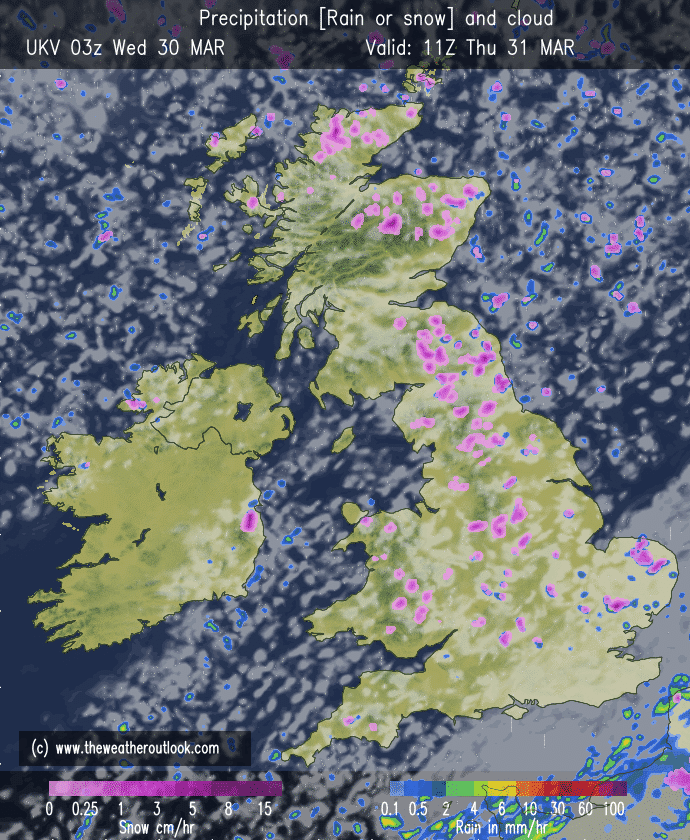
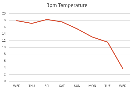
It certainly feels like winter has returned out there today, as Arctic air plunges down across the region bringing cold-rain, sleet and some hill-snow. From 18°C a week ago to just 3.6°C at lunchtime today. Ouch.
It’s not unusual to get a cold-snap at this time of the year, as late-March can be a fickle period of weather. The warmth and blue skies, albeit it hazy with pollution, were amazing but all good things have to end eventually, you just have to make the most of these pleasant spells, especially in the UK.
Thursday: A frosty and icy start with sunny spells developing. Wintry showers will feed in from the northeast during the day with fewer showers the further west you are. Showers will be of rain, sleet, hail and snow There will be a strong and gusty wind leading to a biting wind-chill. Max 7°C

Friday: Again a frosty start then not a bad day with sunny spells and fewer wintry showers. The sun is gaining strength now so out of the breeze in shelter it won’t feel too bad despite the temperature. Max 7°C
Weekend: Less in the way of sunshine
Saturday: Cloud will spread down from the northwest bringing a few showers. Feeling cool with all the cloud during the morning but hopefully some brighter spells into the afternoon. Max 8°C
Sunday: Bright spells and a few showers. Tending to be a little drier into the afternoon with sunny spells developing. Max 9°C
Outlook: A westerly airflow will return bringing low pressure to the northwest of the UK. We will see some showery rain at times, but not a lot of rainfall is expected over the week. Temperatures will return to normal and the night-frosts will end.
Follow @ChadWeather on Twitter for the latest forecasts and warnings.
Thanks,
Jon
Forecast Issued: Wednesday the 30th of March 2022 at 5:07pm.
Image: http://www.theweatheroutlook.com

