Hi all,
The wait for significant rain continues and with everywhere drying up rapidly, after a drier-than-average 6 weeks, there will be petrichor in the air once the rain returns.
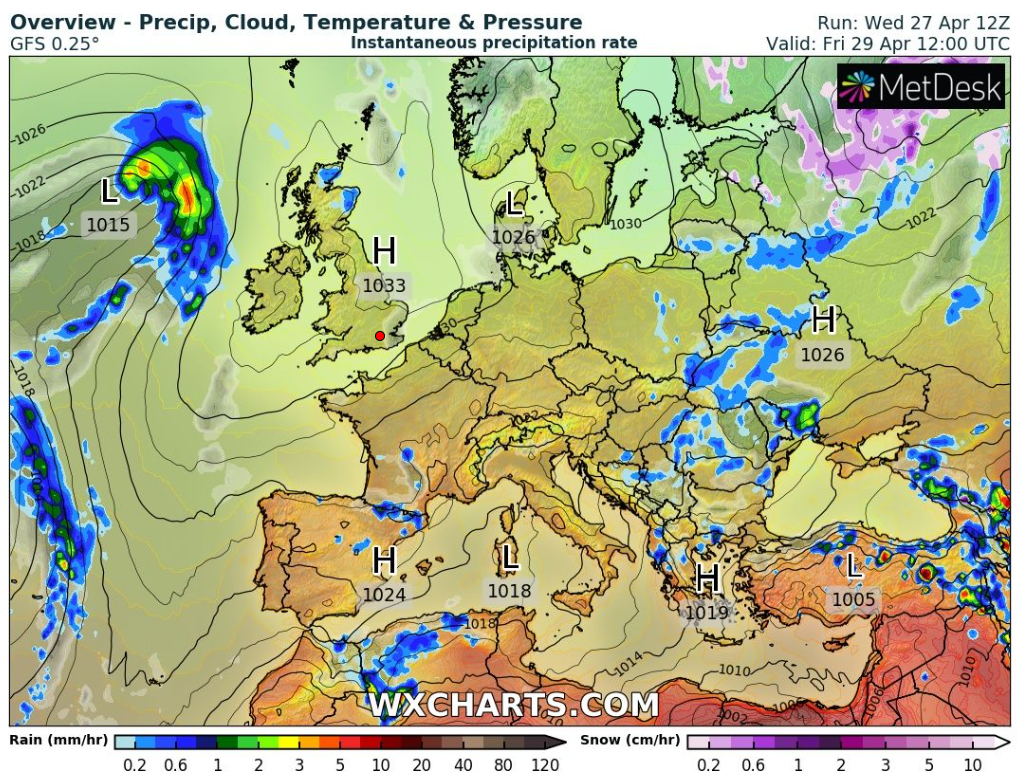
At this stage, it looks like high pressure will mostly dominate our weather pattern for the foreseeable. High pressure can mean warm and sunny but like recent weeks, we will see cloud amounts variable and with a cooling trend into the new month.
Thursday: A chilly start with some ground-frost and localised mist. Sunny spells for the morning but cloud will tend to increase during the day. Dry with generally light winds. Max 13°C
Friday: Little change although it’s not expected to be as cold of a start. Sunny spells followed by cloudier spells. Max 14°C

Weekend: A little warmer on Saturday.
Saturday: Sunny spells here and there and temperatures lifting a little. Max 16°C
Sunday: Cloudy to start, with perhaps a very localised shower early on. Sunny spells breaking through. Dry with light winds. Max 14°C
Bank Holiday Monday: Mostly cloudy with some bright spells. Temperatures still a little disappointing but plenty of dry conditions. Max 14°C
Outlook: A new area of high pressure will slip down from the north bringing slightly cooler air, even with a risk of overnight ground-frosts. Lots of dry weather but again not guaranteed sunshine as cloud spills in from the north or northeast. No sign of the Atlantic-driven weather pattern returning, so wind and any significant rain still being held at bay.
Follow @ChadWeather on Twitter for the latest forecasts and warnings.
Thanks,
Jon
Forecast Issued: Wednesday the 27th of April 2022 at 5:55pm.
Image: http://www.wxcharts.com
