Hi,
Spring is here but temperatures have been struggling so far but at least it’s become less chilly this week and we made it into the mid-teens. But that said, the milder air comes with the added ingredient of wind and rain or even the odd thunderstorm.
Some media report 20°C for Easter but the latest suggests it’s more likely to be an average one with temperatures around normal but will high pressure make an appearance?
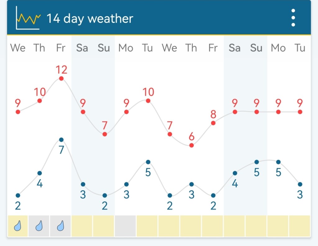
Meanwhile, how are the next four days looking?
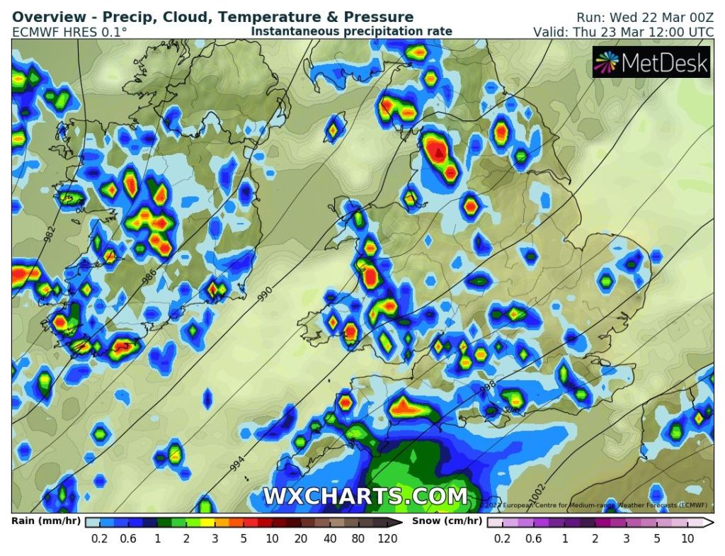
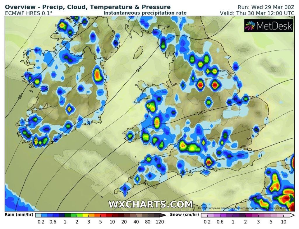
Thursday: Mostly cloudy for the morning. Bright spells for the afternoon with showers developing, some heavy with a chance of hail and thunder. Showers less frequent to the west. Very mild and breezy. Max 15°C
Friday: Cloudy with an area of low pressure affecting the south of the UK meaning it’s an unsettled day with patchy rain at times. Mild but temperatures down on recent days as winds swing north-easterly. Max 13°C
Weekend: Sunday looking the better day.
Saturday: Another cloudy day with rain or drizzle at times. Lighter winds with temperatures dropping away with a northerly airflow. Max 11°C
Sunday: Hopefully some breaks in the cloud allowing for a better day especially to the west. It should be mostly dry. Max 11°C
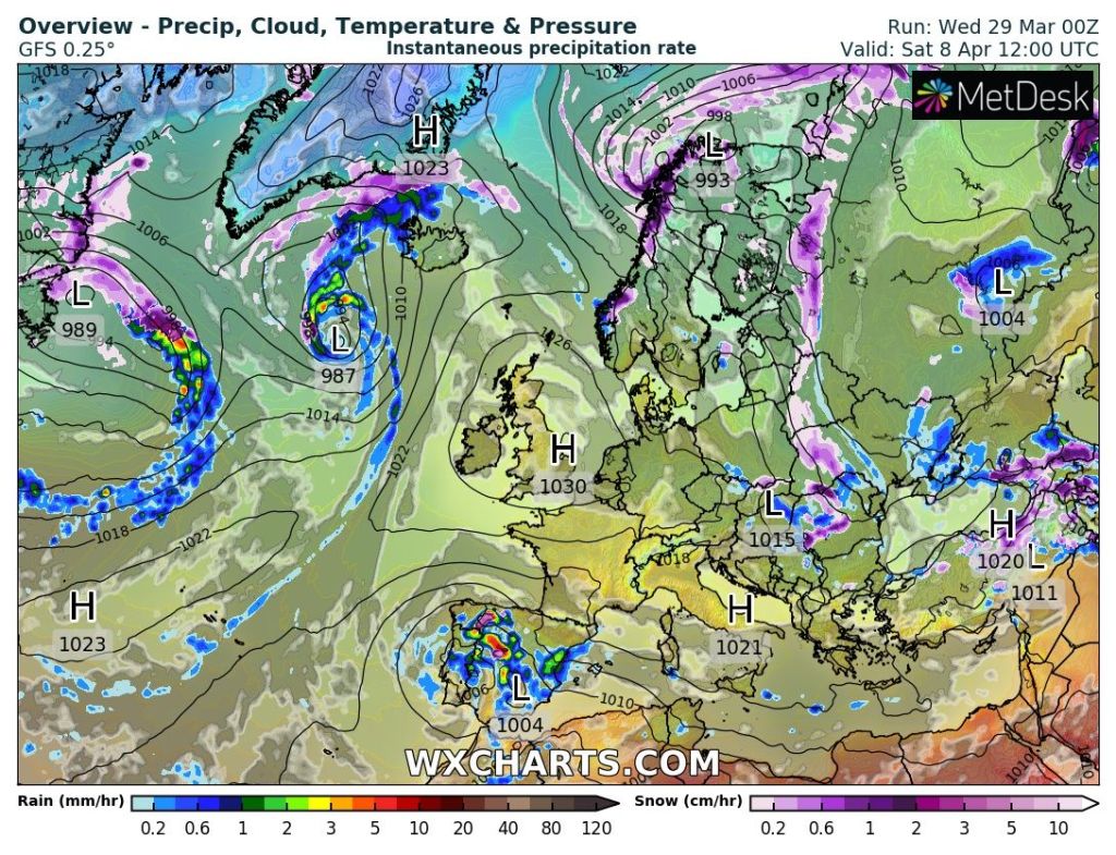
Outlook: Like last week Monday looks a good day with bright or sunny spells. It goes downhill once again Tuesday onwards with periods of showers or longer spells of rain. Staying mild. Easter weekend looking changeable for now but there are hints that high pressure will build in leading to a settled spell of weather but nothing notably warm.
Follow @ChadWeather on Twitter for the latest forecasts and warnings.
Thanks
Jon
Forecast Issued: Wednesday the 29th of March 2023 at 7:10pm.
Images: http://www.wxcharts.com & http://www.wetterzentrale.de