Thursday 26th May 2016 – Bank Holiday Monday 30th May 2016

Hi all,

Heatwave on the way? Nope. However, it is looking generally settled from the weekend so not a washout.

After a miserable Wednesday, we hang onto this set-up into the first half of Thursday with plenty of cloud around and some drizzle or light rain. Low-cloud over the hilltops too. It should be a little milder than yesterday and it will generally dry up into the evening. Max 14°C.

Bright spells around on Friday and feeling warm in any sunshine. The warmth might trigger an afternoon shower or two, otherwise dry. Max 17°C.

Another extended 3-day weekend :). Always nice and the weather is going to be reasonably well-behaved.

During Saturday high pressure will be sitting just to our north bringing settled conditions. Sunny spells and temperatures around average. With the sun strong at this time of the year it will feel pleasant enough. Don’t forget that sun-cream. Max 18°C.

Little change into Sunday. Bright or sunny spells and winds should generally be light. The reason we aren’t warming up into the hot category with this settled weather around, is because we have the wind coming from the north-east. Low risk of an isolated shower into the evening. Max 18°C.

storms

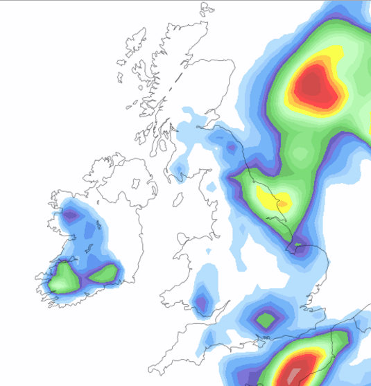
Thundery downpours close by on Bank Holiday Monday as they develop towards our E and SE

The high pressure slips away slightly into Bank Holiday Monday but the likelihood is that we stay dry with sunny spells but just increase the shower-risk. Most of the showers will be in the east and south-east of the UK but we can’t rule out a heavy downpour, possibly thundery, later in the day. Max 19°C.

BH Temps

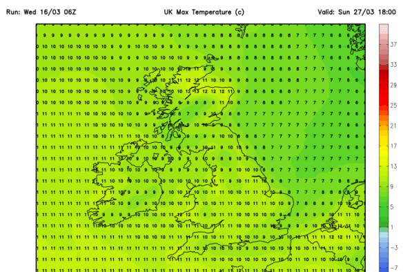
Maximum temperatures for Bank Holiday Monday – no heatwave

At the moment the rest of the week looks settled with high pressure close by. No heatwave yet, but certainly some pleasant conditions and a lot of dry weather. If winds turn to come from the south-east then we could import some warmer air from the Continent.

Follow @ChadWeather on Twitter to catch all the latest weather updates for Manchester and its surrounding boroughs.

Photos/Data: ukweatherforecast.co.uk
Forecast issued at 14:30 on Wednesday the 25th of May 2016

Thanks for reading,
Jon

Thursday 19th May 2016 – Sunday 22nd May 2016

Hi all,

We’ve had a decent May so far, with some warm sunshine, a few calm, chilly nights and mainly dry conditions. In fact we’ve only recorded 13mm of rain this month but this total is set to rise as we enter a few unsettled days.

A chilly and misty or locally foggy start to Thursday, but once this lifts the sun should break through the clouds and a reasonable few hours ahead. Cloud will thicken later though with rain expected late-afternoon and into the evening. Feeling warm and a little muggy. Max 17°C.

A bit of a repeat performance on Friday. Bright spells for the morning and early afternoon so feeling pleasant and not a bad day. Cloud will increase and the wind picks up as showers arrive into the evening. Some of these could be heavy before general rain arrives. So if you’re off out for the Whit Friday celebrations pack something waterproof for late on. Max 16°C.

weather fronts

Plenty of weather fronts from the Atlantic over the coming days keeping us unsettled

It’s a bit of a complex picture as we go into the weekend. A unseasonal low pressure is set to swing in from the southwest Friday night introducing windy conditions for a time and a spell of heavy rain on into Saturday. This will clear quickly to bright spells and showers later. Feeling cool in the fresh wind. Max 16°C.

It’s the Manchester 10k on Sunday and the wife is taking part, so it means I’ll be dodging the showers which will be heavy. Don’t be surprised to see some hail again with thunder and lightning. The bright spells in between the showers will offer some respite. A little cooler. Max 14°C.

Looking ahead into next week and there were some signs of the weather settling down and becoming very warm as high pressure built. This still looks likely, but perhaps delayed until later in the week or towards the end of the month. Otherwise, it will remain showery with temperatures around average.

Follow @ChadWeather on Twitter to catch all the latest weather updates for Manchester and its surrounding boroughs.

Photos/Data: http://www.metoffice.gov.uk
Forecast issued at 14:20 on Wednesday the 18th of May 2016

Thanks for reading,
Jon

Thursday 12th May 2016 – Sunday 15th May 2016

Hi all,

Finally we’ve had our first taste of Spring, well in fact some days felt like summer with a high of 24°C. With UV levels at 6, my tan is coming along nicely. However, cooler weather is on the way.

Thursday will be a decent day after two days of cooler, cloudier conditions. Although slightly breezy, sunny spells are expected and it will be warm. Make the most of it. Max 20°C.

colder air

Colder air arrives Friday and into Saturday


All change as we go into Friday. A bright start then a cold front spreads down from the north introducing a band of cloud and behind it colder air. Generally dry but notably cooler. Max 13°C.

I can promise a settled but chilly weekend which isn’t such bad news. Where we do get some sunshine it won’t feel too bad and despite the cold, the sun is still strong and with a UV of 6. Grab a coat and tan that face :).

frost

A risk of ground frost this weekend


A cold start to Saturday with a chance of some localised frost. The day will be dry with bright spells and cool. Pleasant in any sunshine. Max 12°C.

Very little change into Sunday, sunny spells, chilly early and late. Light northwesterly winds and at least it will be dry. Max 12°C.

Looking ahead to next week and it will be dry to start but then showers are expected as well as a slow rise in the temperatures and back up to the late teens.

Follow @ChadWeather on Twitter to catch all the latest weather updates for Manchester and its surrounding boroughs.

Photos/Data: http://www.ukweatherforecast.co.uk.
Forecast issued at 14:45 on Wednesday the 11th of May 2016

Thanks for reading,
Jon

Thursday 17th March 2016 – Sunday 20th March 2016

Hi all,

In my terms, we are in a pattern of settled but boring weather. Not too warm, not too cold, no frost, no snow, no rain, some dull days, some bright days but nothing to keep an eye on. The only positive, is it gives me a bit of a well-earned, much-needed rest.

With the settled pattern set to continue I will have a look at the outlook for Easter and give a ‘most likely’ forecast rather than the media tripe that has already been published.

easter media bull

A usual Daily Express headline rears its ugly head again – No signs of a heatwave

A chilly start on Thursday, and if we have had clear spells for long enough then perhaps a touch of frost and some fog patches. These will lift into low-cloud but sunny spells expected during the day. Max 8°C.

We have high pressure firmly in charge of our weather hence the dry and settled spell but as we enter Friday this will slip to sit to the northwest of Ireland meaning we drag in a cold northerly breeze. However, another dry day with bright spells is on the cards. Some areas may keep some stubborn cloud. Feeling chilly. Max 7°C.

saturday pressure chart

High pressure that’s giving us settled weather drifts into the Atlantic

The weekend will be mostly dry but I can’t promise wall-to-wall sunshine.

Saturday and Sunday will be similar. A cool breeze from the north and with it plenty of cloud floating around. Some of this may be thick enough to bring some drizzle or light rain to unlucky spots but quite localised. It will remain feeling cold but pleasant in any sunshine. Overnight frost will be possible where we have clearing skies. Max 8°C.

Looking ahead and little change for most of next week but there are signs that we will see the high pressure drift away as we approach Easter. This will allow some rain to push in from the northwest followed by a chilly southeasterly breeze. No heatwave on the radar, with it even being cold enough for some frost over Easter Weekend. Of course look out for updates on Twitter as it is still 10 days away.

frosty start to easter weekend

Possibly a frosty start to the Easter Weekend

risk of a wet easter sunday

A risk of rain on Easter Sunday

easter sunday max temp

Predicted maximum temperatures for Easter Sunday – certainly no heatwave

Follow @ChadWeather on Twitter to catch all the latest weather updates for Manchester and its surrounding boroughs.

Thanks for reading,

Jon

Photos/Data: http://www.ukweatherforecast.co.uk, www.metoffice.gov.uk, www.netweather.tv

Forecast issued at 13:30 on Wednesday the 16th of March 2016


Thursday 16th July – Sunday 19th July

Hello all,

More talk of the weather heating up, but for now, that chance of occasional heat is reserved for the south and southeast of the UK. 

After a lovely, albeit not a scorcher of a Wednesday; we start Thursday with a morning of pleasant sunny spells. More cloud is expected into the afternoon and with it the breeze will pick up. Late evening and overnight there is a chance of some isolated heavy thundery showers and becoming windy. Quite muggy. Max 21°C.

Into Friday and a cloudy morning with some showers around. Brighter into the afternoon with sunny spells but notably and unseasonably windy with 35-40mph gusts possible in exposed parts. Fresher. Max 19°C.

The low pressure responsible for the windy weather slips away into the weekend and it settles down. 

Saturday will still be breezy with bright or sunny spells at times. Apart from an early shower it should remain dry and the breeze easing later on. Max 17°C.

A little more humid on Sunday but with variable cloud at times, still some bright spells and overall a fine day. Can’t rule out an early shower. Temperatures not really going anywhere. Max 18°C.

Looking ahead we look to stay under the influence of westerly winds. This means bright spells and no hot weather. Temperatures about average with some showers or showery rain possible. So changeable and not a heatwave in sight. 

Thanks for reading. 

Jon

Thursday 11th June 2015 – Sunday 14th June 2015

Hi all,

An early blog this week. Signs of a change after temperatures rise.

May was a disappointing month with plenty of rainfall. The overall average was cooler than April and we had 19 rainy days. After a very wet June the 1st, the weather has settled down into June with some welcome sunshine but unfortunately with no signs of the first summer heatwave on the cards.

High pressure has been in control all week, but with some cool air trapped in and around the high, we haven’t seen temperatures regularly into the 20s. 

On Thursday we start to see a change. The high pressure slips away allowing humid and warmer air to feed up from the continent. We can expect another dry day with warm sunny spells and temperatures up. Max 19°C.

On Friday morning, any early mist or low cloud will break up to give some bright spells. Feeling muggy and warm into the afternoon and cloud increasing. Rain, possibly thundery, late evening or overnight. Max 21°C.

The second half of the weekend and into next week slowly improves but Saturday sees low pressure close by. Any morning rain should turn showery and a generally unsettled day. Feeling fresher than recent days. Max 15°C.

Sunday should be a drier day as the low starts to slip away and any early rain is killed off. Plenty of cloud around but I’m hopeful of some bright spells. Definitely feeling cooler. Max 14°C.

Looking ahead, high pressure starts to edge back in from the southwest. So the outlook is mainly dry conditions but with cloud at times. Any bright or sunny spells making it feel pleasant but temperatures look to hold below the 20s.

Follow @ChadWeather on Twitter for your local weather forecasts.

May 2015 Stats: Av. Max Temp: 12.7°C; Warmest: 17.1°C; Coldest: 2.6°C; Wettest: 15.4mm; Windiest: 41mph; Total Rainfall: 107.4mm (wet).

Thanks,
Jon