Hi all,
Summer has been and gone (meteorologically speaking of course). Did anyone see it arrive? I remember June being quite settled late on and quite warm which ran on a little into July. August was very disappointing and the coolest summer month.
Av. Max. Temps
June 18.2°C
July 19.0°C
August 17.8°C
Av. Temps
June 15.0°C
July 15.4°C
August 14.5°C
Thursday: Bright spells, but with the general theme of cloud thickening during the day and the breeze will pick up. Rain arriving during the afternoon. Max 17°C
Friday: A lively day with plenty of showers, maybe thundery, and windy. Feeling cooler. Max 14°C
Weekend: Cool, showery and feeling autumnal.
Saturday: A breezy day with showers feeding in on a northwesterly wind. Cool. Max 14°C
Sunday: Showers will continue but with it some bright spells. Little change in the feel to the weather. Becoming windy into Monday. Max 15°C
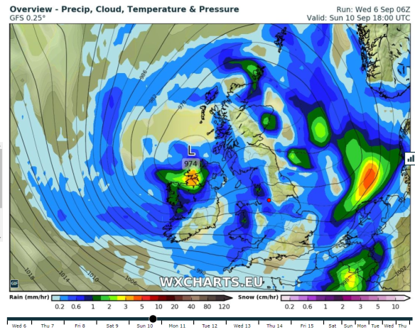
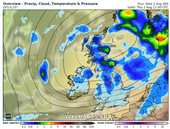
An unsettled weekend ending with the wind picking up & another low pressure
Outlook: Remaining unsettled with low pressure in charge bringing spells of rain or showers. Just a glimpse of something drier towards the end of next week.
Aug 2017 Stats
Max 22.8°C (shocker)
Min 7.7°C
Wettest 10.4mm
Windiest 32mph
Rain 58.2mm (drier than average)
Rainy Days 20 (grim)
Dry Days 11
Follow @ChadWeather on Twitter for the very latest forecast for your area.
Thanks,
Jon
Forecast Issued at 4:20pm on Wednesday the 6th of September 2017