
Hi all,
It’s likely to stay on the mild side as we go through the latter stages of the second month of autumn as winds generally come from a moist source. Tuesday was a beautiful day, cold and fresh to start, locally 3°C and lovely and warm {in the sunshine} during the day. Sitting out for my lunch felt so warm. None of that luxury over the coming weeks as showers seem to dominate.
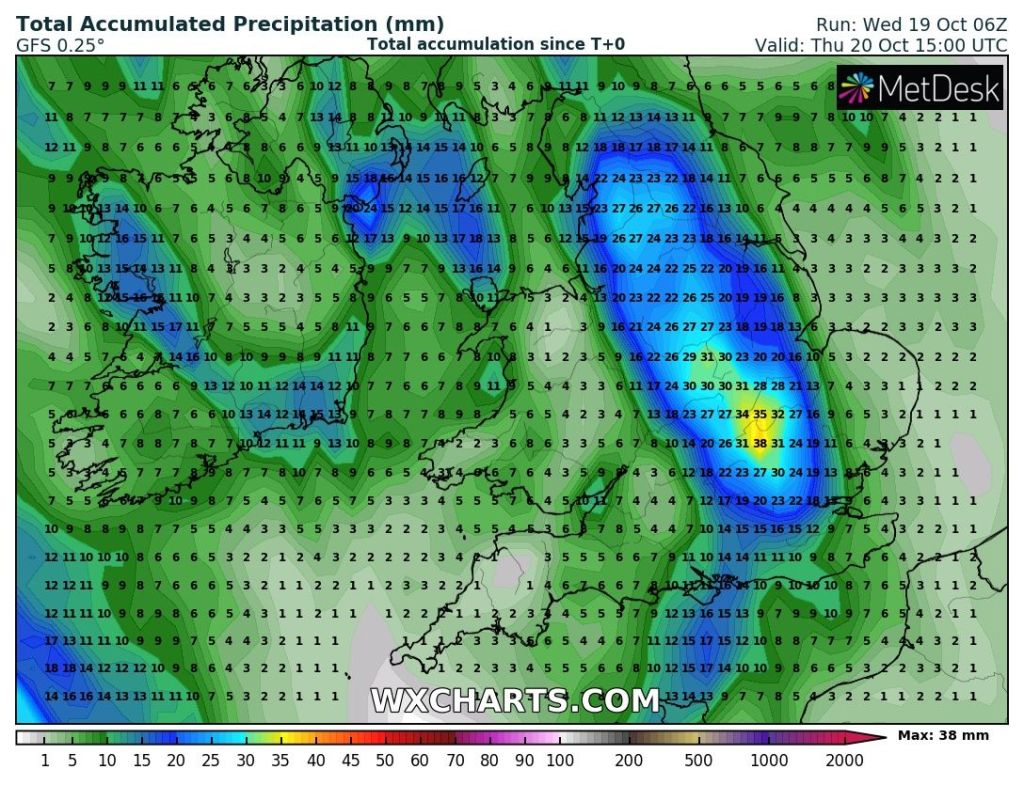
Thursday: Less windy but generally cloudy with some patchy rain out west and localised downpours to the east, chance of thunder and lightning. Risk of some heavier rain for a time before it turns showery and then drier and brighter later in the day. Mild. Max 15°C
Friday: Low pressure in charge, anchored to the south-west of the UK. A fresh breeze again with bright spells and after a dry start showers will push north-east, some heavy with thunder. Mild for the time of year. Max 16°C
Weekend: Fewer showers?
Saturday: After a cloudy start any showers should begin to fade and it turns drier with bright or sunny spells. Still breezy and mild. Max 16°C
Sunday: A nagging easterly wind and bright spells for the morning. Uncertainty for the afternoon with the chance of some rain developing to our south-west and moving in later. A bit cooler. Max 14°C
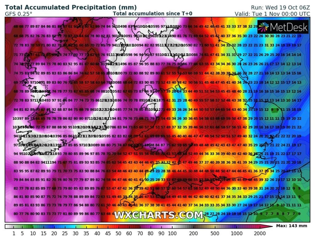
Outlook: The working week looks set to be quite mobile with low pressure parked out in the Atlantic, driving spells of showery rain across the country for most, if not all of the week. Again, some downpours will contain hail and thunder. With a south-westerly airflow temperatures are set to be above average with overnight frosts unlikely.
Follow @ChadWeather on Twitter for the latest forecasts and warnings.
Thanks,
Jon
Forecast Issued: Wednesday the 19th of October 2022 at 7pm.
Image: http://www.wxcharts.com
