Hi,
It’s quite hard to believe that a quarter of the year has gone already. We didn’t have much of a winter in terms of cold and snow, but that always seems to be the case these days. Spring has already been going for a month, meteorologically-speaking and we have had a couple of nice days with a bit of warmth, but overall it’s been disappointing so far.
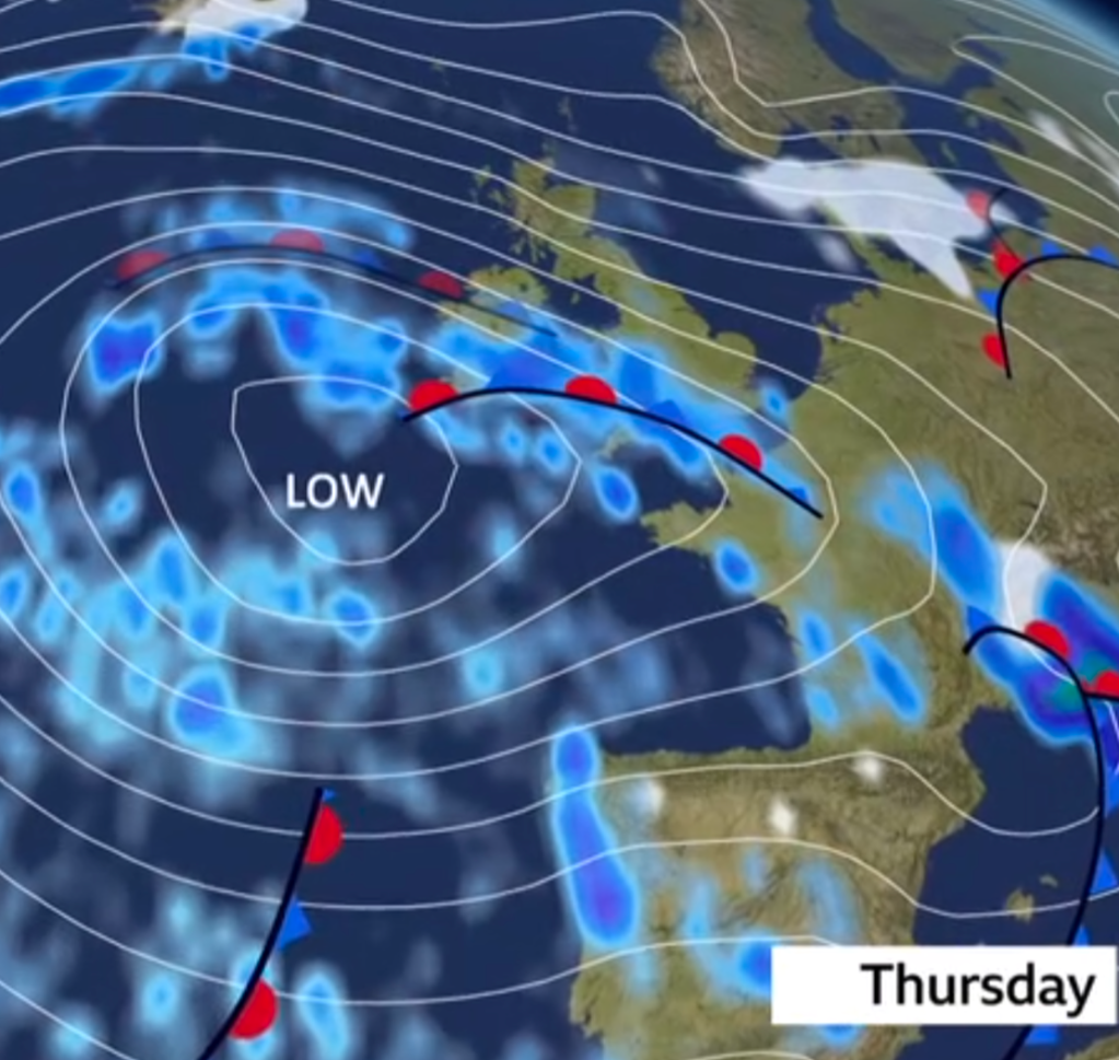
Next on our agenda is the Easter holiday and I did mention that the Easter holiday forecast was flipping and flopping when it came to will it be nice with high pressure or will it be unsettled with Atlantic-driven weather systems? More so the latter I’m afraid.
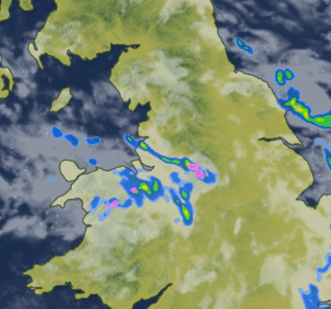
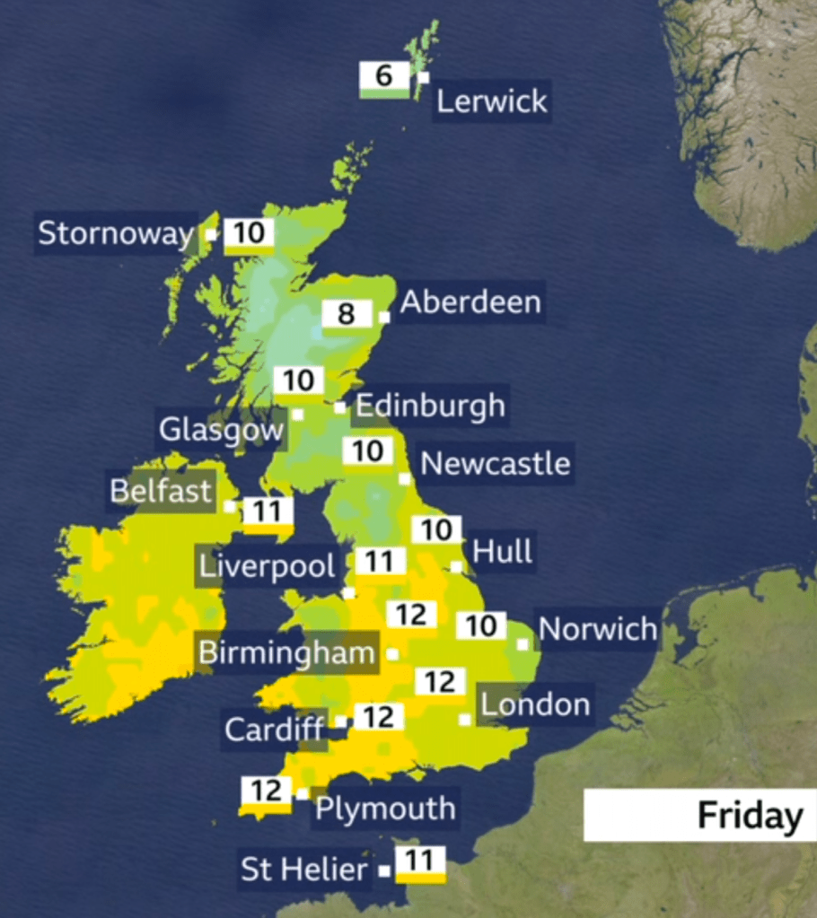
Thursday: Not a bad day to be fair after a misty start and a little bit of a chilly one. Sunny spells will be around for the morning turning hazy later as cloud thickens from the west. Some rain overnight. Max 11°C Min 6°C
Good Friday: Low pressure will be close by, so we will see a day of bright spells and showers and it will be also windy. Especially gusty during any showers. Max 12°C Min 4°C Max Gusts 30mph
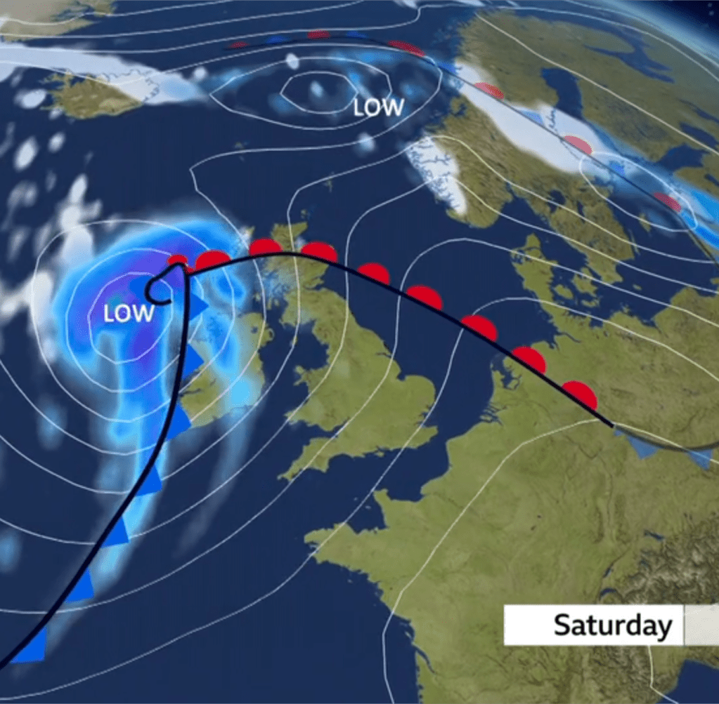
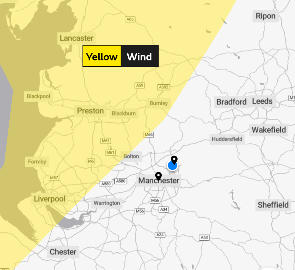
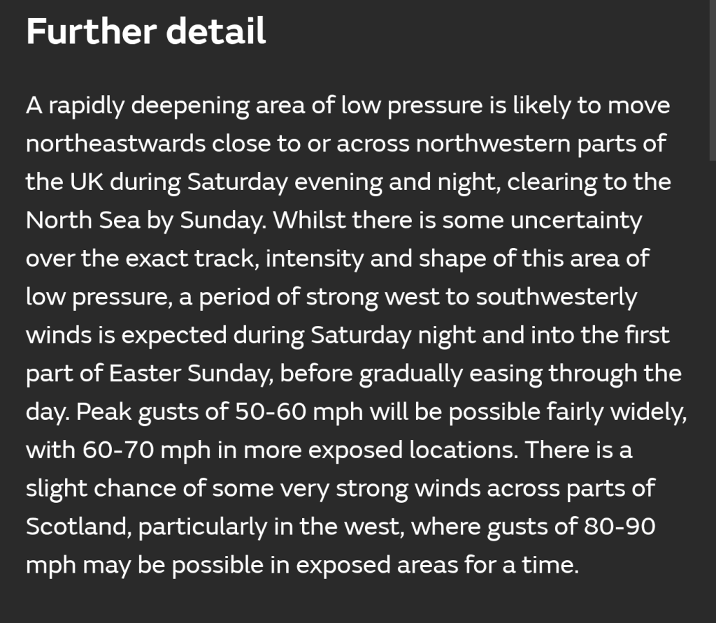
Easter Weekend: Windy but not too bad after Saturday.
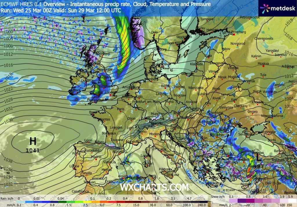
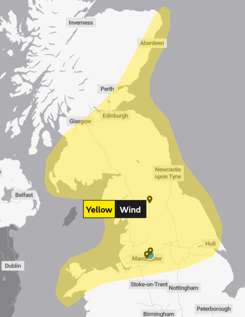
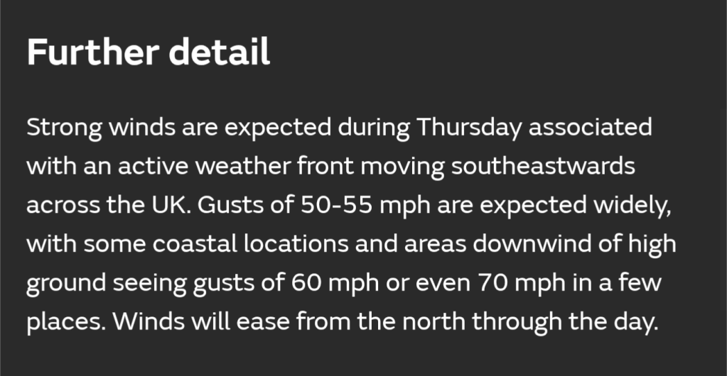
Saturday: Sunny spells to start but these will be brief as cloud thickens from the west. Becoming very windy later with a warning in place as a spell of rain arrives towards evening. Mild. Max 14°C Min 4°C Max Gusts 50mph
Easter Sunday: We return to a cooler airmass now so expect a day of sunshine and showers and some of these showers could be heavy with hail and thunder. Feeling cold in the gusty wind. Max 9°C Min 2°C Max Gusts 30mph
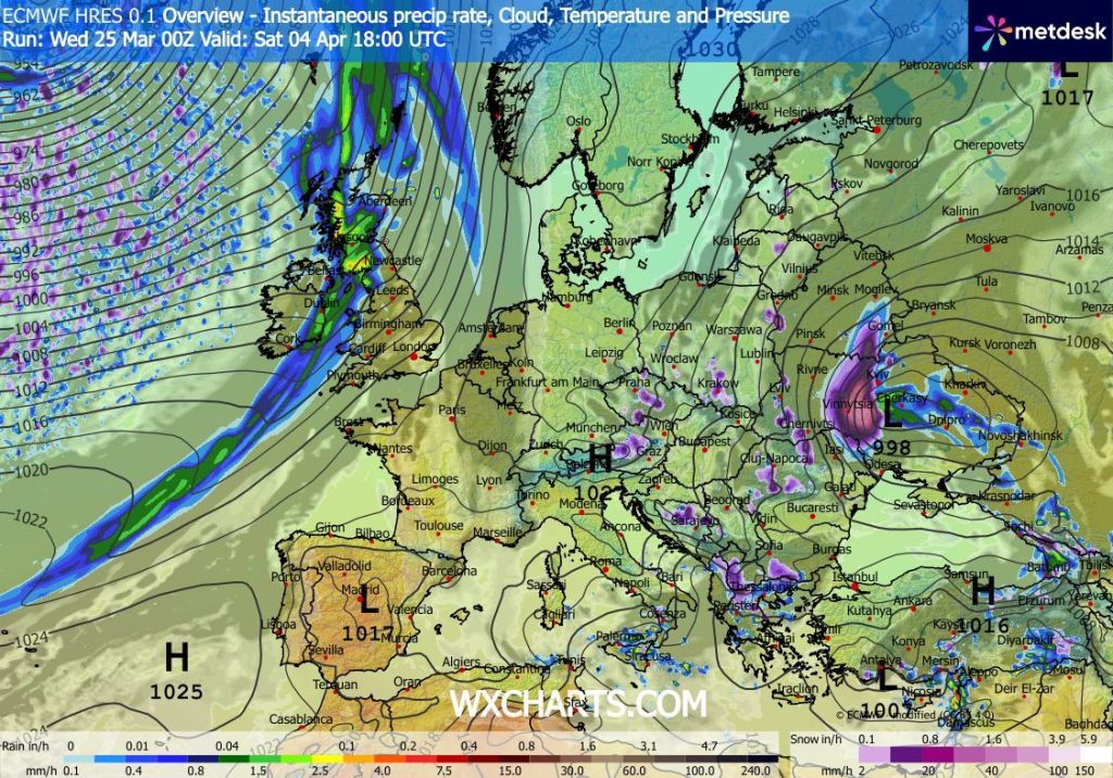
Bank Holiday Monday: At the time of writing, this looks like the best day of the Easter break. It should be dry, bar the odd, isolated shower, plenty of sunny spells and windy. The wind will have switched to a southerly direction, meaning the temperatures will rise. Max 15°C Min 8°C Max Gusts 25mph
Follow @ChadWeather on X and Bluesky for the latest forecasts and warnings.
Thanks,
Jon
Forecast Issued: Wednesday the 1st of April 2026 at 5:30pm
Images: BBC Weather, Met Office & http://www.wxcharts.com