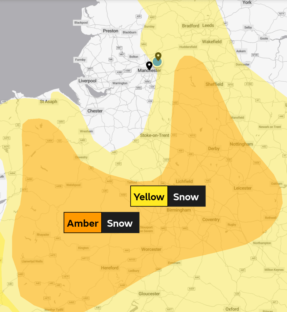
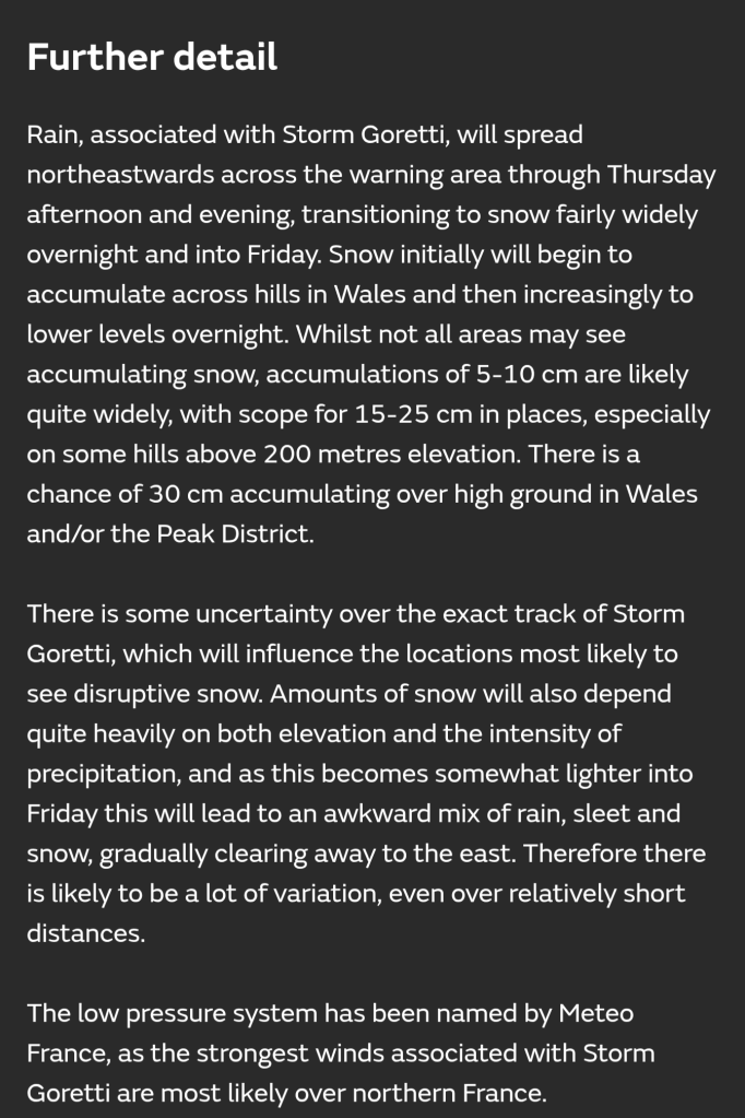
Hi all,
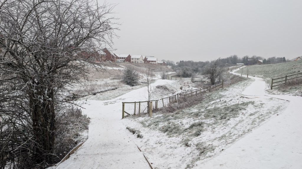
Our cold spell has come to an end and we are back to the usual weather that we see in January, milder-than-average with rain at times and occasionally windy. A few people have already been asking me when is it going to turn colder again and when is it going to snow. This time with more widespread snow, as not everybody saw a decent amount of snow or any at all, during the last cold spell. Again, which is the norm for our winters these days, most of the snow is confined to the higher parts of the region.

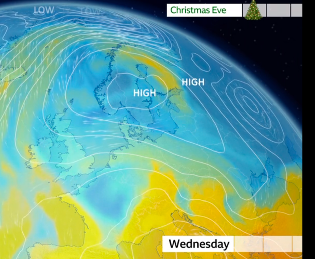
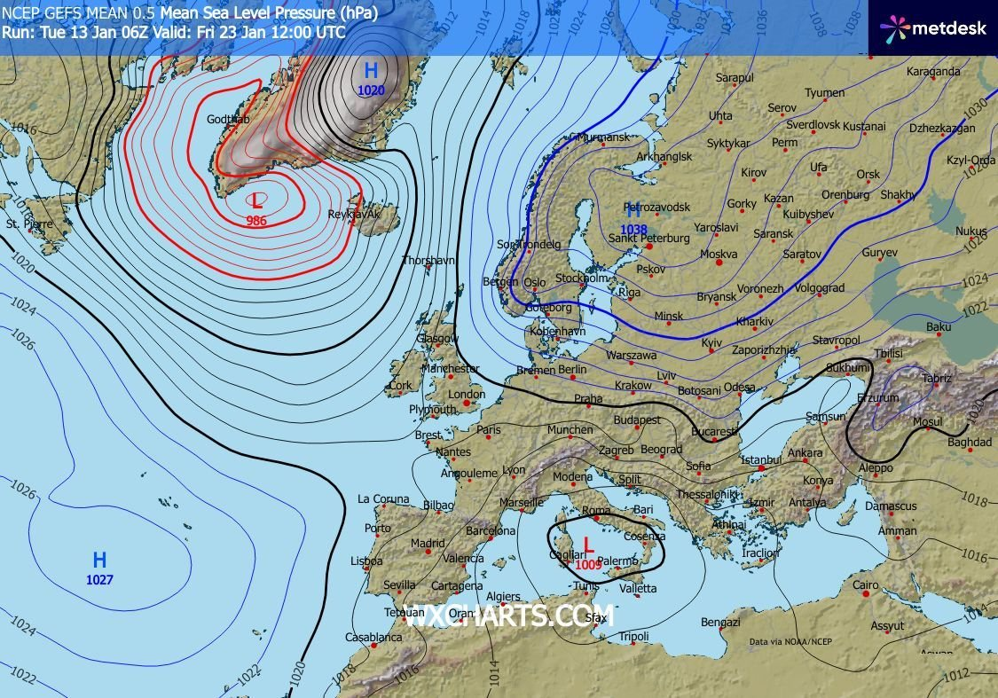
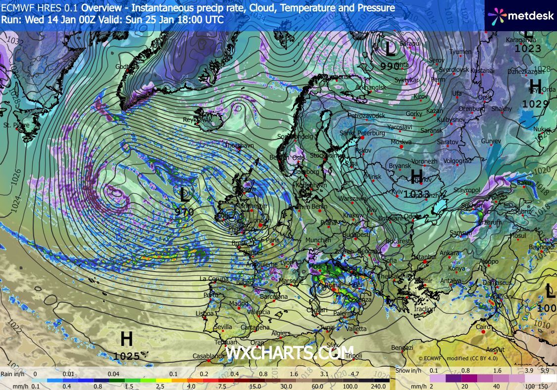
There have been some signs, looking at the long-range forecasts, for colder air, some proper cold days, to drift in from the east but the timeframe is always over 10 days away and this is not a reliable timeframe. But support is growing, with the odd flip back to milder predictions. So all up-in-the-air, and so, for the foreseeable we will be mildish, with the occasional chilly day and more rain to come.
Thursday: Any early showers easing away, then bright spells before cloud thickens later in the day. Less cold. Max 7°C Min 2°C Max Gusts 25mph
Friday: Early showers, wintry on the tops again, move away quite quickly to be followed by sunny spells. Slight breeze. Max 7°C Min 3°C
Weekend: Quiet.
Saturday: A mostly cloudy day with perhaps the odd shower or localised drizzle. Limited brightness. A cool easterly breeze. Max 8°C Min 4°C
Sunday: Very little change. Mostly light winds, a lot of cloud, stubborn to break. Similar temperatures. Max 7°C Min 3°C
Outlook: Cloudy, some bright spells, and occasional showers or drizzle, especially on the hills. Any weather systems from the Atlantic will tend to become blocked, so drying up from midweek onwards and then all eyes on what develops over eastern Europe. If we can get a Scandinavian high and thus easterly winds then we could well be on for another cold spell.
How cold. How snowy. No-one knows at this stage. Keep your eyes peeled for social media updates and the Weekly Blog next week.
I still feel there will be a battle going on between westerly- and easterly-driven weather and we end up in no-mans’ land.
Follow @ChadWeather on X and Bluesky for localised forecasts and warnings.
Thanks,
Jon
Forecast Issued: Wednesday the 14th of January 2025 at 4:42pm
Images & Videos: http://www.wxcharts.com & Lisa Holroyd