Thursday 19th January 2017 – Sunday 22nd January 2017

Hi all,

This is one of the most benign forecasts I’ve ever written in my blog. The weather is stuck in a rut and the last few days have been depressing. Drizzle, mizzle, fog, low-cloud and darkness. Horrible. 

To top things off, as you know I’m a cold- and snow-lover, even Spain has been seeing snow today. 

The Polaris World Golf Resort in Condado de Alhama in Spain saw snow on Wednesday


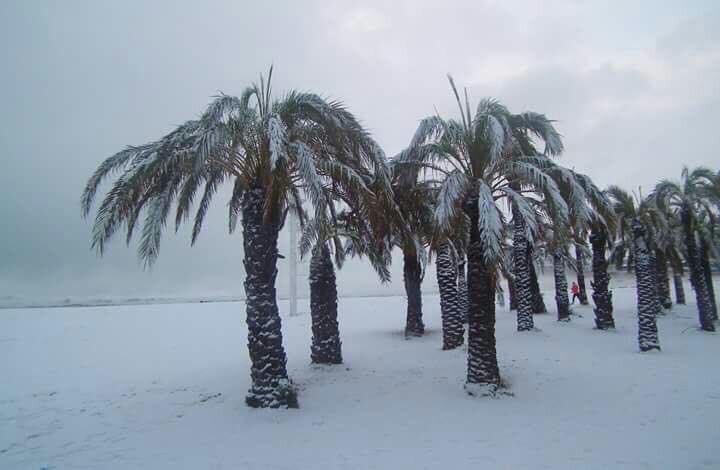
@barrabest on Twitter: Xàbia (Jàvea) Beach on the Costa Blanca, just north of Benidorm, in Spain today. Photo via Patricia Smyth McKeown.

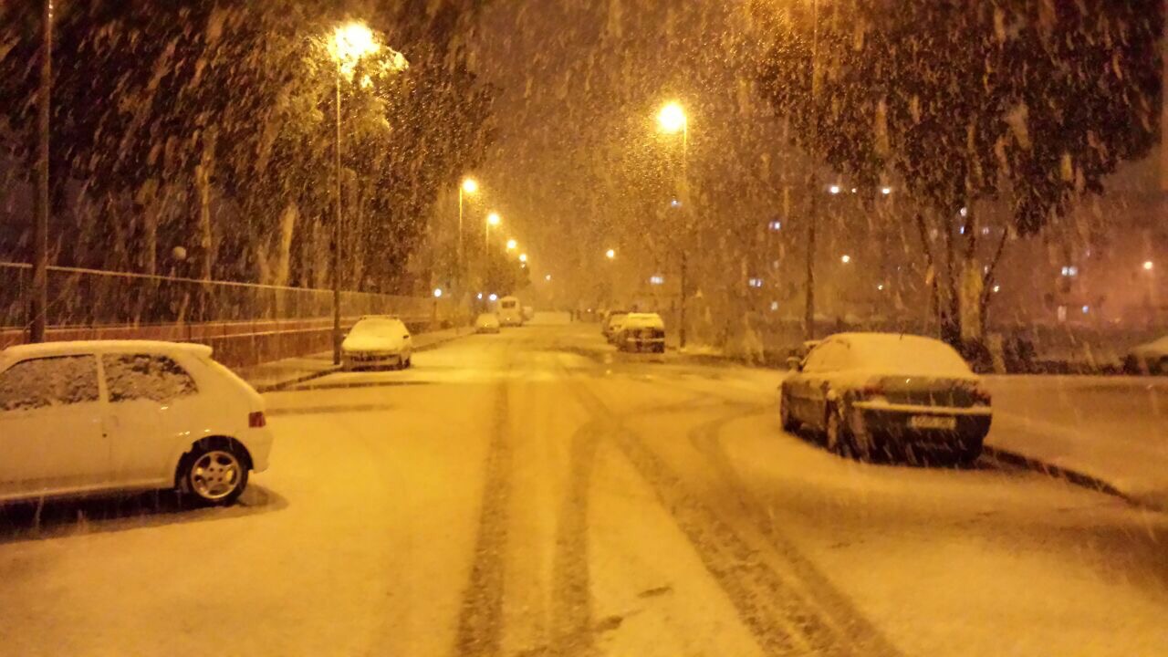
@GVA112 on Twitter – snow falling to sea level this morning on the Valencia Costa


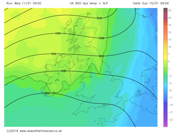
Most of Europe has been cold and snowy and this cold air has extended to most countries bar the U.K. (the SE being an exception for once). 

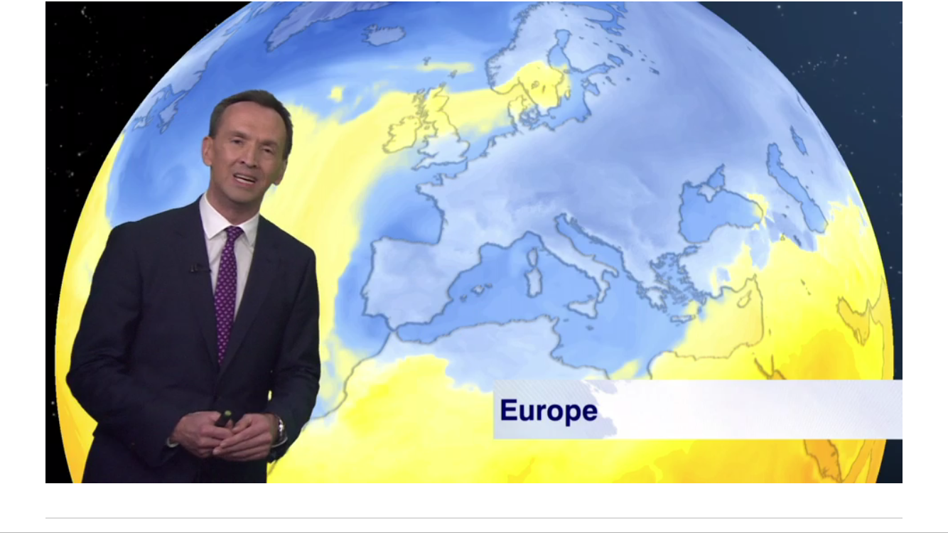
This graphic from the BBC shows exactly where the cold has spread to across Europe.

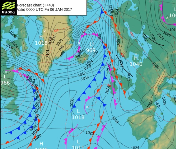
So, are we into for a share of this widespread cold. Well we will all become a little colder towards the weekend but we won’t get any snow or anything resembling very cold conditions. 

We have high pressure in charge of our weather but for us it’s a ‘cloudy high’, which means we’ve dragged in a lot of cloud from the west which is ‘trapped’ and can’t escape. With the sun weak at this time of the year, there’s no strength in it to even attempt to burn off the cloud. This leads to a bland outlook. 

Oh, one thing this weather has done, is broken one of my records. The difference between the Max and Min temperatures during a day, is called the diurnal temperature variation. My previous record was 0.9°C in January 2013. This was beaten on Tuesday 17th January 2017 with the range being just 0.8°C thanks to the lack of sun and damp/dull/misty conditions.

See all records here; Chadderton Weather Records.

Thursday: Cloudy and dull, some local drizzle. Misty on the hills. Light winds. Max 8°C

Friday: Another cloudy day. Slightly cooler than yesterday. Again, we can’t rule out drizzle or mizzle. Max 6°C

Saturday and Sunday: An easterly airflow will drag in some slightly colder air so noticeably chilly across the region. There should be enough cloud-cover to limit any frost. Mostly cloudy during the day but a chance of some brightness especially on Sunday. Max 4°C

Looking ahead: Settled early next week before things look to turn unsettled from the west with rain and milder temperatures. Wanting snow and some ‘proper cold’…..then forget it until February

Keep up to date with my local forecasts on Twitter by following @ChadWeather

Thanks,
Jon

Forecast issued: Wednesday 18th January 2017 at 14:20

Images: From Twitter and credited above and BBC Weather

Thursday 12th January 2017 – Sunday 15th January 2017

Hi all,

Headline: Colder with snow for some of us.

Thursday: A very cold northwesterly wind in place which will bring some rain, hail, sleet & snow showers. Some of the snow will settle leading to tricky driving conditions with some ice later but this is expected to be in areas that are above 225M. You can reference the local elevation map or use the link to see what height you are above sea level. Max 3°C but feeling sub-zero in the wind.

wintry-showers-on-thursday

A bitter Thursday with rain, hail, sleet and snow showers in the mix. Snow settled above 200-250M

Use this link to see exactly how many metres you are above sea levelhttp://www.altitude.nu/ or for local locations see the image below.

heights-above-sea-level

Local locations with their height above sea level

Friday: Windy again with a brisk northerly airflow. Some more wintry showers around but they should be less frequent than what we saw on Thursday. Sunny spells in between the showers. Feeling very cold. Sharp frost overnight. Max 3°C

Saturday: Apart from the odd wintry shower, it looks mostly dry with sunny spells and a cold northerly or northwesterly breeze after a frosty start. It will turn frosty again later in the evening but it is likely to cloud over by morning.  Max 3°C

milder-from-the-nw

Milder air comes in from the NW during Sunday recovering temperatures

Sunday: There is still uncertainty about today but it seems that rain will topple in from the northwest which might, initially, fall as sleet or wet-snow on the higher routes. This weather front will also bring milder temperatures.  Max 6°C

Looking ahead: Mild initially but turning slowly colder from midweek with a chance of a cold easterly feed being established.

Keep up to date via my Twitter account, @ChadWeather.

Thanks,
Jon

Images: http://www.chorleyweather.com/, http://ukweatherforecast.co.uk and Oldham Council.

Forecast issued at 16:30 on the 11th of January 2017.


Thursday 5th January 2017 – Sunday 8th January 2017

Hi all,

Happy New Year and all the best for 2017.

The media have been at it again with their annual, or is it now weekly, lies about a Killer Freeze on the way with record low temperatures and more snow than we’ve ever seen before. 

Unfortunately some folk, especially the vulnerable still believe this tripe, so spread the word, never believe their headlines. I’ll be the first to let you know, if we are due any snow and plummeting temperatures. 

Thursday: A very cold and frosty start with temperatures of -4°C in some parts. A lovely, crisp winter’s day follows with plenty of sunshine. Make the most of it as all change ahead. Max 3°C

Fronts coming in from the west bring rain and milder air on Friday

Friday: Cloudy with rain coming in slowly from the west. Some of the rain will be heavy. A cold-feeling day but temperatures on the rise. Max 8°C

Not much sunshine at the weekend but not a washout. 

Saturday: A mild start with some fog and low-cloud over the hills. The latter could persist all day. Hopefully, most of us will get away with a cloudy and dry day but don’t be surprised to see some drizzle, especially on the hills. Max 8°C

Sunday: Little change. Cloudy, again there could be some low-cloud and drizzle towards hillier areas. No frost as temperatures on the milder side. Max 10°C

Wintry showers later next week?

Looking ahead and the following week does see slightly cooler or colder air return with showers, which might be wintry with snow on the hills. Now where’s that Killer Freeze? 🙂

December 2016 Stats

Max 13.3°C (7th)
Min -0.3°C (28th)
Wettest 16.4mm (8th)
Windiest 49mph (23rd)
Rain 46mm (40% of av.)
Rainy Days 19
Dry Days 12

Thanks for all your support on Twitter and with the blog in 2016. Here’s to an eventful weather year in 2017.

Follow @ChadWeather on Twitter for the latest up to date forecasts. 

Thanks
Jon

Issued: Wednesday 4th January 2017 at 14:30

Images: http://www.metoffice.gov.uk; http://www.netweather.tv

Thursday 29th December 2016 – Sunday 1st January 2017

Hi,

I hope you all had a great Christmas and I wish you all the best for 2017. Here’s hoping for some snow in the early months of next year. At the moment, the start of January is looking like it will offer us some good cold spells and increase the chances of snow. 

Thursday: After a foggy start, more cloud than recent days but remaining dry. Limited sunshine so feeling colder. Max 4°C

Friday: Mostly cloudy but generally dry. Just a chance of some drizzle developing later, especially on the hills. A fresh southwesterly wind picking up introducing milder air. Max 8°C

Saturday (New Year’s Eve): A mostly dry cloudy morning, then some patchy rain is possible into the afternoon and evening. Further, more prolonged rain, will arrive overnight followed by much colder air from the Arctic. Max 8°C

Sunday (New Year’s Day): Sunny spells and wintry showers as colder air reaches all parts from the north. Some showers will fall as hail or sleet with snow showers above 300M. Max 4°C

Outlook: Remaining cold but with a lot of dry weather. Frosts and fog at night. Sunny spells during the day. 

Follow @ChadWeather on Twitter for the latest forecasts. 

Thanks,

Jon

Thursday 22nd December 2016 – Boxing Day 2016

Hi all,

First I would like to wish you all a very Merry Christmas and hope you all enjoy the festivities despite this forecast.

Deep snow? Nah, we have wind and rain to look forward to, and possibly two named storms. After the recent stagnant weather this is a noticeable change especially after a quiet December with rainfall only at 40% of the monthly average.

Thursday: A chilly start with some frost and localised icy patches. Sunny spells and breezy with a risk of a shower or two. These could fall as hail. Feeling cold. Max 7°C

Storm Barbara approaching the U.K.

Friday: A little milder but really not noticeable as Storm Barbara arrives bringing heavy rain after a dry start. It will be windy with gusts of 50mph likely. Weather warning in place. Exposed places could see 60mph. Watch my tweets for updates. Max 10°C

Christmas Eve: Remaining windy with some blustery showers and feeling cold. More rain and wind overnight. Max 8°C

A very mild Christmas Day but colder overnight into Boxing Day

Christmas Day: Early rain, mild and very strong winds. Weather warning in place. There is still some uncertainity about this ‘storm’ and its track. If it develops to be strong enough to be named it will be Storm Conor but at the moment it doesn’t look like it will develop into a system like the one on Friday. During the day we could see gusts to 50mph once again. Later on the rain clears to some scattered blustery showers. Some colder air feeds in overnight, so we could see hail and even some sleet or wet snow to the hills. Max 11°C

The weather calms down as high pressure builds after Boxing Day

Boxing Day and the following few days: Still windy initially then much improved as high pressure builds and the weather eventually ‘relaxes’. Plenty of drier conditions with a risk of some frosts overnight. Chilly at first but maybe becoming slowly milder. Max 7°C

Keep up to date with the latest weather forecast by following @Chadweather on Twitter.

Thanks,
Jon


Forecast issued: 11:00am on Wednesday the 21st of December 2016

Images: http://www.wxcharts.eu; http://www.ukweatherforecast.co.uk; http://www.wetterzentrale.de

Thursday 15th December 2016 – Sunday 18th December 2016

Hi all,

Not long until Christmas and with the big day in range of our long-term forecast models, we can start to get an idea of what the 25th will be like.

Latest suggestion goes for a mild start with temperatures of 8°C, with rain left over from Christmas Eve, clearing during the morning. More updates on Twitter as we approach the festitives.

xmas-day

A mild start to Christmas Day? Certainly no big freeze as per media stories

Thursday: Mostly cloudy and dull. Some rain at times with some drier spells now and again. Plenty of hill-fog and low-cloud. Something we have been used to lately. Max 10°C

Friday: Another cloudy day with low-cloud and some localised drizzle. Mostly dry in the evening as high pressure builds across the UK. Max 10°C

A mostly dry, cooler and settled weekend ahead but sunshine lacking.

Saturday & Sunday: Plenty of dry weather but also a lot of cloud after a cold misty start in places. Some brightness sneaking through, but with plenty of cloud trapped under the high pressure, don’t be banking on it. Cooler. Max 8°C

wind

Dry start to next week perhaps replaced by wind and rain towards midweek

Looking ahead: High pressure in charge for Monday and Tuesday with dry conditions. Wind and rain spreading from the west midweek. Around average temperatures. No sign of any snow.

Follow @ChadWeather on Twitter for your local weather updates.

Thanks,
Jon

Forecast Issued: 15:35 on Wednesday the 14th of December 2016
Images: http://www.netweather.tv

Thursday 8th December 2016 – Sunday 11th December 2016

Hi all,

After a few weeks of relatively cold weather we are back to our more typical December set-up with mild southwesterly winds. I’m still expecting this winter to be colder-than-average but also not expecting any proper cold until we enter the new year. With a southwesterly airflow, rain will not be too far away over the next 48 hours, although the weekend isn’t looking too bad.

Thursday: Rain to start the day, some heavier bursts. It will tend to become drier as we approach lunchtime and the afternoon will remain mild and cloudy with some hill-fog and localised drizzle. Max 13°C

rain-for-thursday

A wet start to Thursday for all

Friday: Another cloudy day with some bright spells. The mild theme continues and some rain is expected as we head into the evening. Breezy. Max 13°C

A cooler but drier weekend ahead.

Saturday: A cloudy start with some rain knocking around from yesterday. The day should then become dry with bright spells but feeling a little fresher. Max 10°C

Sunday: Not a bad day at all. Sunny spells and feeling cool but with lighter winds it shouldn’t feel too bad. Max 8°C


lows-to-nw

Low pressures next week seem to affect the northwest of the UK the most


A mixed bag as we look ahead. Some cooler days and then some milder shots as we get some southwesterly winds again. Some spells of rain, mostly to the northwest of the UK, so more focus on drier and quieter for us. No sign yet of snow or proper cold. I’ll be tweeting some Christmas Day forecasts soon so watch out for those.

Follow @ChadWeather on Twitter for the very latest.

Thanks,
Jon

Forecast issued 13:45 on Wednesday the 7th of December 2016
Image: http://www.chorleyweather.com/


Thursday 1st December 2016 – Sunday 4th December 2016

Hi all,

A late posting this week, washing machine troubles :/. Welcome to the meteorological winter

We have high pressure in charge of our weather and it’s been around for a few days now, which was welcome news after the floods earlier in the month, and it is here to stay.

After some sharp frosts and sunny days earlier this week, things have changed. Earlier in the week the wind was easterly dragging in drier air and clear skies, hence the frost and sunshine. 

The high pressure has now slipped position allowing cloud to topple in from the northwest making for a stale weather pattern.

Thursday to Sunday will all be similar days. Plenty of cloud and mostly dry but just the odd thicker area of cloud might produce drizzle at times.

More cloud-cover means the nights won’t be as frosty and the days will feel cooler with less in the way of sunshine. Hopefully more in the way of sunshine by Sunday.

If breaks do occur overnight we will see some mist or fog as well as a frost.

Max 6-9°C, Min -2°C.

Looking ahead: High pressure continues to be in charge early next week. Variable amounts of cloud. Any breaks allowing sun by day and some frosts by night. Very dry. Possibly a change later in the week as the high is pushed away but not without a fight.

Follow @ChadWeather on Twitter for local weather updates.

Thanks,

Jon

Thursday 24th November 2016 – Sunday 27th November 2016

Hi all,

Well that certainly was an active week of weather. Snow for many places above 250M on Friday morning, followed by 45-50mph gusts and 2-3 inches of rain on Monday, with almost an inch falling in an hour, with serious flash floods following.

Here in Chadderton, some records were broken.

  • 45mm of rain in 1 day beating Boxing Day 2015
  • 21.6mm of rain in any 1-hour period

Again, I would like to thank all those that tweeted me with photos, videos and information about local roads affected. These kind of instant ‘news flashes’ keeps everyone in the know quicker than anything else.

After all that, we have a much quieter week ahead as November eases toward an end.

high-pressure-set-to-hang-around-for-5-6-days

High pressure set to bring drier and settled conditions for the next 5 days


Thursday: 
A chilly start with a local patchy frost. A lovely day ahead with sunny spells and dry. A risk of an overnight frost. Max 8°C

Friday: Similar conditions with maybe more in the way of cloud as bright spells develop during the day. Max 8°C

cloud-cover

A lot of cloud expected this weekend – any breaks likely in western areas


Saturday: 
With an easterly feed now in place, we will drag in more cloud from the North sea. So although it should remain dry, it will feel colder with less sunshine on offer. The cloud however will mean a frost-free night. Max 7°C

Sunday: Little change from yesterday. Cloudy, feeling cold and in places, especially on the hills, the cloud might be thick enough for some drizzle. Max 8°C

Outlook: High pressure to start next week but it is replaced by some rain from the west. Remaining on the chilly side as we go through the week. Early signs point towards a colder start to December.

If you’re into weather charts then have a look at this website, http://wxcharts.eu/, some great charts, features and animations.

To keep up to date with the local weather around Manchester, Tameside and Lancashire then follow @ChadWeather on Twitter.

Thanks,
Jon

Image/GIF: http://wxcharts.eu/

Forecast issued at 16:00 on Wednesday 23rd November 2016


Thursday 17th November 2016 – Sunday 20th November 2016

Hi all,

A bit of a late posting today, but I’m finally here with the usual weekly outlook on what our weather’s going to throw at us. It’s certainly not going to disappoint this week.

Thursday: Cold and windy. Showers of rain and possibly hail and thunder. Some sleet for the hills. There is a chance of more prolonged rain during the morning. 6°C

**There is a possibility that wintry showers will merge together to bring a spell of sleet or snow overnight on Thursday, especially above 200M. One to keep an eye on via my tweets**

Possibilities of some localised sleet and snow overnight Thursday and into Friday morning. Above 200M most at risk.

Friday: Possibly a wintry start as mentioned, then feeling quite bitter with a stiff northwesterly wind and some wintry showers. Sunny spells during the day mixed in with those showers. Showers dying away overnight leading to a frost. 5°C

Heavy rain arrives on Sunday, preceded by Pennine-snow?

Saturday: Frosty start, then a typical pleasant, autumnal day. Sunny spells, just the odd wintry shower but with lighter winds it won’t feel as cold as previous days. 6°C

Sunday: Another cold start with a touch of frost. Cloud soon thickening and the wind increasing as heavy rain, possibly preceded by hill-snow for a time, moves in from the south-west. There is a good deal of uncertainty about how strong the winds could be and how heavy the rain will be so keep your eyes on my tweets. A cold raw feeling day. 7°C

Looking ahead and it’s set to stay cold with unsettled conditions close by. 

Keep up to date with your local weather by following @ChadWeather on Twitter.

Cheers,

Jon

Images: http://www.netweather.tv

Forecast issued Wednesday 16th November at 18:30.