Thursday 18th October 2018 – Sunday 21st October 2018

Hi all,

Our weather is settling down with high pressure building and set to control things for at least the next 7 days.

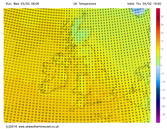
Thursday:  A cold start with a touch of ground-frost in some parts. This is good news though as it means clear skies to start so plenty of sunshine on offer during the day. Temperatures will recover and it will feel pleasant in the sunshine. Max 14°C

Friday: A sunny start then cloud increasing during the day. It will remind dry for all. Max 13°C

Weekend: Dry with some sun.

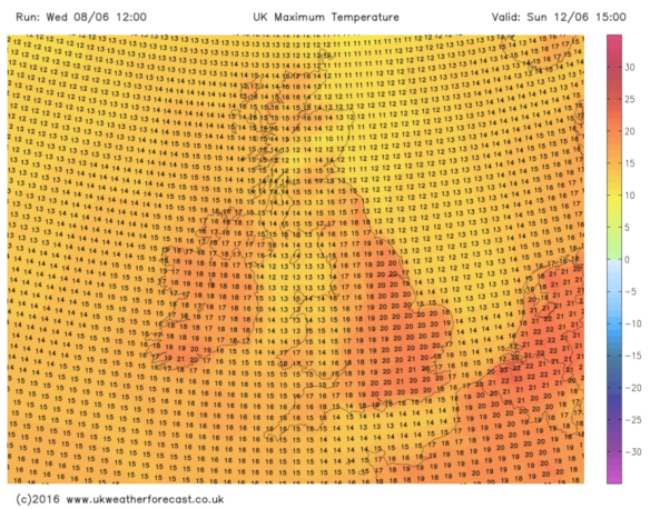
Saturday:  A mostly dry day with bright spells after early stubborn cloud. Sunny spells developing during the day. Max 15°C

Sunday: Little change. Variable amounts of cloud with sunny spells breaking through. A southwesterly airflow keeping temperatures on the mild side. Max 15°C

HIGH PRESSURE

High pressure rules

Outlook: A switch to a west or northwesterly airflow will mean temperatures will be pegged back at little at first. High pressure continuing to dominate our weather though, so I expect it to remain dry and temperatures recovering to around average, in the early teens. A few chilly nights, with some localised mist or fog if skies clear for long enough. Daytimes will be filled with bright spells.

Remember you can keep up to date with the weather via Twitter by following @ChadWeather.

Thanks,
Jon

Forecast Issued: 17:40 on Wednesday the 17th of October 2018
Image: http://wxcharts.eu

Thursday 11th October 2018 – Sunday 14th October 2018

Hi all,

It’s a warm one today. In fact it will be the warmest October day I have ever recorded, as southerly winds push up air all the way from Africa with plenty of sunshine on offer. It’s like we have turned the clock back to summer. UV levels are now low, so you won’t be getting a tan from today’s sunshine and of course it’s too good to last.

Thursday: Cloudy with any morning light rain clearing to sunny spells. Cloud thickening late-afternoon bringing showery rain and becoming breezy. Cooler. Max 18°C

Friday: Windy with 35mph gusts and showery rain for the morning. The afternoon and into the evening will see heavier and more prolonged rain arrive from the southwest and remaining windy. A much different feel to the weather compared to 48 hours ago. Max 16°C

Weekend: Improving on Sunday

Currently there are some weather warnings for the rain Friday/Saturday but they are not covering our region. Of course updates will be posted on Twitter if this changes.

Rain Friday and Saturday

Click to animate – Heavy rain will continue to fall in one zone on Friday/Saturday – its position could shift further southeast.

Saturday: Cloudy with some rain at times. Some uncertainty on how heavy and prolonged this rainfall will be as the position of the weather front is still not set in stone. It looks like it might sit to our north, therefore the worst of the weather could be across the Lake District and north Lancashire. Certainly one to watch. Feeling muggy despite the breeze and rain. Max 18°C

Sunday: Any leftover rain will clear to leave a much better day with plenty of sunny spells and drier conditions. Lighter winds too. Fresher though. Max 13°C

Outlook: Next week sees what’s left of Hurricane Michael get picked up in the Jet Stream, as a normal low pressure, which could bring us a spell of wet and windy weather, mainly to the northwest of the UK. The media will be all over it but I can not see any issues affecting us. Otherwise, bright spells and showers next week with temperatures around normal, 12-14°C.

Follow @ChadWeather on Twitter for the latest forecasts.

Forecast Issued: Wednesday the 10th of October 2018 at 11:15am
GIF: http://wxcharts.eu

Thanks,
Jon

Thursday 4th October 2018 – Sunday 7th October 2018

Hi all,

Autumn is well and truly here after some frosty mornings and a chill in the air. There is still a chance of an Indian Summer but time is running out and everything points towards October being slightly cooler than average.

Thursday – Bright spells and remaining dry. Breezy at times but coming from a warm direction. Max 16°C

Friday – Mostly cloudy but it should remain dry for the morning. Still quite mild but a little cooler as patchy rain arrives into the afternoon and late-evening. Max 14°C

WeekendSunday looks the best day.

Saturday – Rain lingering for most of the day and feeling cold. Some uncertainty on how heavy the rain gets. A fresh breeze from the north. Max 9°C

Sunday – A chilly start, perhaps a touch of ground-frost then a decent day with plenty of sunny spells and lighter winds. Less cold and dry. Max 13°C

Outlook – Changeable. Breezy with spells of rain at times but days of sunny spells in between. Most of the rain to the northwest. Temperatures around average.

September 2018 Stats

Max 23.1°C (2nd)
Min 3.2°C (24th)
Av. 12.5°C
Wettest 26mm (20th)
Windiest 40mph
Rain 85mm
Rain Days 18
Dry Days 12

Follow @ChadWeather on Twitter for the latest forecasts.

Thanks,
Jon

Forecast Issued at 10:45am on Wednesday the 3rd of October 2018.


Thursday 27th September 2018 – Sunday 30th September 2018

Hi all,

Official Autumn is now here and there were a few chilly days earlier this week. Monday morning started with a widespread ground-frost. Lows of 3°C were recorded and grass temperatures dropped to below freezing, -0.5°C. Still time for an Indian Summer but nothing in the immediate forecast.

Thursday: A cloudy morning but remaining dry. After a few warmer days, cooler air is on the way. Once this cloud clears later to a few sunny spells, that cooler airmass will arrive. Max 16°C

Friday: A fresh start and certainly a different feel to the weather with a northerly airflow. That said, a decent day ahead with plenty of sunshine and light winds. Max 13°C

Weekend: Mostly dry but cool.

Saturday and Sunday: Pretty much similar days. Plenty of cloud but some brightness at times, especially in eastern parts. Also, a little breezy and from a cool northwesterly direction. Remaining dry though, with high pressure close by. Max 12-13°C

Outlook: High pressure staying in charge and anchored to the west of the UK. This means north to northwesterly winds will flow across the region. Remaining cool with bright spells. Any thicker cloud could produce some drizzle, especially over the hills. Any clear spells overnight leading to localised ground-frost and misty mornings.

Follow @ChadWeather on Twitter for the latest forecasts.

Forecast Issued at 4:25pm on Wednesday the 26th of September 2018.

Thanks,
Jon

Thursday 20th September 2018 – Sunday 23rd September 2018

Hi all,

So Autumn isn’t messing about. First the leftovers from ex-Hurricane Helene then Storm Ali. There is a chance we could see Storm Bronagh bring some stormy conditions to England and Wales this Sunday, assuming another storm isn’t named on Thursday night into Friday as then it would be Storm Callum. It’s all go at the moment.

Thursday: A cloudy start and briefly dry. Some patchy rain or drizzle will develop towards lunch. Into the afternoon the rain will really set in and become heavy and persistent lasting for the rest of the day. Localised flooding possible with some areas seeing up to two inches of rain. Yellow warning in place. Max 14°C

Yellow warning for heavy rain on Thursday

We could see another windy spell overnight into Friday. Another yellow warning is in place.

Warning for windy conditions overnight Thursday into Friday

Friday: Much cooler and fresher with strong west to northwesterly winds bringing frequent beefy showers. Possible hail and thunder. Max 13°C

Weekend: Saturday the calm before the storm?

Saturday: A brief ridge of high pressure with bring a calmer and drier day with bright spells. Thicker cloud during the evening bringing some light rain. Max 14°C

Sunday: Still uncertainty over this day. At the moment rain will spread in from the southwest and winds will freshen. Showers and brighter conditions later. If an area of low pressure develops, it could well be deep and with it bring very windy conditions. Yellow warning, at this moment, is in place. There is still chance that the low doesn’t develop and the rain stays away to our south. Watch this space. Max 14°C

Sunday’s warning has been issued early but remains uncertain

Outlook: Wind and rain clears early on Monday then the week should settle down with plenty of drier weather and sunny spells. Maximum temperatures in the early-teens so some chilly nights with a local ground frost in rural spots.

Follow @ChadWeather on Twitter for the latest weather forecasts.

Thanks,

Jon

Forecast issued at 5:25pm on Wednesday the 19th of September.
Warnings: Met Office

Thursday 19th October 2017 – Sunday 22nd October 2017

Hi all,

Autumn continues to live up to its name as we experienced some wild weather earlier this week. Ex-Hurricane Ophelia (Bizarre Storm) arrived as forecast but we escaped the worst. Chadderton recorded a 44mph gust but generally across the region it was 50-55mph with 70mph along the coast. What was unusual was it wasn’t hammering down with rain. Once morning-showers moved away, some lightning was recorded near Bury, then the day turned very strange indeed. I had noticed a weird ‘light’ on the way to work and soon the sky was filled with rolling cloud that looked very smoke-like and a glowing red sun. Ex-Ophelia’s southerly winds had pushed smoke particles from the Portuguese/Spanish wildfires and Saharan Sand northwards (Red Sun Phenomenon).

As you know we have named-storms and we are currently on ‘B’ as we had Aileen in September. The reason Ophelia wasn’t Brian was because she was already named and since she kept her strength, she remained named the same, even though an ex-Hurricane, as she arrived on our shores.

Storm Brian could well be here quicker than you think……

Thursday: A lot of cloud around but with some bright spells during the day after a misty start. With light winds it will feel pleasant and mild. However, the breeze will pick up later in the day with a risk of some showery rain developing especially to the south and east. Max 16°C

Friday: Fronts will arrive from the west, so a spell of rain which will be followed by brighter conditions and some showers. Breezy and fresher. Max 13°C

Weekend: Poor. Wet and very windy.

Brian

Storm Brian this weekend?


Saturday: A deep area of low pressure will have been forming out west on the Jet Stream and this system could well be named as Storm Brian. At the moment the strongest winds (70mph gusts) look to be heading to Southern Britain, but the track is still uncertain so watch tweets for updates. Currently, it will be a wet day with rain, heavy at times and windy with 40mph gusts. Feeling cold. Max 13°C

Sunday: The ‘storm’ will move into the North Sea but will introduce cold north-easterly winds and with it frequent showers which could be thundery. Remaining windy with gusts possible to 45mph during showers. Max 12°C

Outlook: Remaining unsettled with some spells of wind and rain broken up by some drier slots. Temperatures around or just above average.

Follow @Chadweather on Twitter to keep up to date with the local weather.

Thanks,
Jon

Forecast Issued: Wednesday the 18th of October 2017 at 1pm
Images: WXCHARTS – Follow them on Twitter.

Thursday 22nd June 2017 – Sunday 25th June 2017

Hi all,

After several days of very warm to hot weather and a risk of thunderstorms later on Wednesday, we’re finally back to more accustomed conditions.

Thursday: The humid air is now being pushed away to the east after yesterday’s showers cleared the air. A lot of cloud with some localised light rain or drizzle for the morning but it will tend to become a little brighter into the afternoon. Much cooler. Max 18°C

Friday: Cloudy with some rain at times, clearing later into the evening to bring some drier conditions and perhaps some brightness. A fresh westerly breeze. Max 17°C

Weekend: Bright spells and showers. Breezy.

Saturday: Bright spells and some showers with a noticeable breeze. I prefer this to the horrible humidity we experienced earlier in the week. Max 17°C

Sunday: Fewer showers, in fact some places dry with some brightness, and hopefully not as breezy as it was on Saturday. Risk of some rain late-evening and overnight. Temperatures around normal. Max 16°C

Outlook: Likely to turn more unsettled with showers and temperatures slipping just below normal.

Follow @ChadWeather on Twitter for the latest weather forecasts.

Thanks,
Jon

Forecast Issued at 12:30pm on Wednesday the 21st of June 2017

Thursday 22nd December 2016 – Boxing Day 2016

Hi all,

First I would like to wish you all a very Merry Christmas and hope you all enjoy the festivities despite this forecast.

Deep snow? Nah, we have wind and rain to look forward to, and possibly two named storms. After the recent stagnant weather this is a noticeable change especially after a quiet December with rainfall only at 40% of the monthly average.

Thursday: A chilly start with some frost and localised icy patches. Sunny spells and breezy with a risk of a shower or two. These could fall as hail. Feeling cold. Max 7°C

Storm Barbara approaching the U.K.

Friday: A little milder but really not noticeable as Storm Barbara arrives bringing heavy rain after a dry start. It will be windy with gusts of 50mph likely. Weather warning in place. Exposed places could see 60mph. Watch my tweets for updates. Max 10°C

Christmas Eve: Remaining windy with some blustery showers and feeling cold. More rain and wind overnight. Max 8°C

A very mild Christmas Day but colder overnight into Boxing Day

Christmas Day: Early rain, mild and very strong winds. Weather warning in place. There is still some uncertainity about this ‘storm’ and its track. If it develops to be strong enough to be named it will be Storm Conor but at the moment it doesn’t look like it will develop into a system like the one on Friday. During the day we could see gusts to 50mph once again. Later on the rain clears to some scattered blustery showers. Some colder air feeds in overnight, so we could see hail and even some sleet or wet snow to the hills. Max 11°C

The weather calms down as high pressure builds after Boxing Day

Boxing Day and the following few days: Still windy initially then much improved as high pressure builds and the weather eventually ‘relaxes’. Plenty of drier conditions with a risk of some frosts overnight. Chilly at first but maybe becoming slowly milder. Max 7°C

Keep up to date with the latest weather forecast by following @Chadweather on Twitter.

Thanks,
Jon


Forecast issued: 11:00am on Wednesday the 21st of December 2016

Images: http://www.wxcharts.eu; http://www.ukweatherforecast.co.uk; http://www.wetterzentrale.de

Thursday 9th June 2016 – Sunday 12th June 2016

Hi all,

A quick blog this evening after the afternoon was spent storm-watching and seeing a monsoon deliver 15mm of rain; 12.2mm in an hour alone (2nd highest-recorded). It’s not shifted the humid-feel just yet, but that will eventually go as we approach the weekend.

Thursday will dawn misty and mild. Sunny spells during most of the day and feeling muggy. Cloud will thicken and some showery rain is expected later into the evening and overnight. Low risk of thunder and lightning. Still warm. Max 21°C.

A change. If you hate this ‘tropical’ feel to the weather then finally we turn cooler on Friday. Showers will be on and off all day as we enter an mixed spell. Max 17°C.

The weekend is certainly tricky to forecast but it will be unsettled and cooler than what we have become used to.

Cloudy on Saturday with some rain at times. There will be some drier slots with a little brightness but gone are the hot, sunny days of recent weeks. Max 18°C.

Cooler Weekend

A cooler weekend awaits

It looks like Sunday will start dry for most but more rain from the west will arrive. Possibly showery at first then heavier and becoming breezy. Max 17°C.

Wet

Plenty of rain expected between Friday and Sunday

Looking ahead and next week will be cool, possibly temperatures just below average at times, with plenty of showers.

Follow @ChadWeather on Twitter to catch all the latest weather updates for Manchester and all its surrounding boroughs.

Photos/Data: ukweatherforecast.co.uk; www.weatheronline.co.uk
Forecast issued at 20:15 on Wednesday the 8th of June 2016

Thanks,
Jon

Thursday 4th February 2016 – Sunday 7th February 2016

Hi all,

Two named-storms in a short period of time and even some snow showers last weekend confirms our weather remains in an unsettled state. As we enter the final meteorological winter month, I am still hopeful of some prolonged cold during mid-February and we can also always rely on March to bring us some wintry weather; so don’t put your sledges away yet.

Rain and milder conditions arrive once again on Thursday after recent cooler conditions. With this comes rain, initially heavy, but easing later on. Hill-drizzle may remain into the evening. Max 11°C.

milder thur

Max Temperatures for Thursday – back to double-figures

The flip-flop pattern continues into Friday as cooler air comes in from the north-west. This doesn’t look like arriving until later on into the late-evening, after a mainly cloudy day with some showery rain and hill-drizzle. Max 10°C.

cold front

A cold front will sink SE slowly on Friday bringing rain then cooler air

The weekend will be chilly and windy with showers at times and some cool nights. To be honest forecasting this weekend has been a bit of a headache with several what-if scenarios to deal with.

For Saturday, bright spells and some showers early on and it will feel colder than recently. Later on there is a good chance rain will spread in from the west and winds increase. Max 7°C.

Bright spells and showers on Sunday after early rain clears. If anything, maybe feeling a little cooler, especially in the fresh wind. Again, more general rain and wind later or overnight. Max 7°C.

Looking at early next week it seems to remain chilly with some showers, which could be wintry at times over the hills. The week looks breezy throughout and there is a good chance we will see some more windy weather later on; perhaps another named-storm?

named storm imogen

Another named-storm later next week – Storm Imogen?


colder

If the stormy weather comes off it could be followed by much colder Arctic air


January 2016 Stats

Av. Temp 5.3°C 
Max Temp 13.2°C (24th)
Min Temp -2.7°C (16th)
Wettest Day 13mm (27th)
Highest Gust 45mph (27th)
Rainfall 129.8mm
Rainy Days 26 

Follow @ChadWeather on Twitter to catch all the latest weather updates for Manchester and its surrounding boroughs.

Thanks for reading,

Jon

Photos/Data: http://www.ukweatherforecast.co.uk

Forecast issued at 16:30 on Wednesday 3rd of February 2016