
Hi all,
It’s going to get hot again, but this time hotter and the lack of notable rain continues. The hottest day I’ve ever recorded is 33.4°C on the 25th of July 2019. This record is under threat; as is the UK’s highest ever recorded temperature, which sits at 38.7°C (July 2019). Not only will daytime records be on the line, but the night-time highest minimum temperatures will be too. Let’s face it. Some of us have to work and we don’t all have a swimming pool in our back garden to cool off in. Three days of grim conditions await.
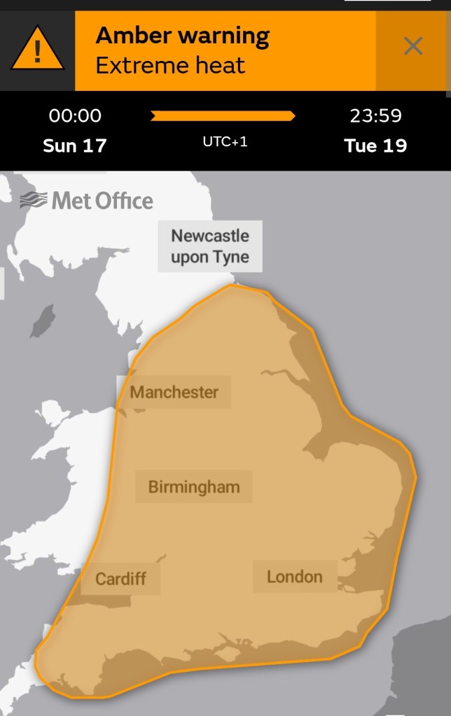
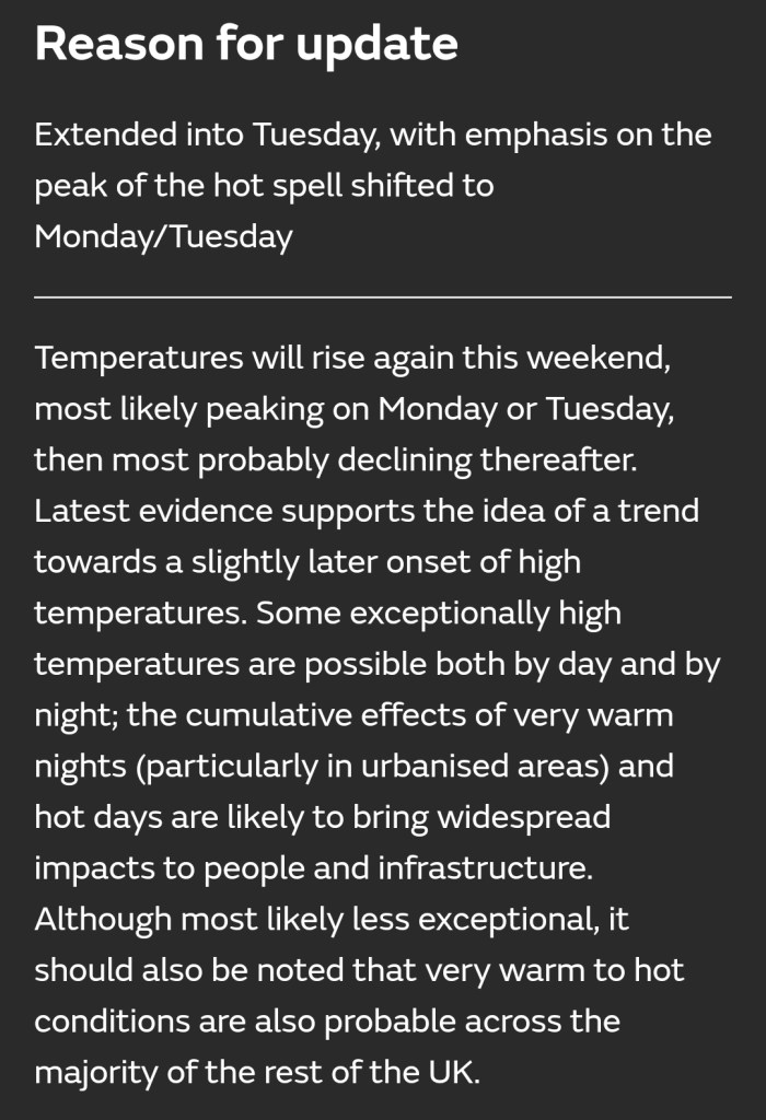
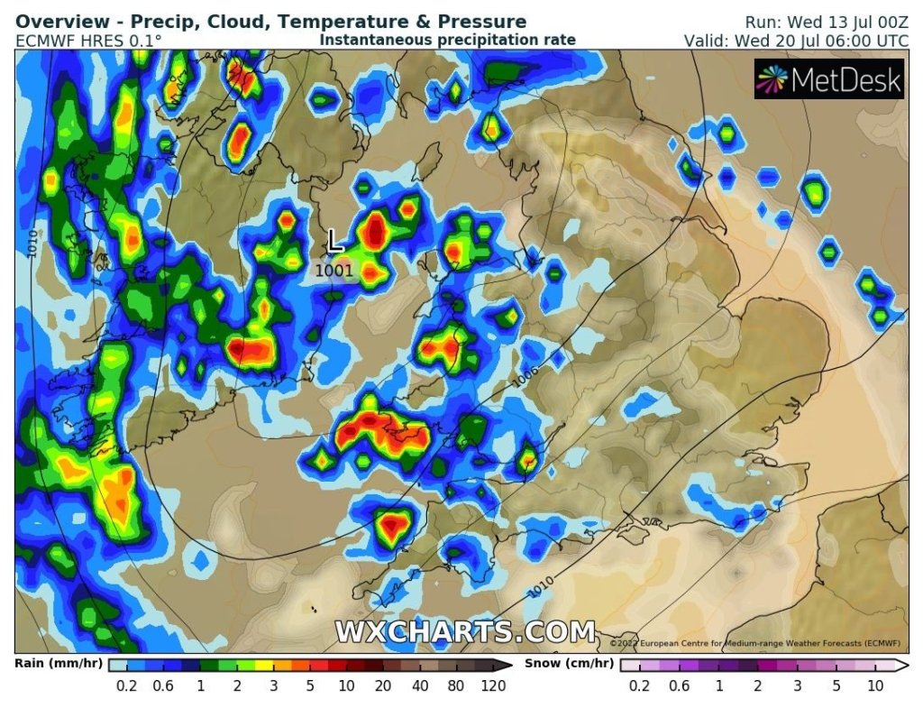
The heat looks set to break overnight Tuesday into Wednesday with a risk of some localised thunderstorms. The detail on this is still uncertain at this stage.
UV levels are high at this time of the year so it is easy to burn in the sunshine, especially 11am-3pm, regardless of the maximum temperature.
Thursday: We remain in average temperatures for the time of year with some sunny spells and just the chance of a shower, especially in northern parts. Breezy. Max 19°C
Friday: More in the way of cloud as a weakening weather-front brings some scattered showers. Windy at times. Max 18°C
Weekend: Becoming increasingly hot and humid.
Saturday: Sunny spells with cloud bubbling up during the day. Likely to stay dry. Lighter winds and a warm night to follow. Max 24°C Min 15°C
Sunday: Hot and humid with some bright spells of sunshine. An afternoon breeze. A sticky night and starting to become uncomfortable for sleeping. Max 27°C Min 18°C
Normally my daily forecast ends here but I’ll throw a couple more days into the mix.
Monday: The impressive waft of hot air from southern origin continues to spread across the region. More in the way of sunshine is expected and with light winds it will be hard to find some relief to escape the heat. Max 31°C Min 19°C
Tuesday: Hot with sunny periods and temperatures getting close to the local record. Can’t rule out 35°C in a few spots in the east. Of course we are still 6 days away from this date and the heat can easily be downgraded or upgraded (more likely the former) so stayed tuned on social media for updates. Max 33°C Min 19°C
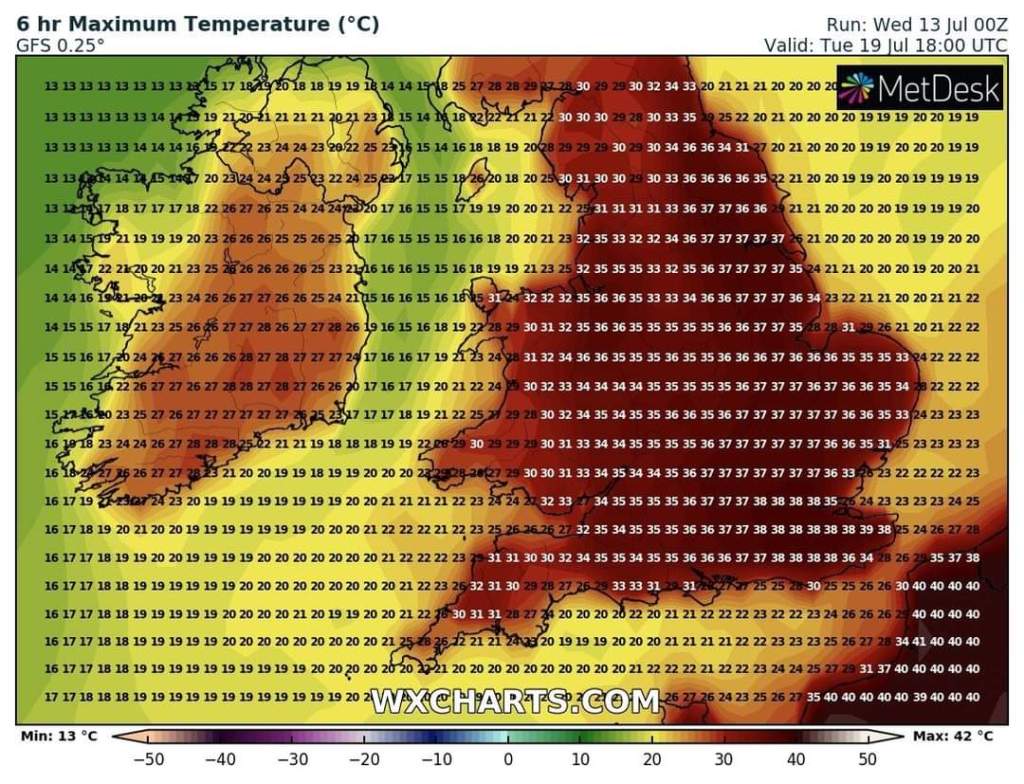
The hot conditions look set to breakdown overnight Tuesday into Wednesday with thunderstorms looking possible, leaving Wednesday a showery day as cooler air arrives, dropping the temperature back down to a maximum of 23°C
Follow @ChadWeather on Twitter for the latest forecasts and warnings.
Thanks,
Jon
Forecast Issued: Wednesday the 13th of July 2022 at 6:25pm
Images: http://www.wxcharts.com & The Met Office
