Hi,
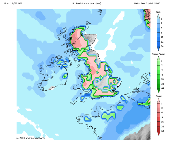
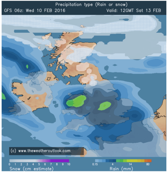
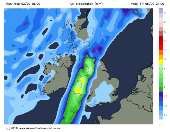
One of my easiest forecasts for a while as the weather slips into a settled spell which is welcome news to most and rainfall totals will remain low in the next 5-7 days.
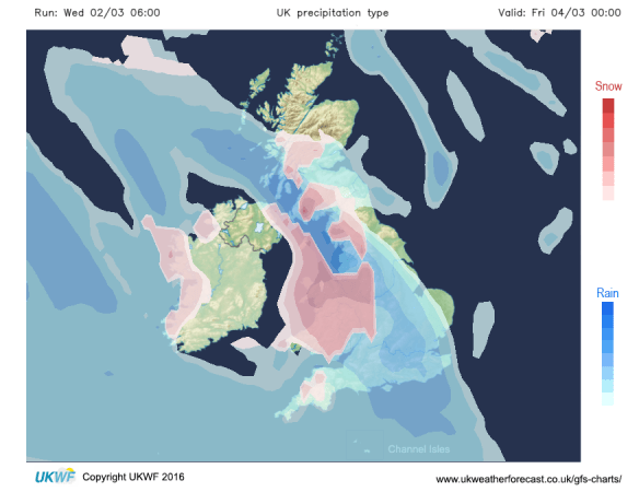
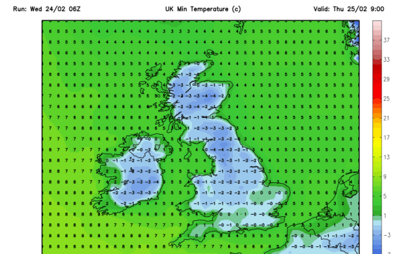
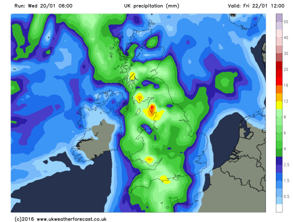
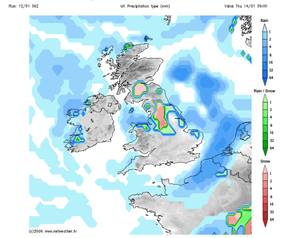
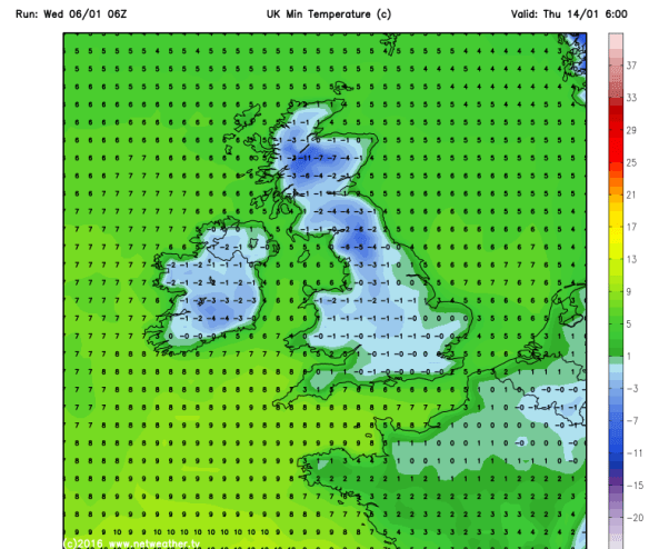
After rain in the past 24 hours there is a risk of some localised ice along with a frost on Thursday morning. Any morning sunshine should be replaced by more in the way of cloud from the east with some light rain showers or drizzle possible in places. Overall much drier in most areas after the rain of Wednesday. Milder. Max 8°C.
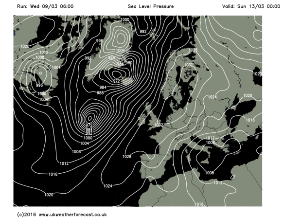
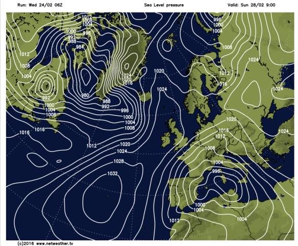
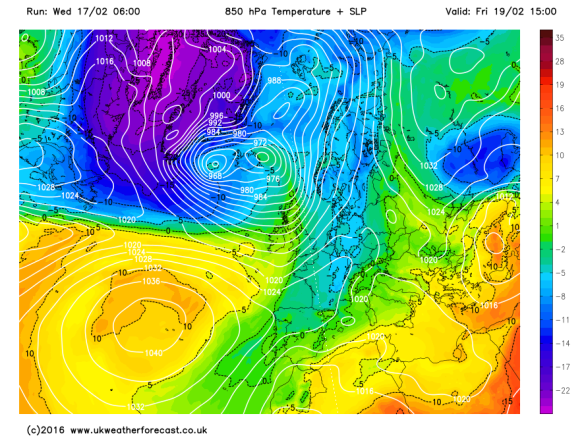
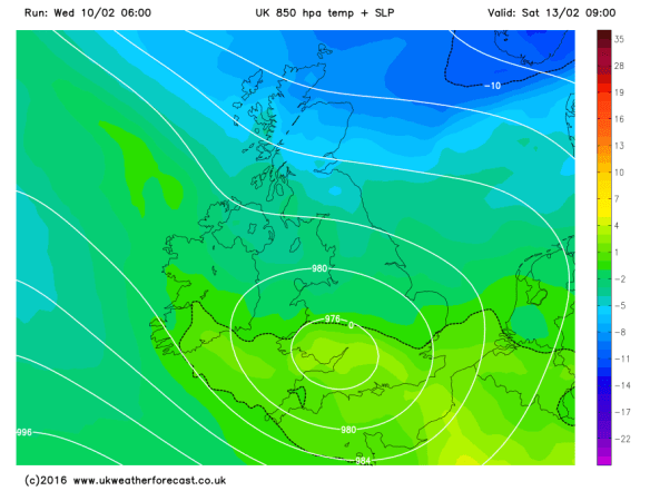
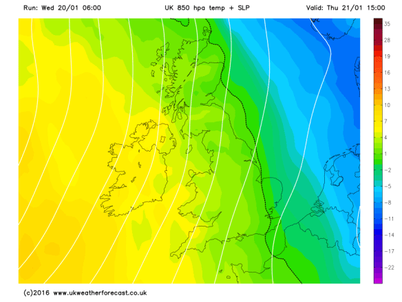
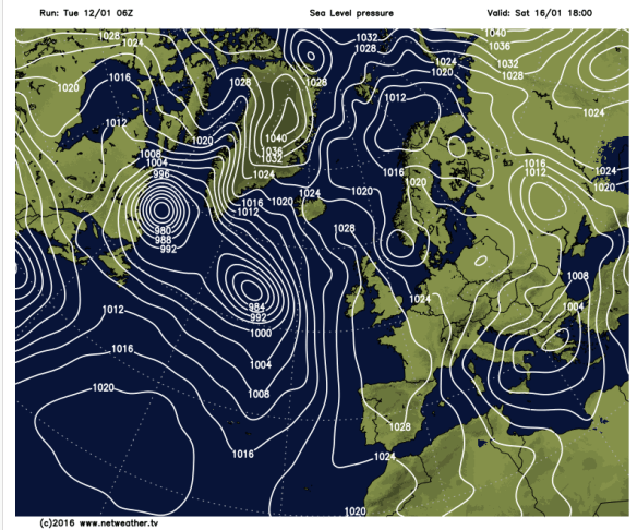
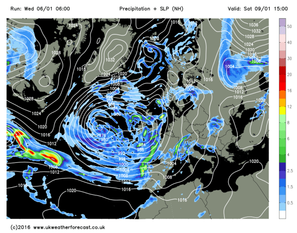
High pressure builds from Friday and lasts into the weekend bringing drier conditions
On into Friday and high pressure builds in across the UK and with it a lot of dry weather. Bright spells and feeling a little more pleasant. Just a risk of some hill-drizzle hanging around. Max 9°C. A big contrast compared to last Friday’s widespread snowfall.
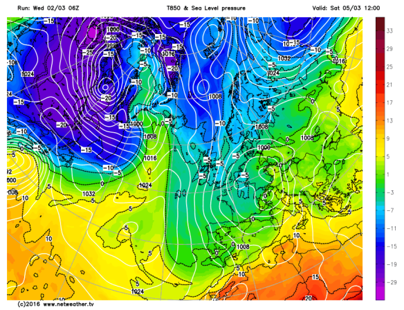
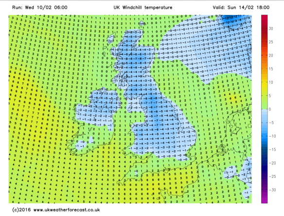
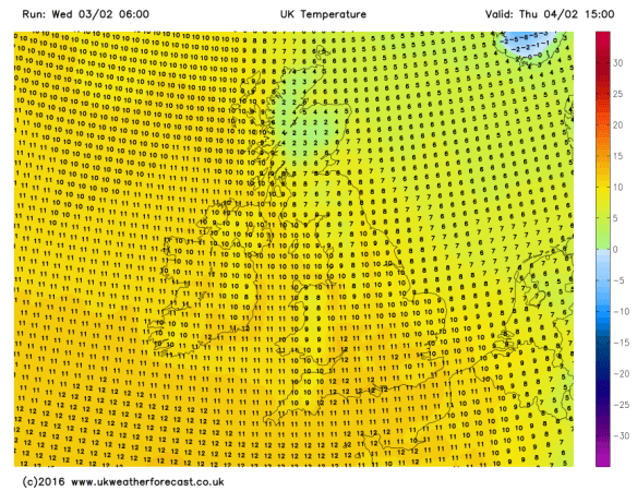
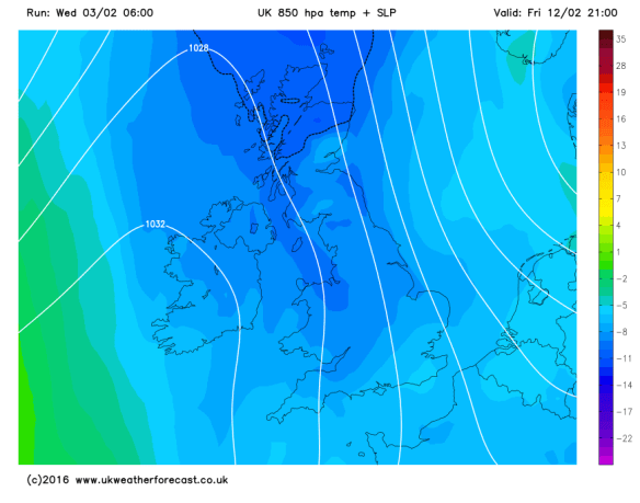
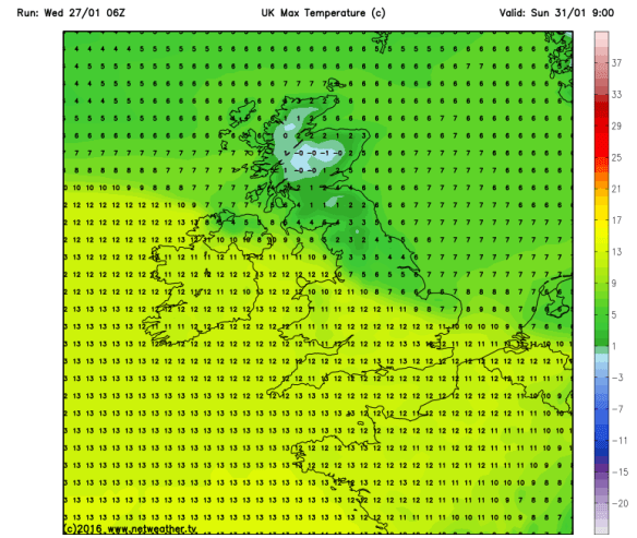
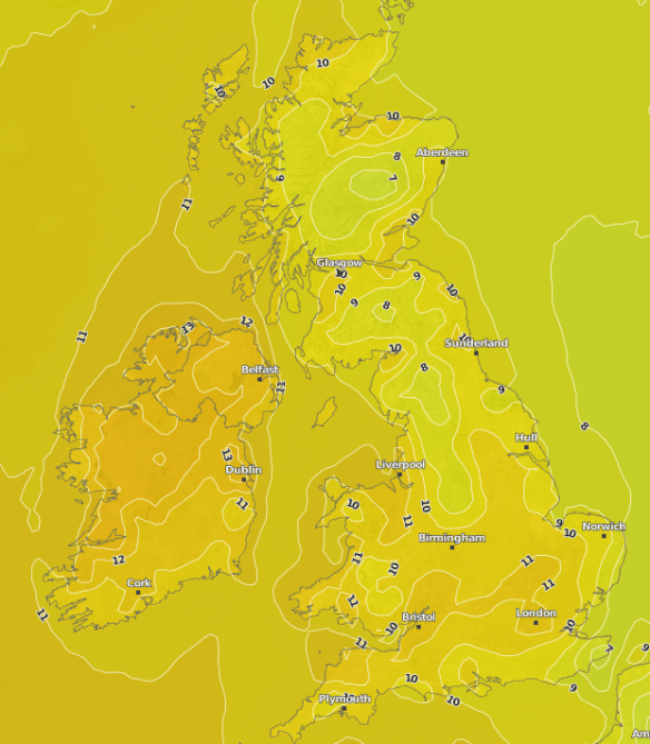
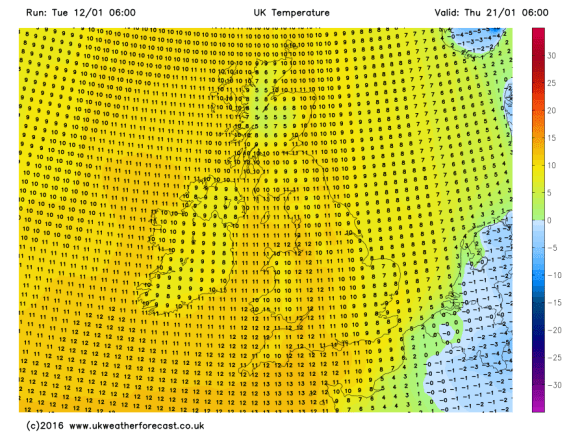
A similar theme continues into the weekend. Winds are from a southwesterly direction so milder air covers England and Wales with temperatures into double-figures.
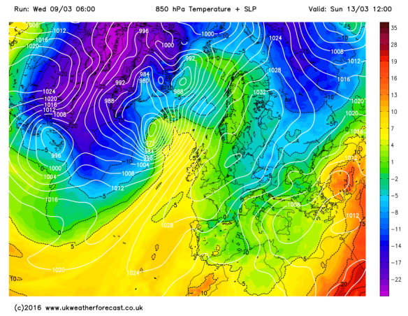
Out with the cold blues and in with the milder greens and yellows as temperatures rise
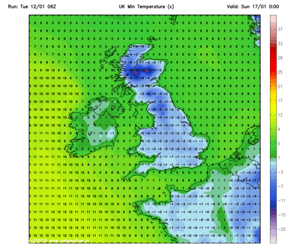
Saturday and Sunday looking dry across the region with a fair amount of cloud. Some bright spells are possible during the day and if we see them, we might have temperatures up to 12°C. Otherwise generally a Max of 10°C and with the cloud-cover it looks likely that we escape frost-free.
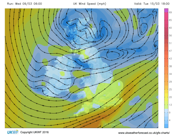
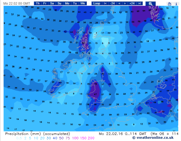
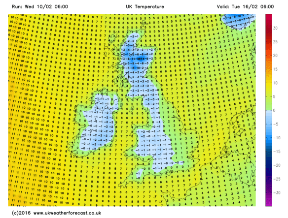
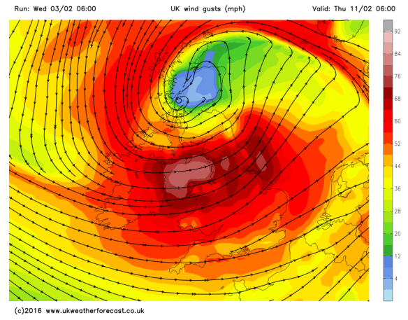
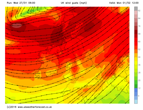
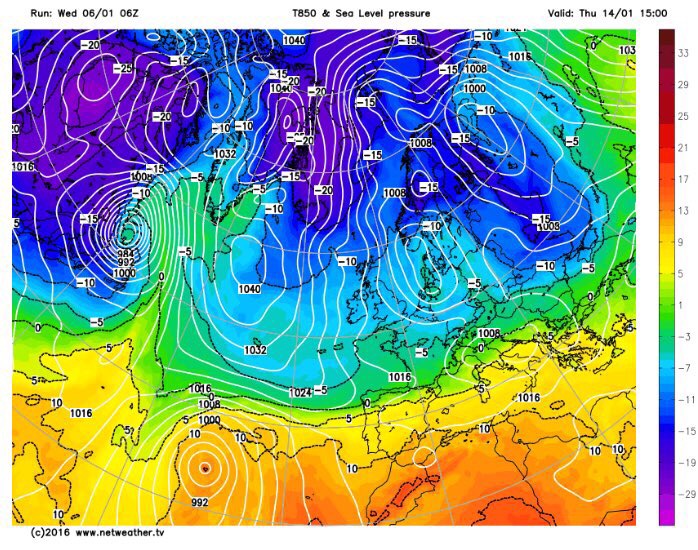
An easterly wind will peg temperatures back slightly next week
Next week it will turn slightly colder again as we drag in an easterly wind but the mainly dry theme continues with very little rain expected. Good news for Oldham Athletic’s football pitch which could do with a breather.
Follow @ChadWeather on Twitter to catch all the latest weather updates for Manchester and its surrounding boroughs.
Thanks for reading,
Jon
Photos/Data: http://www.ukweatherforecast.co.uk
Forecast issued at 13:45 on Wednesday 9th of March 2016