Hi all,
Last week we discussed the ‘Beast from the East 2’, the sequel etc. and it certainly delivered. To be honest the amount of snow it brought even surprised me. The wind was also a feature bringing a severe wind-chill and snow drifts up to 4 feet high. It was only a short-lived affair, basically freezing us for the weekend and it wasn’t as intense as the previous Beast, but it was certainly impressive for the second half of March. Of course the media have jumped on this opportuinity to say number 3 is coming and we will see snow at Easter, but what is the realistic outlook?
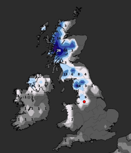
‘Beast from the East 2’ Stats
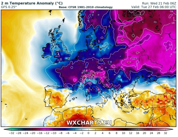
- The temperature dropped 6°C in 90 mins as colder conditions arrived on Friday
- Snow fell most of Saturday afternoon and overnight
- Widely 8cm of snow-cover
- Snow drifts up to 4ft
- Many road closures
- Lowest wind-chill of -10°C
- Lowest feels-like temperature of -11°C
- Sunday didn’t see the temperature rise above freezing
- Wind gusts of 50mph locally and especially on the hills felling some trees
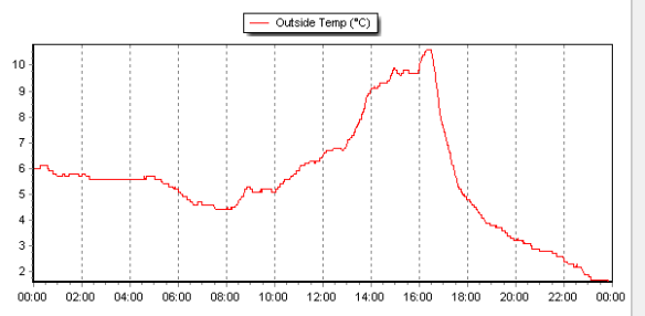
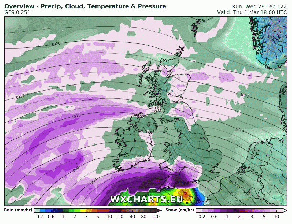
A rapid temperature drop as the ‘Beast from the East 2’ arrived last Friday
Thursday: Sunny spells and southwesterly winds freshening. It should remain dry until later in the evening and overnight when rain will arrive. Max 9°C
Friday: Early rain, some heavy clearing during the morning. Bright spells into the afternoon with a few showers, possibly thundery. Cool and breezy. Max 10°C
Weekend: Not bad at all, no dramas like last weekend.
Saturday: Apart from the odd shower it looks a reasonable day with sunny spells. Max 9°C
Sunday: A misty start, soon lifting to sunny spells and the odd rogue shower. With light winds it will feel pleasant in any sunshine. Max 10°C
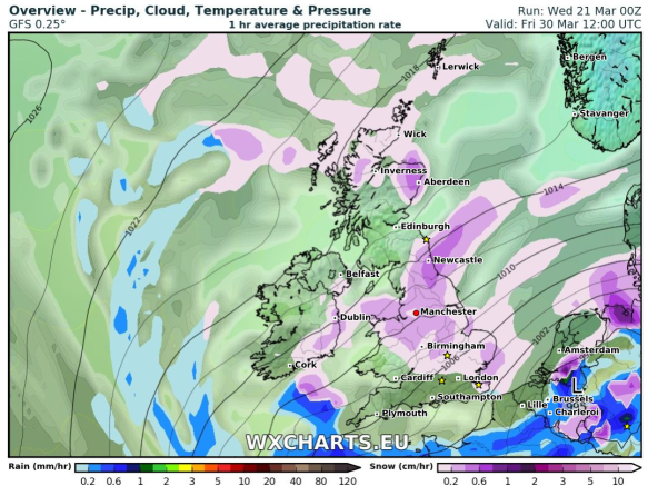
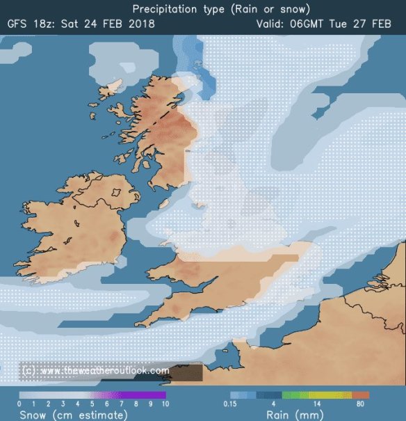
Colder with a chance of snow showers by the time we get to Good Friday
Outlook: Remaining mild with temperatures close to double-figures. Some rain at times, especially into Tuesday, but brighter spells too. As we approach Easter the computer models are showing signs of a cold wind developing again. This looks to be from the northwest or north, but some signs are there for a northeasterly. This will bring lower temperatures and with it the risk of some wintry showers and snow. This looks to last 2-3 days, and yes you’ve guessed it, starting on Good Friday. So, at this current stage, no Beast from the East 3 exactly, but definitely not the Easter forecast you wanted to hear.
Follow @ChadWeather on Twitter for the latest weather forecasts.
Thanks,
Jon
Forecast Issued at 10:30am on Wednesday the 21st of March 2018
Image: wxcharts.eu