Hi all,
After some welcome rain last week, it’s time to turn up the heat as we experience our first taste of Summer temperatures. However, after initially hoping it would last all weekend, it is now looking like Friday will be the warmest day with a cooling trend over the weekend.
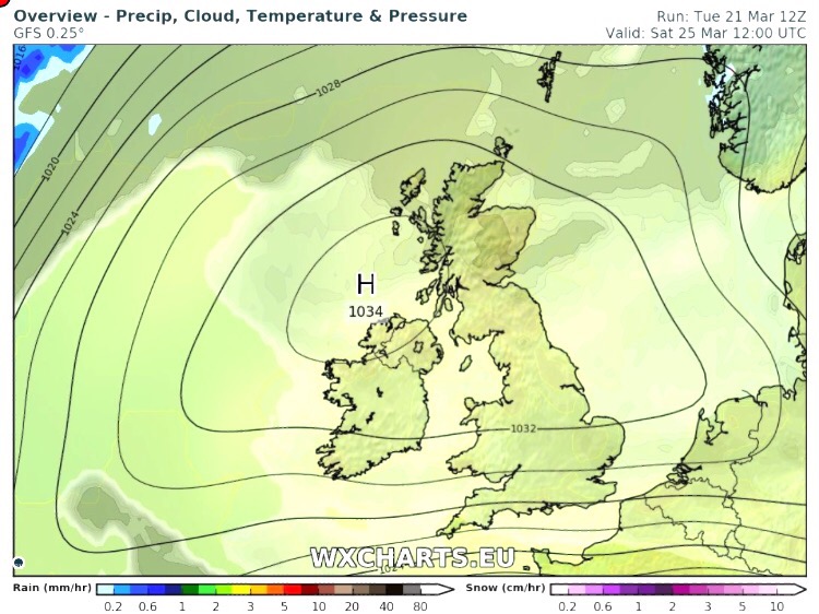
High pressure has built in across the UK as this week has gone on and with it comes some very warm and humid air from the southeast.

High pressure brings us a short spell of hot & humid sunny weather
Thursday: Dry with sunny spells developing and with light winds it will feel humid and becoming hot. Max 26°C
Friday: A little breeze will develop but this coming from the southeast will only help import warmer air. Feeling hot and humid with plenty of sunny skies. Max 26°C
Saturday: Low pressure bringing a showery breakdown of the heat with possible thunderstorms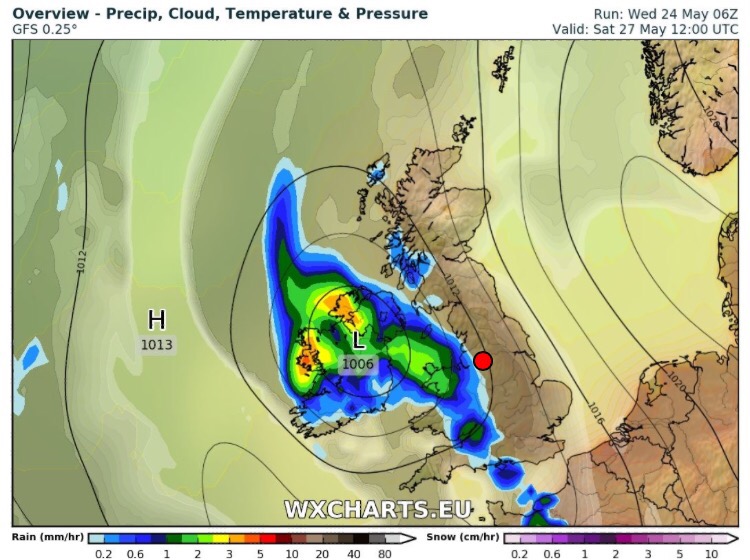
Saturday: Feeling very humid to start the day with some sunny spells but less sunshine later as low pressure tracks in from the southwest. During the day we can expect a breakdown from the hot and humid conditions with heavy, possibly thundery, showers coming in from the west. Fresher air will follow, which will be welcome. Max 23°C
Sunday: Cooler as fresher air takes over from the west. Some sunny spells but with a risk of showers. Temperatures down on recent days, welcome news for the Great Manchester Run. Max 19°C
Bank Holiday Monday: A westerly airflow across the region. Some bright spells but thicker cloud at times too. Max 18°C
Follow @ChadWeather on Twitter for the very latest weather forecasts.
Thanks,
Jon
Forecast Issued: Wednesday May the 24th at 12:30pm
Images: http://wxcharts.eu