Thursday 17th November 2016 – Sunday 20th November 2016

Hi all,

A bit of a late posting today, but I’m finally here with the usual weekly outlook on what our weather’s going to throw at us. It’s certainly not going to disappoint this week.

Thursday: Cold and windy. Showers of rain and possibly hail and thunder. Some sleet for the hills. There is a chance of more prolonged rain during the morning. 6°C

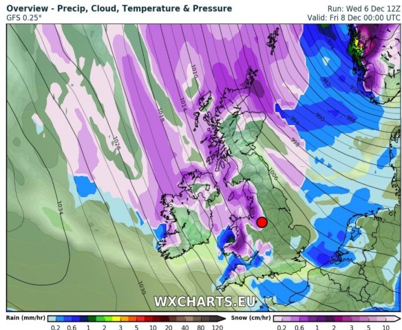
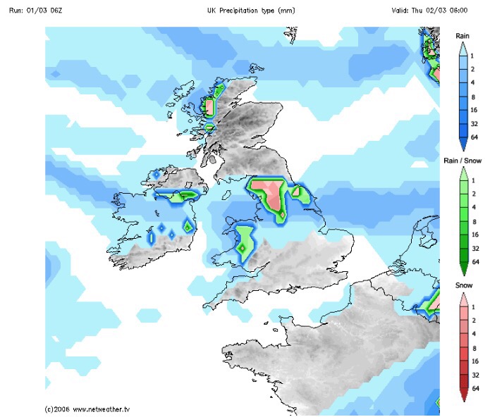
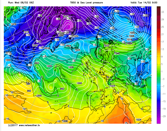
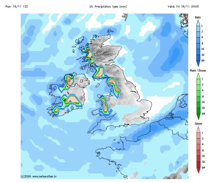
**There is a possibility that wintry showers will merge together to bring a spell of sleet or snow overnight on Thursday, especially above 200M. One to keep an eye on via my tweets**

Possibilities of some localised sleet and snow overnight Thursday and into Friday morning. Above 200M most at risk.

Friday: Possibly a wintry start as mentioned, then feeling quite bitter with a stiff northwesterly wind and some wintry showers. Sunny spells during the day mixed in with those showers. Showers dying away overnight leading to a frost. 5°C

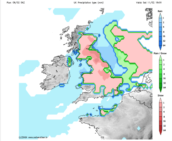
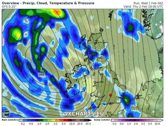
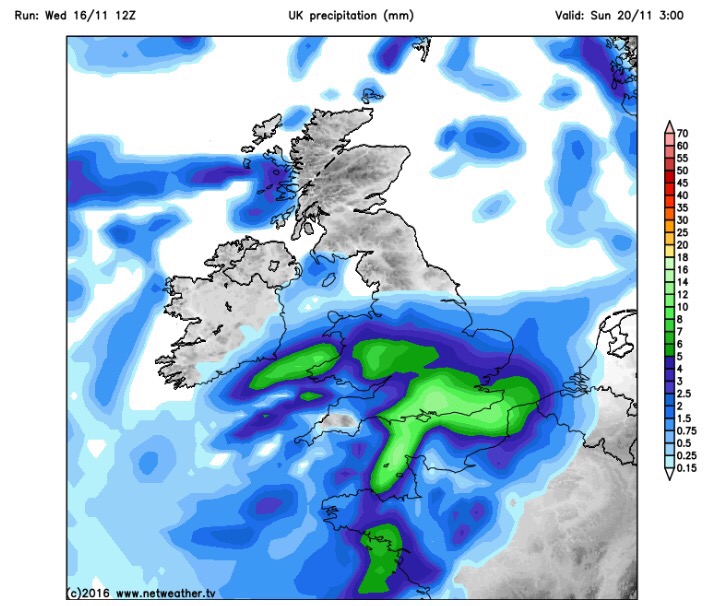
Heavy rain arrives on Sunday, preceded by Pennine-snow?

Saturday: Frosty start, then a typical pleasant, autumnal day. Sunny spells, just the odd wintry shower but with lighter winds it won’t feel as cold as previous days. 6°C

Sunday: Another cold start with a touch of frost. Cloud soon thickening and the wind increasing as heavy rain, possibly preceded by hill-snow for a time, moves in from the south-west. There is a good deal of uncertainty about how strong the winds could be and how heavy the rain will be so keep your eyes on my tweets. A cold raw feeling day. 7°C

Looking ahead and it’s set to stay cold with unsettled conditions close by. 

Keep up to date with your local weather by following @ChadWeather on Twitter.

Cheers,

Jon

Images: http://www.netweather.tv

Forecast issued Wednesday 16th November at 18:30. 


Thursday 10th November 2016 – Sunday 13th November 2016

Hi all,

So we’re about 10 days into November and some areas have already experienced a ‘winter’ feel with some snow falling on higher ground on Tuesday night and into Wednesday. This is much earlier in the year/season than we are normally accustomed to. As things stand, the ingredients are all there for this coming winter to be a colder-than-average one and possibly, in my opinion, the coldest since 2010/11. Time will tell.

Thursday: An improvement on recent days with bright spells and milder. Some showers expected which could be heavy. Drier into the evening. Max 8°C

Friday: A little cooler again so a fresh feel but better with bright spells and mostly dry conditions. Rain will be trying to push in from the west overnight. Max 7°C

Not a great start to the weekend.

Saturday: Rain heavy at times makes slow progress across the region and slightly milder, showery weather follows. Breezy. Max 10°C

Sunday: Any showers should ease away and an improvement during the day. Bright spells and hopefully most places dry into the afternoon. Max 9°C

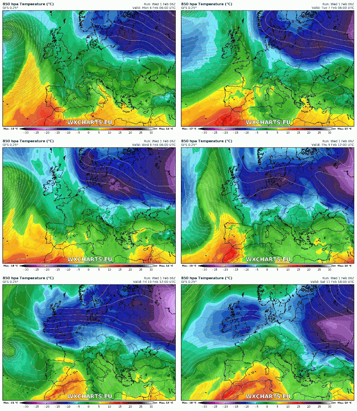
A slice of milder air into next week but cooler air should return

Looking ahead and next week looks milder but possibly only for several days then the cooler air returns. Whilst mild, expect some showers or longer spells of rain.

Keep up to date with your local weather forecasts by following @ChadWeather on Twitter.

Thanks,
Jon

Images: http://www.netweather.tv
Forecast Issued: Wednesday 9th November 2016 at 12:20

Thursday 22nd October 2015 – Sunday 25th October 2015

Hi all,

Well would you believe it. The newspapers, sorry trash-mags, are at it again. “It’s going to snow next week”; “It’s going to be the coldest, snowiest winter for 50 years” and of course what we all want “A White Christmas”. What a load of nonsense, putting it politely. It’s nothing but guesswork and in a word ‘lies’ in order to sell papers and get everyone talking. In truth, no-one knows what this coming Winter will be like and yes I personally would love a White Christmas and several feet of snow; but all I can do is hope. There are no facts and proof that all the media stories hold any truth.

So, no snow on the horizon just yet 🙂 but what can we expect the coming 4 days and into next week.

A cloudy start to Thursday with some local drizzle or light rain around. Generally a drier picture after that with sunny spells. Feeling cooler than Wednesday with the odd afternoon shower possible. Breezy. Max 13°C.

Friday will be quite similar. A little ridge of high pressure settles things down, so bright spells and mainly dry. Just a very low risk of an isolated shower. Light winds. Max 13°C.

The weekend will not start well as a band of rain spreads in from the north-west on Saturday with some heavy bursts and gusty winds. This will sink south and leave some drizzle behind it for a few hours. Eventually drying up into the late-afternoon or evening. Gusty south-westerly winds for a time then switching back north-westerly and easing slightly. Not much difference in temperatures to previous days but it will turn cooler later on. Max 13°C.

A colder feel to Sunday with bright spells and some scattered showers. A chilly breeze across the region but looking a better day than Saturday. Temperatures down a notch. Max 11°C.

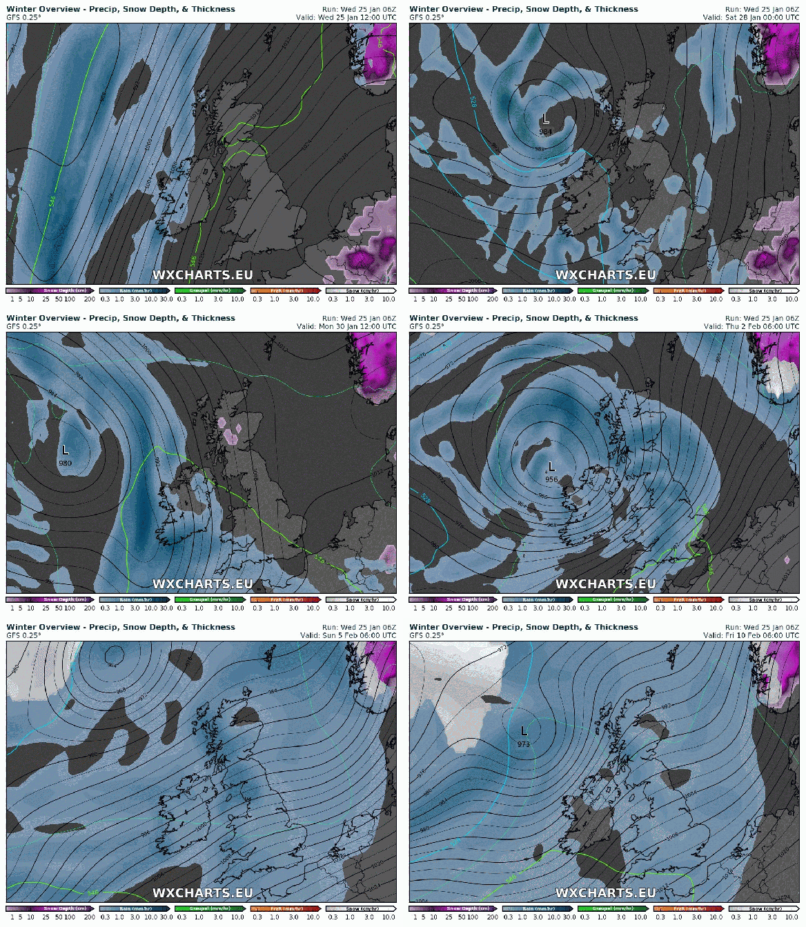
Looking ahead into next week the Atlantic is pretty much back in charge bringing spells of wet and windy weather but with sunny spells and drier interludes either side of low pressure systems.

To keep up to date with your local weather, follow @ChadWeather on Twitter.

Thanks for reading.
Jon

Snowy and wintry scenes – 26th-29th December 2014

Rain on the evening of Boxing Day 2014 gradually turned to snow as a low pressure moves south-eastwards and colder air dug in from the north. Most places saw snow but it was all about your height above sea level whether it managed to stick or not. Here in Chadderton we had a slight covering on the cars and grass but you had to go up to the east of Oldham, to the likes of Moorside to see some decent snow. In these hillier areas up to 4 inches of snow fell over a 6-hour period. After the snow came the frost then some freezing fog. Here are a selection of the photos that I had tweeted to me. Thanks to everyone for their stunning photos. I hope you don’t mind me using them. Any issues using them please let me know.

/home/wpcom/public_html/wp-content/blogs.dir/5a5/52181690/files/2014/12/img_5069.jpg

/home/wpcom/public_html/wp-content/blogs.dir/5a5/52181690/files/2014/12/img_5068.jpg

/home/wpcom/public_html/wp-content/blogs.dir/5a5/52181690/files/2014/12/img_5070.jpg

/home/wpcom/public_html/wp-content/blogs.dir/5a5/52181690/files/2014/12/img_5071.jpg

/home/wpcom/public_html/wp-content/blogs.dir/5a5/52181690/files/2014/12/img_5074.jpg

/home/wpcom/public_html/wp-content/blogs.dir/5a5/52181690/files/2014/12/img_5075.jpg

/home/wpcom/public_html/wp-content/blogs.dir/5a5/52181690/files/2014/12/img_5076.jpg

/home/wpcom/public_html/wp-content/blogs.dir/5a5/52181690/files/2014/12/img_5077.jpg

/home/wpcom/public_html/wp-content/blogs.dir/5a5/52181690/files/2014/12/img_5078.jpg

/home/wpcom/public_html/wp-content/blogs.dir/5a5/52181690/files/2014/12/img_5081.jpg

/home/wpcom/public_html/wp-content/blogs.dir/5a5/52181690/files/2014/12/img_5079.jpg

/home/wpcom/public_html/wp-content/blogs.dir/5a5/52181690/files/2014/12/img_5080.jpg

/home/wpcom/public_html/wp-content/blogs.dir/5a5/52181690/files/2014/12/img_5085.jpg

/home/wpcom/public_html/wp-content/blogs.dir/5a5/52181690/files/2014/12/img_5084.jpg

/home/wpcom/public_html/wp-content/blogs.dir/5a5/52181690/files/2014/12/img_5086.jpg

/home/wpcom/public_html/wp-content/blogs.dir/5a5/52181690/files/2014/12/img_5087.jpg

/home/wpcom/public_html/wp-content/blogs.dir/5a5/52181690/files/2014/12/img_5090.jpg

/home/wpcom/public_html/wp-content/blogs.dir/5a5/52181690/files/2014/12/img_5091.jpg

/home/wpcom/public_html/wp-content/blogs.dir/5a5/52181690/files/2014/12/img_5109.jpg

/home/wpcom/public_html/wp-content/blogs.dir/5a5/52181690/files/2014/12/img_5110.jpg

/home/wpcom/public_html/wp-content/blogs.dir/5a5/52181690/files/2014/12/img_5111.jpg

/home/wpcom/public_html/wp-content/blogs.dir/5a5/52181690/files/2014/12/img_5112.jpg

/home/wpcom/public_html/wp-content/blogs.dir/5a5/52181690/files/2014/12/img_5113.jpg

/home/wpcom/public_html/wp-content/blogs.dir/5a5/52181690/files/2014/12/img_5131.jpg

/home/wpcom/public_html/wp-content/blogs.dir/5a5/52181690/files/2014/12/img_5114.jpg

/home/wpcom/public_html/wp-content/blogs.dir/5a5/52181690/files/2014/12/img_5133.jpg

/home/wpcom/public_html/wp-content/blogs.dir/5a5/52181690/files/2014/12/img_5267.jpg

/home/wpcom/public_html/wp-content/blogs.dir/5a5/52181690/files/2014/12/img_5122.jpg

/home/wpcom/public_html/wp-content/blogs.dir/5a5/52181690/files/2014/12/img_5272.jpg

/home/wpcom/public_html/wp-content/blogs.dir/5a5/52181690/files/2014/12/img_5273.jpg

/home/wpcom/public_html/wp-content/blogs.dir/5a5/52181690/files/2014/12/img_5274.jpg

/home/wpcom/public_html/wp-content/blogs.dir/5a5/52181690/files/2014/12/img_5275.jpg

/home/wpcom/public_html/wp-content/blogs.dir/5a5/52181690/files/2014/12/img_5277.jpg

/home/wpcom/public_html/wp-content/blogs.dir/5a5/52181690/files/2014/12/img_5276.jpg

/home/wpcom/public_html/wp-content/blogs.dir/5a5/52181690/files/2014/12/img_5299.jpg

/home/wpcom/public_html/wp-content/blogs.dir/5a5/52181690/files/2014/12/img_5301.jpg

/home/wpcom/public_html/wp-content/blogs.dir/5a5/52181690/files/2014/12/img_5302.jpg

/home/wpcom/public_html/wp-content/blogs.dir/5a5/52181690/files/2014/12/img_5300.jpg

/home/wpcom/public_html/wp-content/blogs.dir/5a5/52181690/files/2014/12/img_5304.jpg

/home/wpcom/public_html/wp-content/blogs.dir/5a5/52181690/files/2014/12/img_5315.jpg

/home/wpcom/public_html/wp-content/blogs.dir/5a5/52181690/files/2014/12/img_5316.jpg

/home/wpcom/public_html/wp-content/blogs.dir/5a5/52181690/files/2014/12/img_5309.jpg

/home/wpcom/public_html/wp-content/blogs.dir/5a5/52181690/files/2014/12/img_5330.jpg

/home/wpcom/public_html/wp-content/blogs.dir/5a5/52181690/files/2014/12/img_5310.jpg

/home/wpcom/public_html/wp-content/blogs.dir/5a5/52181690/files/2014/12/img_5329.jpg

/home/wpcom/public_html/wp-content/blogs.dir/5a5/52181690/files/2014/12/img_5331.jpg

/home/wpcom/public_html/wp-content/blogs.dir/5a5/52181690/files/2014/12/img_5333.jpg

/home/wpcom/public_html/wp-content/blogs.dir/5a5/52181690/files/2014/12/img_5334.jpg

/home/wpcom/public_html/wp-content/blogs.dir/5a5/52181690/files/2014/12/img_5356.jpg

/home/wpcom/public_html/wp-content/blogs.dir/5a5/52181690/files/2014/12/img_5357.jpg

/home/wpcom/public_html/wp-content/blogs.dir/5a5/52181690/files/2014/12/img_5361.jpg

/home/wpcom/public_html/wp-content/blogs.dir/5a5/52181690/files/2014/12/img_5355.jpg

/home/wpcom/public_html/wp-content/blogs.dir/5a5/52181690/files/2014/12/img_5363.jpg

/home/wpcom/public_html/wp-content/blogs.dir/5a5/52181690/files/2014/12/img_5362.jpg

/home/wpcom/public_html/wp-content/blogs.dir/5a5/52181690/files/2014/12/img_5364.jpg

/home/wpcom/public_html/wp-content/blogs.dir/5a5/52181690/files/2014/12/img_5365.jpg

/home/wpcom/public_html/wp-content/blogs.dir/5a5/52181690/files/2014/12/img_5366.jpg

/home/wpcom/public_html/wp-content/blogs.dir/5a5/52181690/files/2014/12/img_5370.jpg

/home/wpcom/public_html/wp-content/blogs.dir/5a5/52181690/files/2014/12/img_5367.jpg

/home/wpcom/public_html/wp-content/blogs.dir/5a5/52181690/files/2014/12/img_5373.jpg

/home/wpcom/public_html/wp-content/blogs.dir/5a5/52181690/files/2014/12/img_5374.jpg

/home/wpcom/public_html/wp-content/blogs.dir/5a5/52181690/files/2014/12/img_5375.jpg

/home/wpcom/public_html/wp-content/blogs.dir/5a5/52181690/files/2014/12/img_5385.jpg

/home/wpcom/public_html/wp-content/blogs.dir/5a5/52181690/files/2014/12/img_5386.jpg

/home/wpcom/public_html/wp-content/blogs.dir/5a5/52181690/files/2014/12/img_5388.jpg

/home/wpcom/public_html/wp-content/blogs.dir/5a5/52181690/files/2014/12/img_5392.jpg

/home/wpcom/public_html/wp-content/blogs.dir/5a5/52181690/files/2014/12/img_5393.jpg

/home/wpcom/public_html/wp-content/blogs.dir/5a5/52181690/files/2014/12/img_5394.jpg

Quick Update for Next Week

NEXT WEEK’S WEATHER

Monday: Cloudy and dry. Reasonably mild still. 8’C

Tuesday: Similar. Cloudy and dry but expecting light rain into the evening. Mild. 8’C

Wednesday: Light rain slowly spreads through the region. Cooler later. 7’C

Thursday: The change begins. Windy especially as the day goes on. Rain, heavy at times spreading south. Much colder air digs in and there is a chance the rain could turn to snow, especially on the higher ground but even to lower levels later. Icy and snow showers overnight giving a covering in places. 5’C

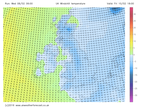
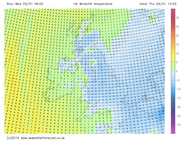
Friday: Bitterly cold with a keen strong northerly wind which will give a significant wind-chill. Some snow showers are expected which maybe heavy at times. These should ease away to our west later. 2’C but feeling like -5’C. Frosty and icy overnight.

Saturday: Sunny spells but still very cold. Winds easing so less of a wind-chill but a frosty start and evening. Odd isolated snow shower still possible. 4’C

Sunday-Monday: Dry with bright spells and starting to get milder again. 5-6’C